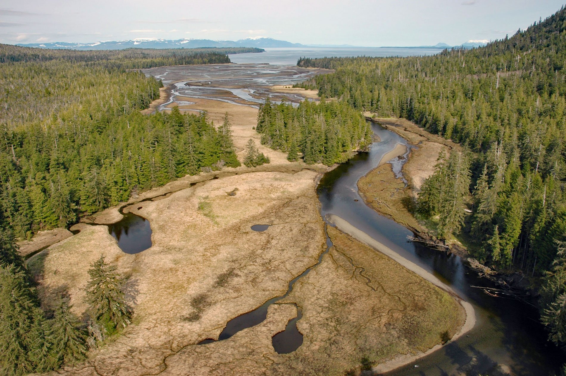
Black Bear Creek is situated on the southwest coast of the Cleveland Peninsula and starts at an elevation of 493 feet from the outlet of Bear Lake and flows generally northwest for 6 miles (10 km) through the Tongass National Forest to Union Bay, about 52 miles (84 km) south of Wrangell and 35 miles (56 km) northwest of Ketchikan, Alaska. The descriptive stream name was recorded in 1914 by E. Lester Jones of the U.S. Bureau of Fisheries, who ‘observed here a heavy destruction of salmon by black bear’. Union Bay is near the south entrance to Ernest Sound, and is 3.5 miles (5.6 km) wide at the entrance, 1.25 miles (2.01 km) at its head, and about 3 miles (4.8 km) long. At its head is a large lagoon forming the estuary for Black Bear Creek, which is mostly dry at low water. Most of the watershed is covered by Quaternary sediments overlying sedimentary rocks of the Gravina sequence that formed during the Cretaceous and Jurassic comprising greywacke and mudstone, conglomerate, and andesitic to basaltic volcanic rocks.
Tongass National Forest is the largest national forest in the United States with 16.7 million acres (6,800,000 ha). The forest is managed by the U.S. Forest Service and encompasses islands of the Alexander Archipelago, fjords and glaciers, and peaks of the Coast Mountains. Most of its area is temperate rainforest that provides habitat for many species of endangered and rare flora and fauna. The origin of the Tongass National Forest dates to 1902 when President Theodore Roosevelt, an avid hunter and naturalist, issued a proclamation declaring it the Alexander Archipelago Forest Reserve. Five years later, Roosevelt signed another proclamation, creating a separate Tongass National Forest. Both areas were officially combined on July 1, 1908. An additional proclamation, signed in 1909, added more Southeast lands and islands. With its vast expanses of remote and undeveloped lands, the Tongass is one of the world’s last largely intact temperate rainforest ecosystems.
The Tongass is inhabited by large populations of brown and black bears. The American black bear occurs on the southern islands of the Alexander Archipelago at high densities, likely due to intact anadromous Pacific salmon runs and productive forests. Black bears are the most abundant and widely distributed of the three species of North American bears, and an estimated 100,000 black bears inhabit Alaska. Kuiu Island, which is 80 miles (130 km) northwest of Union Bay, has a population of 1,019 black bears which is one of the highest black bear densities known. The black bear is the smallest of the North American bears, an adult is about 29 inches (73 cm) high at the shoulders and about 60 inches (152 cm) long from nose to tail. Black bears can vary in color from jet black to white. Black is the color encountered most frequently, but brown or cinnamon-colored black bears are sometimes seen in Southcentral Alaska and on the southeastern mainland. Some bluish-colored bears called glacier bears may be found in the Yakutat area and in other parts of Southeast Alaska. Read more here and here. Explore more of Black Bear Creek and Cleveland Peninsula here:

