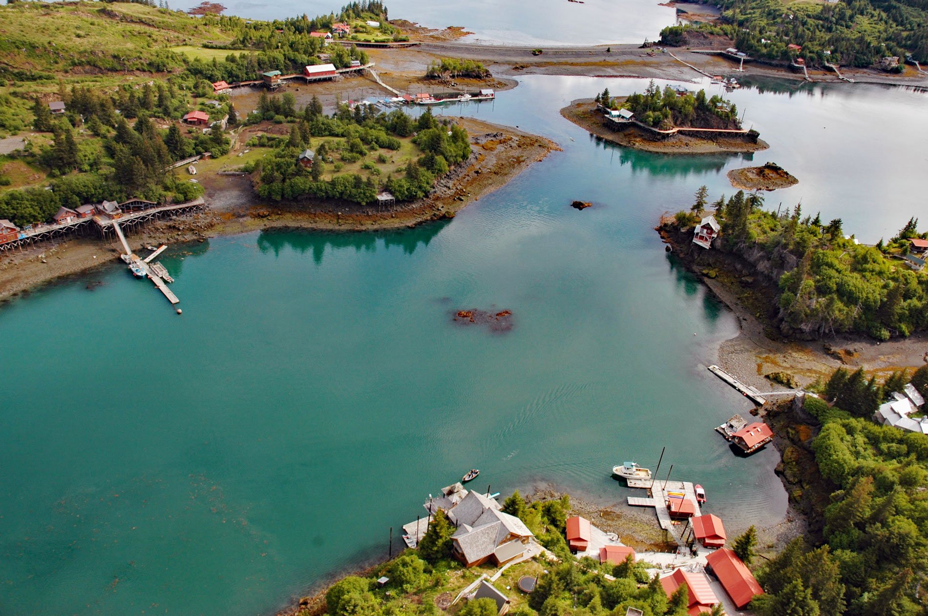
Halibut Cove is a small community lining the shores of The Narrows, a protected waterway separating Ismailof Island to the north from the Kenai Peninsula to the south, on the southeastern shore of Kachemak Bay, about 20 miles (32 km) northeast of Seldovia and 11 miles (18 km) east-southeast of Homer, Alaska. Ismailof Island is actually two islands connected by a sand and gravel spit about 1300 feet (400 m) long that historically was called Beluga Spit. The island was named for Captain Gerasim Izmailov of the Imperial Russian Navy who in 1789 was the first European to explore and map the Kenai Peninsula. The community is named after the adjacent embayment of Halibut Coved formed by Ismailof Island on the western shore and the Kenai Peninsula on the eastern shore. The cove was named in 1880 by William H. Dall while charting the western coast of the Kenai Peninsula for the U.S. Coast and Geodetic Survey. Dall also made the first systematic investigations on the geology of the peninsula and first noted the contorted chert exposed at Halibut Cove. In 1904, the Harriman Expedition visited Kachemak Bay and Benjamin K. Emerson wrote about the banded chert exposed on the northeastern shore of Halibut Cove that was intruded by light-colored porphyry dikes. These rocks represent the McHugh Complex which in this area is composed of basalt and chert that developed between the Middle Triassic to Early Cretaceous or between 201.4 million years ago and 145 million years ago.
Upper Kachemak Bay was historically occupied by the Dena’ina people, an early Athabaskan culture of Cook Inlet. One of the important food sources for the Dena’ina was the Pacific herring, one of the most abundant fish species in Alaska. They were caught with rakes or beach seines and sun-dried. The dried fish were consumed locally and were also important for trading with interior peoples. In Kachemak Bay, herring spawn in early April and prefer kelp-rich shallow water and intertidal areas such as Halibut Cove. The eggs are coated with an adhesive membrane and stick to underwater algae and seagrasses. The Dena’ina gathered and consumed herring eggs on kelp and spruce boughs. In 1914, commercial herring fishing first occurred in lower Cook Inlet with the development of a gillnet fishery in Kachemak Bay. The preferred method to preserve the fish was by Scotch curing, where the herring were packed into barrels with salt so that the fish are pickled in brine. A full barrel held about 240 gutted and salted fish and weighed 250 lbs. By 1923, during the peak of the fishery, there were eight salteries operating in Kachemak Bay, with six in Halibut Cove, plus a few floating processors. The fishery employed as many as 1,000 people during the height of the season. A community quickly developed around the docks built to accommodate the steamers that arrived to load barrels of salted fish. In 1923, a purse seine fishery in Kachemak Bay began, but after three successive years of average annual harvests approaching 8,000 tons, the herring population rapidly declined. By 1927, the herring spawning grounds were destroyed and by 1928 the herring were gone and the boom was over. Halibut Cove became a ghost town and only a few tenacious pioneers remained with a few operating a fox farm on Ismailof Island.
The community of Halibut Cove first appeared in 1940 census records with 23 residents. In 1948, Clem Tillion bought a pioneer homestead on Ismailof Island and over many years fostered the development of a community. He started a regular mailboat service with a surplus U.S. Army T-Boat named Stormbird, and a daily ferry from Homer on a restored herring boat named Danny J. In 1984, The Saltry restaurant was opened in a building on piles overlooking The Narrows. Today, the community supports about 80 residents and a thriving tourist industry, as well as resident artists, and oyster farmers. Halibut Cove is only accessible by water, including by boat or float plane which are weather dependent; therefore, a high percentage of homes in Halibut Cove are used seasonally. The community is connected to the state electricity grid and a local hydroelectric facility operated by the Homer Electric Association. In 2000, residents of Halibut Cove had the highest per capita income of any community in Alaska. A few Halibut Cove residents still participate in commercial fisheries as state and federal permit holders, quota account holders in federal catch share fisheries, vessel owners, and crew license holders; however, the number of fishing vessels homeported in Halibut Cove has declined from 22 in 2000 to less than 10 in 2020. Read more here and here. Explore more of Halibut Cove and Ismailof Island here:

