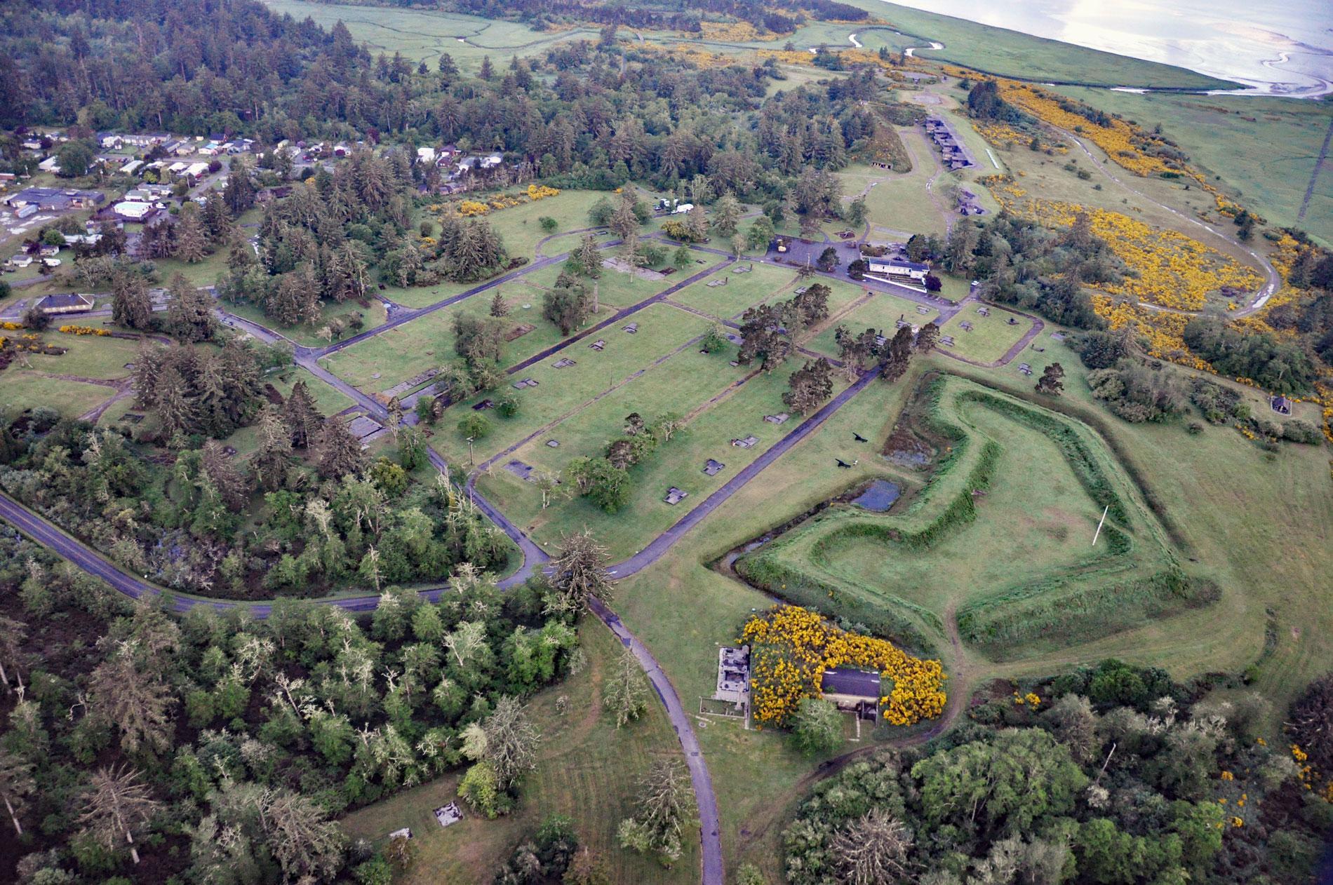
Fort Stevens was constructed during the American Civil War as an earthwork battery on the south shore at the mouth of the Columbia River on Point Adams, about 15 miles (24 km) north of Seaside and 6 miles (10 km) west-northwest of Astoria, Oregon. It was originally known as the Fort at Point Adams, and in 1865, was renamed Fort Stevens in honor of the former territorial governor of Washington, Isaac I. Stevens who had been killed in action. Point Adams historically formed the most northerly tip of the Clatsop Plains prior to jetty construction and was named in 1792 by Captain Robert Gray for President John Adams. The Clatsop Plains were formed by a southward drift of river-derived sediments that extends as far as Tillamook Head. The continuous shift of channels and shoaling at the mouth of the Columbia River resulted in the construction of the south jetty which was completed in 1895 and extended 4.5 miles (7.2 km) to the northwest from Point Adams. The jetty was extended to 6.5 miles (10.6 km) between 1903 and 1913, and subsequent sand accretion to the south of the south jetty took the form of Clatsop Spit which now connects Point Adams to the jetty.
Point Adams is the historical site of a prominent village called Klaát-sop inhabited by the Clatsop people. The village was a place of great importance for the salmon that were caught, dried, and traded. The village continued to be a center of tribal life and trade despite several incursions by Euro-Americans. In 1829, the British square-rigged ship William and Ann, bearing supplies for the Hudson’s Bay Company Fort Vancouver, wrecked on Clatsop Spit and 29 lost their lives. The Hudson’s Bay Company bombarded the village in response to false rumors of Clatsop attacks on survivors of the shipwreck. During the 1851 Tansy Point treaty negotiations to extinguish the land title of Columbia-Pacific tribes, U.S. negotiators promised Point Adams to the Clatsop as a small reservation. But Congress never ratify these treaties, in part because Oregon Territorial Delegate Joseph Lane and others opposed placing a reservation in an area they believed had strategic value. Today, the community of Hammond occupies the village site.
Fort Stevens was established in 1864 by the U.S. Army as part of a system of defense points at the mouth of the Columbia River and the primary military installation in what became the three-fort Harbor Defense System. The other forts were Fort Canby, built at the same time as Fort Stevens, and Fort Columbia, built between 1896 and 1904. Both are on the Washington side of the river. The forts were intended as a defense against potential British attacks during regional tensions over land claims in the Pacific Northwest between 1859 and 1870. The fort was also important during the 1896-1903 Alaska boundary dispute when British-American tensions again were high and the two countries were on the brink of war. In 1904, Battery Russell was constructed with two 10-inch (25.4 cm) rifles on disappearing mounts that fired a projectile of 617 pounds (280 kg) with a range of 16,290 yards (14,896 m). During World War II, Fort Stevens again guarded the mouth of the Columbia River. On June 21, 1942, a Japanese submarine with a crew of 97, and transporting a Yokosuka seaplane, entered U.S. coastal waters following fishing boats to avoid minefields. The submarine later surfaced and opened fire on Fort Stevens with a deck gun. American Army Air Corps planes on a training mission spotted the submarine but it submerged undamaged. Fort Stevens was decommissioned in 1947 and today is preserved as part of Fort Stevens State Park. Read more here and here. Explore more of Fort Stevens and Point Adams here:

