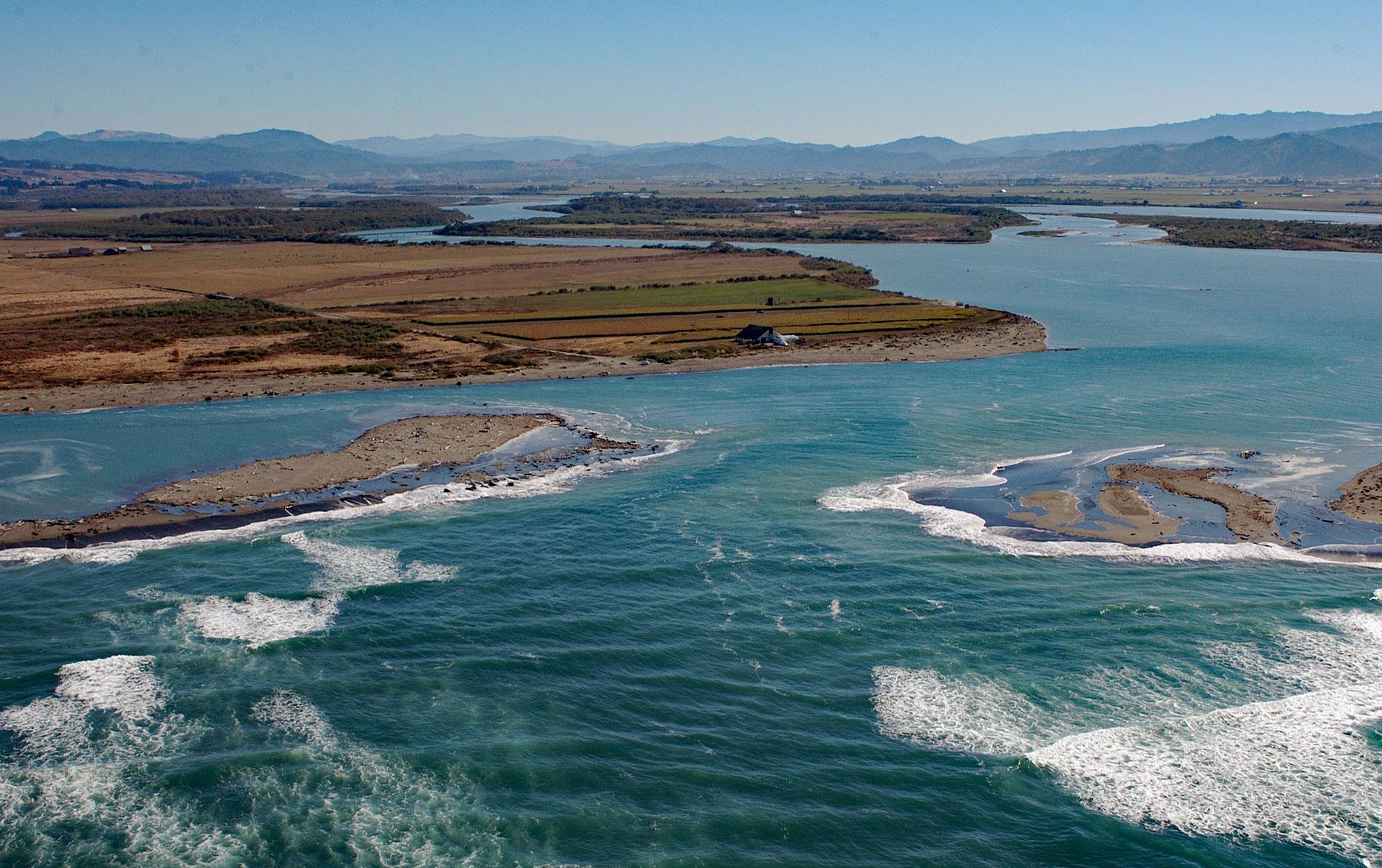
A delta of 33,000 acres (13,355 ha) is formed by the Eel River, which starts at an elevation of 6,245 feet (1,903 m) on the southern flank of Bald Mountain in Mendocino National Forest and flows generally northwest for 196 miles (315 km) draining a watershed of 2,357,761 acres (954,152 ha) in the California Coast Ranges, about 13 miles (21 km) south-southwest of Eureka and 5 miles (8 km) northwest of Ferndale, California. The Indigenous people of Humboldt Bay and the Eel River Delta named the river Wiyot, or Weott, reputedly referring to the abundance of salmon obtained every fall. European Americans named the river for the abundance of Pacific lamprey observed being caught and traded by these tribes. The watershed represents the southern portion of the Cascadia accretionary prism that is associated with the Gorda-North American plate margin. The dominant geological features are a series of synclines, anticlines, and faults that form a sedimentary basin 155 miles (250 km) long and 44 miles (70 km) wide. The watershed is underlain by Jurassic to Eocene rocks of the Franciscan Complex that comprise a sequence of Neogene sediments 13,000 feet (4,000 m) thick primarily consisting of marine mudstones, siltstones, and fine sandstones. The river basin supports abundant forests including coastal redwood, but due mostly to slope failures, the river transports the highest suspended sediment load of any river of its size in the U.S. The lower 12 miles (19 km) of the river are tidal and sediments accumulate creating a delta with a variety of habitats including tidal flats, salt marshes, and riparian woodlands that attract abundant wildlife.
The abundant resources of the Eel River and the surrounding watershed attracted prehistoric human settlement and petroglyphs indicate that people may have occupied the Eel River watershed for more than 2,500 years. The watershed was historically inhabited by several Indigenous Peoples distinguished by dialects of the Athabaskan language and included the Nongatl and Sinkyone in the north, the Lassik and Wailaki in the middle and southern basin, the Huchnom Yuki in the upper valley, and the Pomo frequently fished the river and its tributaries. The Wiyot tribe had a village in the delta and spoke an Algic language which also includes Yurok, spoken immediately to the north, as well as all the Algonquian languages that were historically spoken across the central plains of Canada and the northern United States. In 1603, Sebastián Vizcaíno sailed into the mouth of the Eel River in search of the mythical Strait of Anián, or the Northwest Passage, and made contact with one of the tribes. In 1850, during the California Gold Rush, an exploring party led by Josiah Gregg traveled overland for months from the mining camp of Helena to the Pacific Ocean, a distance of 55 miles (89 km), and then south along the coast where they crossed the Eel River. The survivors returned to San Francisco where they reported their discoveries resulting in ships with settlers immediately departing for Humboldt Bay. Most of the early settlements were made along the coast, but some people ventured upstream into the Eel River valley and conflicts with the tribes over resources soon followed. A treat negotiated by Indian Agent Colonel Reddick McKee would have given the tribes a large reservation around the mouth of the river, but it was never ratified by Congress.
The sloughs and tributaries of the Eel River Delta provide spawning, nursery, and feeding areas for a variety of fishes including coastal cutthroat trout, steelhead, coho and Chinook salmon. From the 1870s to the 1920s, most of the land was appropriated for timber, agriculture, and grazing land. Salmon canneries flourished but then salmon populations declined from overfishing, dam building, and from timber and agricultural practices. In 1907, the Cape Horn Dam was completed about 170 miles upstream from the river mouth creating Lake Van Arsdale. A tunnel 5,826 feet (1,776 m) long diverted water to a hydroelectric power station at Potter Valley in the Russian River watershed. In 1908, water was also being diverted to provide water for Mendocino and Sonoma Counties. In 1921, the Scott Dam was completed 12 miles (19 km) farther upstream, impounding Lake Pillsbury to maintain water flow to the hydroelectric plant during times of low water runoff. The natural river discharge is related to the seasonal climate which is highly variable, with average winter flows over 100 times more than in summer. In 2004, the Federal Energy Regulatory Commission relicensed the project but placed limits on the amount of water than can be diverted. Since then, late summer water has been released from Cape Horn Dam at rates roughly mimicking or exceeding natural flows in an attempt to mitigate the impacts on fisheries. Read more here and here. Explore more of the Eel River Delta and the Eel River here:

