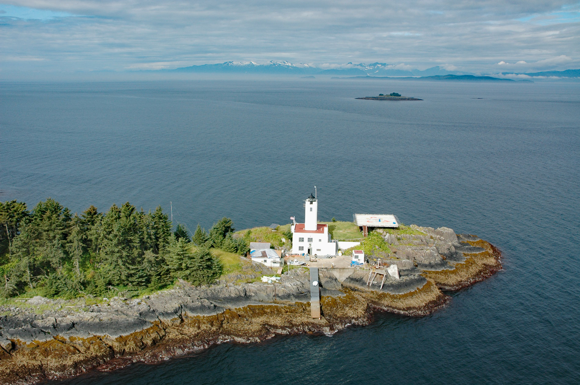
Five Fingers is a group of islets and the site of a historic lighthouse situated at the southern entrance to Stephens Passage, about 67 miles (108 km) east-northeast of Sitka and 41 miles (66 km) northwest of Petersburg, Alaska. Stephens Passage was named in 1794 by Captain George Vancouver for Sir Philip Stephens. According to the 1883 Pacific Coast Pilot published by the U.S. Coast and Geodetic Survey, ‘Five Fingers’ is a descriptive name given in 1869 by Commander Richard W. Meade on the USS Saginaw. Meade also applied the name ‘Five Fingers’ to a reef off Port Simpson, now called ‘Pointer Rocks’ in Dixon Entrance about 200 miles (322 km) to the south. Five Fingers are formed by sedimentary rocks of the Stephens Passage Group that consists of greywacke and mudstone, andesitic to basaltic volcanic rocks, minor amounts of limestone, and regionally metamorphosed and deformed equivalents of these strata that developed from the Jurassic to Cretaceous periods. This geologic formation extends from Gravina Island in the south to Lynn Canal in the north, and Five Fingers represents an extension of Cape Fanshaw.
The nutrient rich water of Stephens Passage provides habitat for a diverse terrestrial and marine ecosystem that includes deer, bears, shellfish, Pacific herring, all species of Pacific salmon, many resident and migratory birds, as well as whales, dolphins and porpoises, and seals. These animals in addition to an assortment of berries have provided food for humans for thousands of years. The Tlingit people historically inhabited the coast and islands of Southeast Alaska from Yakutat Bay in the north to Prince of Wales Island in the south except for Dall and Annette Island, and the southern half of Prince of Wales which in historical times was ceded to the Kaigani Haida. Various Tlingit matrilineal clans, or kwáans, traditionally inhabited the territory with the southern end of Stephens Passage occupied by the Kéex’ Kwáan with villages at Kake and Cape Fanshaw. The eastern shore of central Stephens Passage was the territory of the S’awdaan Kwáan with a village at Sumdum in Holkham Bay. The western shore and northern Stephens Passage were occupied by the T’aaku Kwáan with villages at Sikanasankian on Taku Inlet, Takokakaan at the mouth of Taku River, and Gambier Bay.
Stephens Passage is the principal maritime corridor of the Inside Passage leading to Juneau. In 1901, a contract was awarded to construct a lighthouse on the southernmost island of the Five Fingers. The rectangular wooden lighthouse with a square tower was completed in 1902. Atop the tower was a lantern room with a fourth-order Fresnel lens that produced a fixed white light. The original wooden structure burned down in December 1933 and was replaced in 1935 with an Art Deco design reinforced-concrete structure. The new building was a square one-story structure with a basement, and a square tower extending 13 feet (4 m) high from the center of the building. The basement included space for engine generators, storage battery, motor compressors, air receivers, coal room, boiler room, and a storage room. The basement doors opened out onto a concrete wharf constructed so that the walls form a water cistern. In 1984, the light was automated and subsequent budget cuts prompted the Coast Guard to lease the lighthouse to a non-profit organization. The Juneau Lighthouse Association was formed in 1997, and that same year it obtained a 35-year lease on Five Finger Lighthouse. In 2011, members of the Alaska Whale Foundation spent five weeks at the lighthouse monitoring humpback whales and investigating how vessel noise affects the whale’s behavior. On good days, the team was tracking up to 100 whales in Fredrick Sound. Read more here and here. Explore more of Five Fingers and Stephens Passage here:

