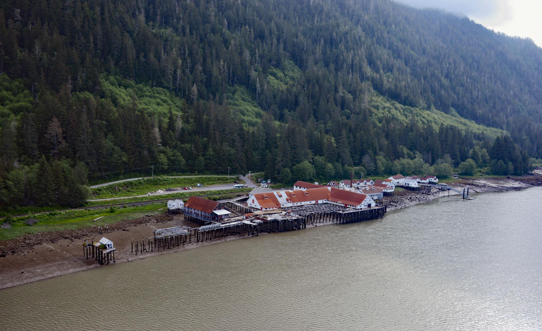
North Pacific Cannery was built in 1889 on 183 acres (74 ha) of Crown land on the north shore of Inverness Passage across from Smith Island and near the mouth of the Skeena River, about 70 miles (113 km) southwest of Terrace and 9 miles (14.5 km) south-southeast of Prince Rupert, British Columbia. Inverness Passage is a tidal channel that was named for a salmon cannery originally built in 1876 by the North Western Commercial Company and later owned by Turner Beeton & Company who named it after Inverness, Scotland. This area lies in the Coast Mountains of British Columbia and is geologically contiguous with the southern tip of Alaska. The bedrock is mostly metamorphic and plutonic rocks. Inverness Passage is roughly aligned with a geologic shear zone of metamorphic rocks sandwiched between the Alexander terrane to the west and Stikinia terrane to the east. The metamorphic rocks are mostly schist with some quartzite. The channel separates the Tsimpsean Peninsula to the north from Smith Island to the south, and the eastern end connects to the lower Skeena River.
The Skeena River is the second-longest river entirely within British Columbia after the Fraser River. Since ancient times, the Skeena has been an important transportation artery, particularly for the Tsimshian people. The Tsimshian comprise four major divisions; the Nisga’a on the Nass River, the Gitxsan on the Upper Skeena above the canyon at Kitselas, the Coast Tsimshian live along the banks of the lower Skeena and on the many estuarine inlets and islands, and the Southern Tsimshian on the coast and islands to the south at Milbanke Sound. In late prehistoric times, the Coast Tsimshian extended their territories from the lower Skeena towards the coast and built new villages on the islands where the weather was milder. As the salmon began to enter the rivers in early summer, the Coast Tsimshian moved to traditional fishing sites where seasonal camps were maintained. The sites for fishing were under the control of the matrilineal clans or ‘houses’ managed by the chiefs. During the mid to late 19th century, salmon canneries were built along the coast to exploit the huge salmon runs. On the Skeena River, canneries had to be built near the fishing grounds since prior to refrigeration the catch had to be transported and processed to prevent spoilage. These canneries also exploited the labor pool from First Nations villages and their fishing expertise.
North Pacific Cannery was built by Angus R. Johnston, John A. Carthew, and Alexander G. McCandless as a self-sustaining entity because of the physical isolation. Shortly after it was built in 1891, heavy rains caused a mud slide that wiped out the cabins used by the First Nations workers and their families. In 1892, when Anglo-British Columbia Packing Company took over the plant, it was a one-line cannery with 2 rooms for mild cure fish. A cold storage plant was added in 1910 but it closed in 1920 and was dismantled in 1954. A can-making factory was built at the site in 1918 and until 1936 it supplied cans for Seymour Inlet, Good Hope, British American, Cassiar, Knight Inlet, Arrandale, and Port Nelson canneries. By 1923, the cannery had expanded to a two-line operation, with cold storage and a blacksmith shop. The last full season of salmon canning at North Pacific Cannery was 1968. The Canadian Fishing Company re-opened the plant for a partial season in 1972 after a fire destroyed their Prince Rupert Oceanside plant. BC Packers bought North Pacific Cannery in 1980 and closed it in 1981. It was given National Historic Site designation in 1985 and now operates as a museum. Read more here and here. Explore more of North Pacific Cannery and Inverness Passage here:

