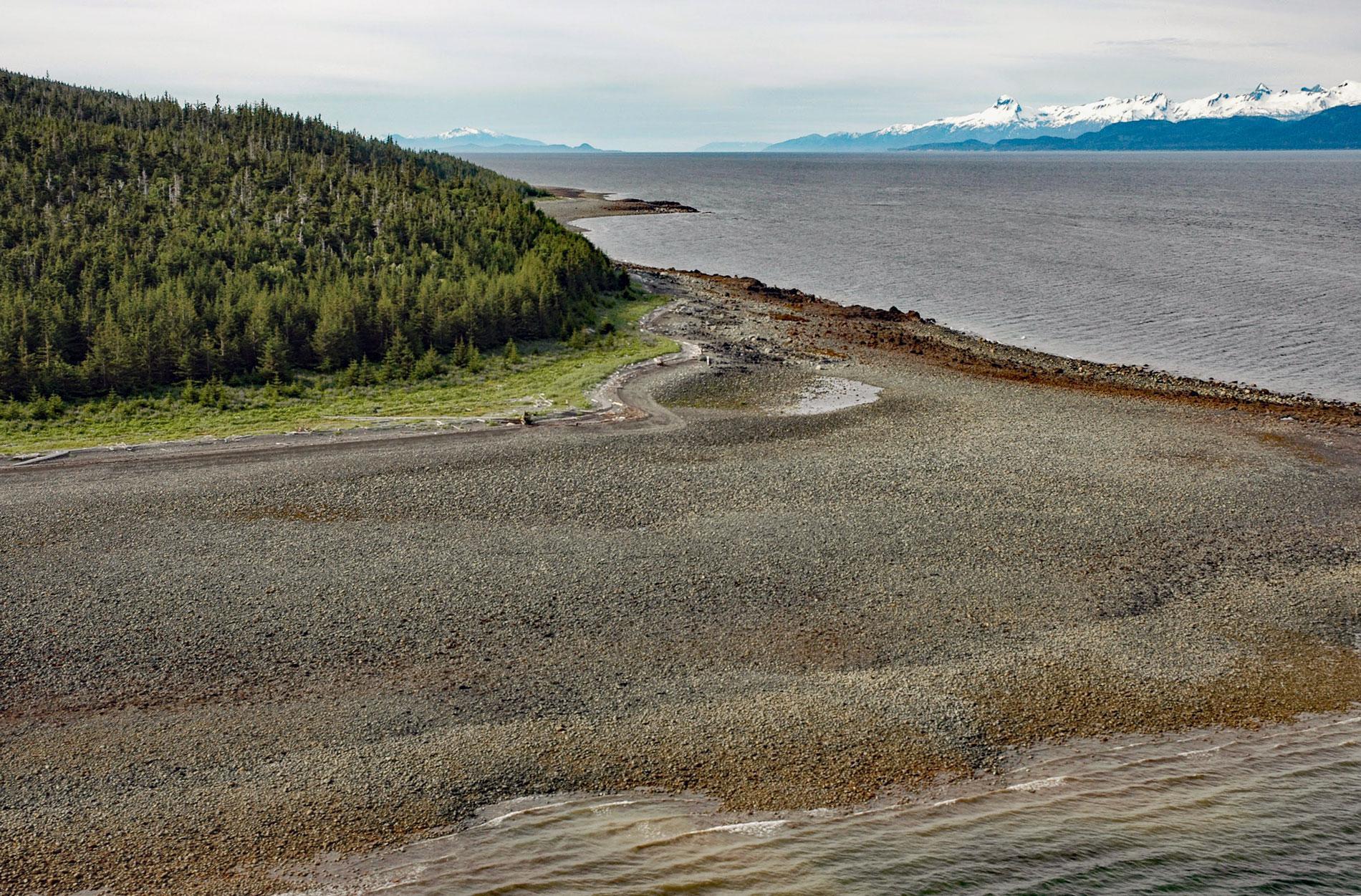
Point Sherman is the site of a historic lighthouse and now a navigational aid marking a shallow ledge that extends 1,600 feet (488 m) from the eastern shore of Lynn Canal and a reef called Sherman Rock situated 2,640 feet (805 m) to the southwest, about 46 miles (74 km) northwest of Juneau and 30 miles (48 km) south-southeast of Haines, Alaska. Lynn Canal is a deglaciated fjord about 90 miles (145 km) long and over 2,000 feet (610 m) deep. The fjord was named in 1794 by Captain George Vancouver for his birthplace, King’s Lynn, Norfolk, England. Point Sherman was named in 1869 by Commander Richard W. Meade of the U.S. Navy for William Tecumseh Sherman who was a U.S. Army General during the American Civil War. The point is formed by the Gravina Formation a belt of rocks in the Alexander terrane that extends along the axis of Southeast Alaska with multiple exposures of greywacke and mudstone, with lesser amounts of conglomerate, andesitic to basaltic volcanic rocks, limestone, and regionally metamorphosed and deformed equivalents of these strata.
Point Sherman marks the approximate boundary between the traditional territories of Tlingit Clans with the Auke people to the south and the Chilkoot and Chilkat people to the north. In 1778, when the Russian-American Company established a trading post at present day Sitka, Lynn Canal was subsequently often visited by maritime fur traders. In 1811, a skirmish between the American fur trader Captain Samuel Hill, on the brig Otter, and the Chilkat occurred in Lynn Canal. Accounts of the incident do not mention what instigated the confrontation, but the blame was placed on the 1st mate William Hughes who apparently noticed but did not report that Tlingit who came aboard the ship to trade were armed with knives. Second mate Robert Kemp and boatswain John Smith were killed and the Tlingit lost between 40 and 50 men including 13 chiefs. Between 1896 and 1899, Lynn Canal became a major shipping route to the Klondike gold fields via the boom towns of Skagway and Dyea. This traffic prompted the construction of a series of lighthouses along the Inside Passage including Eldred Rock Light, Sentinel Island Light, and Point Sherman Light.
Point Sherman Light Station was constructed during the summer of 1904 making it the eleventh U.S. lighthouse built in Alaska. The light was similar to those constructed on Fairway Island and Point Retreat and was displayed from a black hexagonal lantern room situated atop a white hexagonal tower. A keeper’s dwelling and a boathouse were located just east of the light. In 1911, the original fixed white oil light was replaced by an acetylene light that produced a white flash every three seconds and raised the light’s focal plane from 38 feet (11.6 m) to 42 feet (12.8 m) above high water. With this change, the light was also automated, and the last resident lighthouse keeper was withdrawn. In 1932, the station was transferred to the U.S. Forest Service and replaced by a nearby buoy. In 1981, a day marker and a light were placed on the site of the original lighthouse and is operated by the U.S. Coast Guard. The day marker has two diamond-shapes painted in a red and white checkerboard pattern. The light has a focal plane of 47 ft (14.5 m) and flashes white every 4 seconds. Read more here and here. Explore more of Point Sherman and Lynn Canal here:

