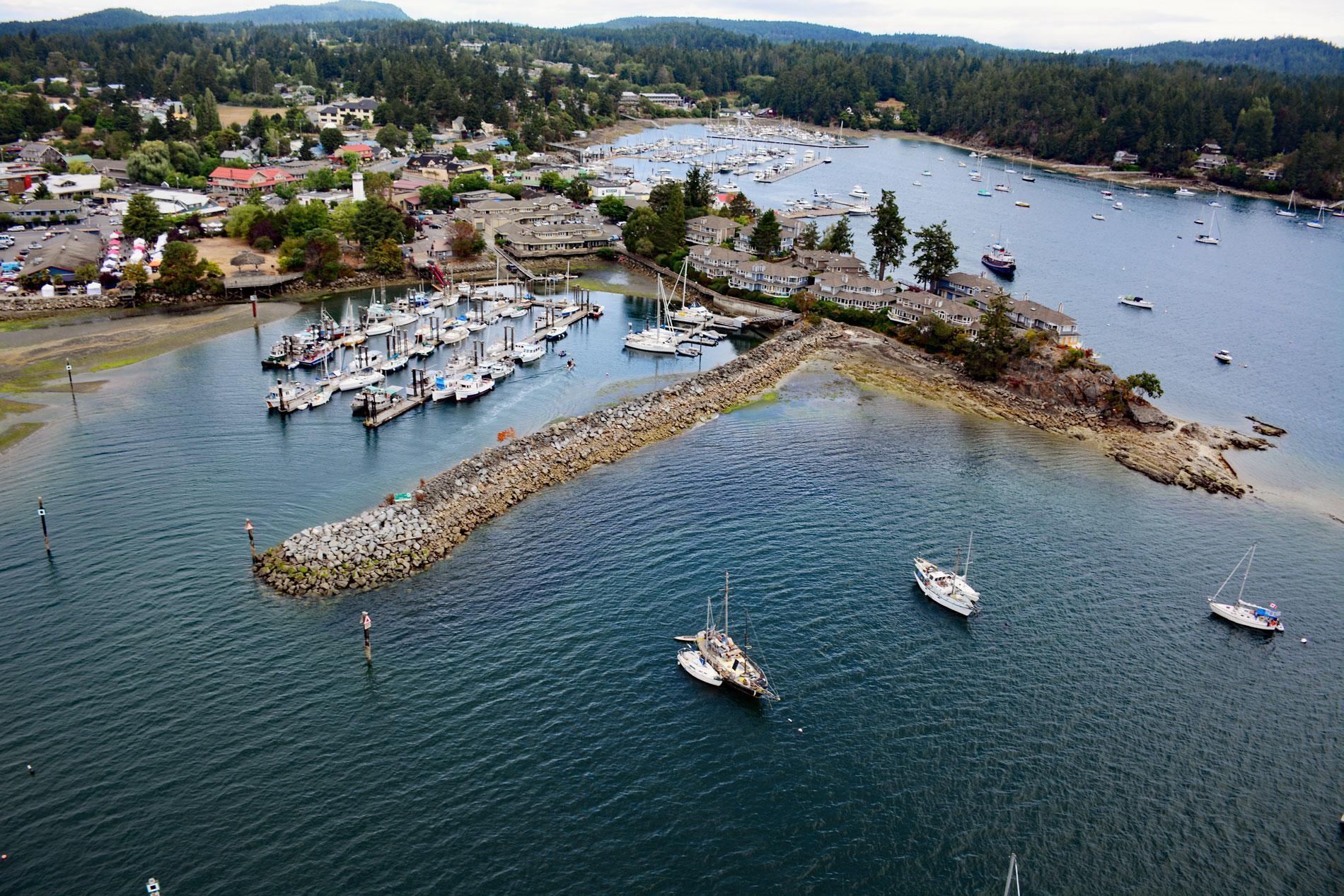
Ganges Harbour is an embayment on the eastern coast of Salt Spring Island that extends 5 miles northwest from Captain Passage, about 35 miles (57 km) southwest of Vancouver, and 15 miles (24 km) north-northwest of Sidney, British Columbia. Ganges Harbour was originally called Admiralty Bay and was renamed in 1859 by Captain George H. Richards after the HMS Ganges that was at the Pacific Station at Esquimalt on Vancouver Island from 1857 to 1860 under the command of Captain John Fulford. Salt Spring Island is one of the Gulf Islands in the Strait of Georgia and was named by James Douglas who found salt springs on the north end of the island. The bedrock geology of Salt Spring Island consists of sedimentary rock of the Nanaimo Group in the northern part of the island and volcanic rock of the Saltspring Intrusive, Sicker and West Coast Complex in the southern part of the island. The Nanaimo Group is primarily a marine sedimentary sequence up to 2.5 miles (4 km) thick that developed during the Cretaceous and consists of sandstone and conglomerate separated by mudstone and siltstone. The bedrock of Salt Spring Island is covered by unconsolidated deposits of till, glaciofluvial gravel and sand, and glaciomarine clay deposits more than 100 feet (31 m) thick in the lower valley regions.
Salt Spring Island is part of the traditional territory of several Salishan peoples including the Saanich, Cowichan, and Chemainus First Nations. Aboriginal use of the Gulf Islands based on shell middens dates to 3,200 BC. Permanent settlements fluctuated with the main prehistorical and historical population centers at present-day Fulford Harbour, Ganges, Long Harbour, and Hudson Point. A major epidemic in the 1780s and subsequent warfare with northern peoples shifted resident populations to villages on Vancouver Island, Penelakut Island, and Valdes Island from which the various families continued to access their ancestral lands and seasonal resources on Salt Spring Island. In 1849, the Hudson’s Bay Company established the Crown Colony of Vancouver Island. In 1859, Governor James Douglas in Victoria allowed access to unceded aboriginal lands by immigrants who were desperate for a place to settle. Among the settlers were Australians, Americans, and Europeans who had come to Canada in search of gold. The early settlers also included former Hudson’s Bay Company employees, including several Hawaiian Islanders who had been brought to the Pacific Northwest as laborers. Some of these settlers chose Salt Spring, despite being isolated by the surrounding waters, and the geographically rugged terrain covered by huge Douglas firs that had to be cleared.
The island has a detailed history because it was the first in British Columbia to allow settlers to acquire land through pre-emption. Settlers could occupy and improve the land before purchasing for one dollar per acre. The island became a refuge from racism for African Americans who had resided in California but left in 1858 after the state passed discriminatory legislation, and 26 families acquired land on the island. The first house on Salt Spring Island was built at Ganges in 1859 by the first group of 20 settlers that arrived on the island that summer. Despite the settlements, internecine raids continued, and in 1860, Ganges Harbour was the scene of the killing of eight Heiltsuk people from Bella Bella and the capture of three pioneer women and two boys by the Cowichans. During the 1960s, the island became a political refuge for United States draft evaders during the Vietnam War. The community of Ganges is the main population center situated at the head of Ganges Harbour and is the main service area on the island with several grocery stores, numerous restaurants and art galleries, banks, and the Ganges Market. Read more here and here. Explore more of Ganges Harbour and Salt Spring Island here:

