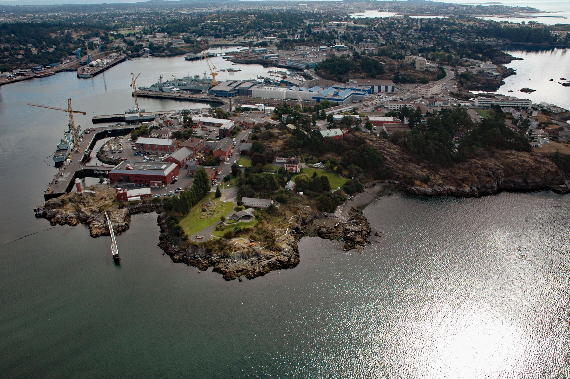
Esquimalt Harbour is a sheltered embayment on the southern tip of Vancouver Island, about 21 miles (34 km) north of Port Angeles, Washington and 3 miles (4.8 km) west-northwest of downtown Victoria, British Columbia. The harbour is bounded by the communities of Colwood to the west, View Royal to the north, and Esquimalt to the east. The entrance to Esquimalt Harbour is from the Strait of Juan de Fuca through a narrow channel known as Royal Roads. The entrance is marked by the historic Fisgard Lighthouse. Esquimalt Harbour is home to the Canadian Forces Maritime Forces Pacific.
The region now known as Esquimalt was settled by First Nations people approximately 400 years before the arrival of Europeans. The treaties of the Hudson’s Bay Company, signed in 1843, refer to these people as the Kosampsom group, though they are now known as the Esquimalt Nation. The word Esquimalt is a transliteration of “Ess-whoy-malth”, a phrase usually translated as “place of the shoaling waters”. The Songhees people, who now have a reserve in Esquimalt, were originally located on the western shore of what is now Victoria Harbour, but were relocated in 1911. Both nations spoke a North Straits Salish dialect called Lekwungen which is also an alternate name for the Songhees.
In the summer of 1790, Manuel Quimper, Gonzalo López de Haro, and Juan Carrasco aboard Princesa Real explored the Strait of Juan de Fuca where they claimed Esquimalt Harbour for Spain, naming it Puerto de Córdova. In 1792, Captain George Vancouver extensively explored the region. Following the resolution of the Nootka Crisis in 1795, control of the region went to the British and the British owned Hudson’s Bay Company. In 1843, the company was looking for a new location for its Pacific base of operations. Esquimalt Harbour was rejected as a site for a fort because there were too many trees there. However, ships continued to use Esquimalt Harbour to load and offload passengers and supplies. In 1852, sailors from HMS Thetis built a trail through the forest linking the harbour with the new fort at Victoria Harbour. This trail is now paved and called Old Esquimalt Road. In 1855, the British Royal Navy constructed three hospital buildings on the harbour to treat casualties of the Crimean War. In 1858, the discovery of gold on the Fraser River triggered a massive influx of people, and with the growing population came the area’s first building boom. In 1865, the Royal Navy relocated the headquarters of its Pacific fleet from Valparaíso, Chile, to Esquimalt Harbour. In 1905, the Royal Navy abandoned the area, but the Pacific base of the new Royal Canadian Navy replaced it in 1910. In June 2010, the Royal Canadian Navy celebrated its 100th anniversary. Read more here and here. Explore more of Esquimalt Harbour here:

