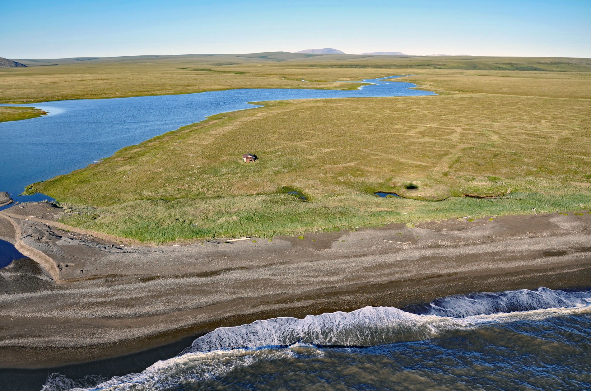
Aitiligauraq Shelter Cabin is in the Cape Krusenstern National Monument in northwestern Alaska and is situated on the south bank of an unnamed creek that flows west for 5 miles (8 km) from Eigaloruk Mountain to a coastal lagoon, about 110 miles (177 km) southeast of Point Hope and 40 miles (65 km) northwest of Kotzebue, Alaska. Eigaloruk Mountain has an elevation of 757 feet (231 m) and the name is from the Iñupiaq language meaning ‘little window’ according to the U.S. Coast and Geodetic Survey in 1950. The national monument is collocated with the Cape Krusenstern Archeological District centered on Cape Krusenstern which is primarily a coastal plain, containing large lagoons and rolling hills of limestone. The eroding coastal bluffs record thousands of years of change in the shorelines of the Chukchi Sea, as well as evidence of about 9,000 years of human habitation.
Atiligauraq is on the coastal lowlands bordering the Chukchi Sea coast historically inhabited by an Iñupiaq group called Qikiqtagrungmiut. Europeans first identified the Qukiqtagrungmiut as a tribe in 1838 when Alexander F. Kashevarov, an employee of the Russian-American Company, explored the area. They traditionally subsisted on sea mammals, land mammals, fish, and flora that entailed a seasonal cycle of movement practiced to take advantage of these resources. This seasonal movement pattern included both a change in locality and the consolidation or disbursement of family groups. Dwelling structures throughout the year varied from substantial houses to tent camps. The site at Atiligauraq was typically occupied during the early summer ice breakup. In July, the entire Qikiqtagrungmiut population moved south to Sheshalik for an annual trade fair attended by members of many different Iñupiaq groups and, after contact, by increasing numbers of Europeans
From 1905 to 1932, the Alaska Road Commission developed an elaborate system of trails and sled roads in Alaska totaling more than 10,000 miles (16,000 km). This system was designed to serve military needs as well as those of the mostly itinerant population of fishermen, trappers, and miners. The early labor consisted of flagging winter sled routes and cutting brush for a pioneer overland trail. The commission eventually abandoned the system of trails and sled roads and instead built airfields. The winter trail along the Chukchi Sea coast continued to be used and maintained by miners who worked the creeks and by people from coastal villages who would use the trail with dogs and later with snowmachines to camp at Aitiligauraq and other lagoons. Several shelter cabins remain today in Cape Krusenstern National Monument as a testament to this history, although many of the cabins have deteriorated and there are no current plans to preserve or reconstruct them. Read more here and here. Explore more of Aitiligauraq and Cape Krusenstern here:

