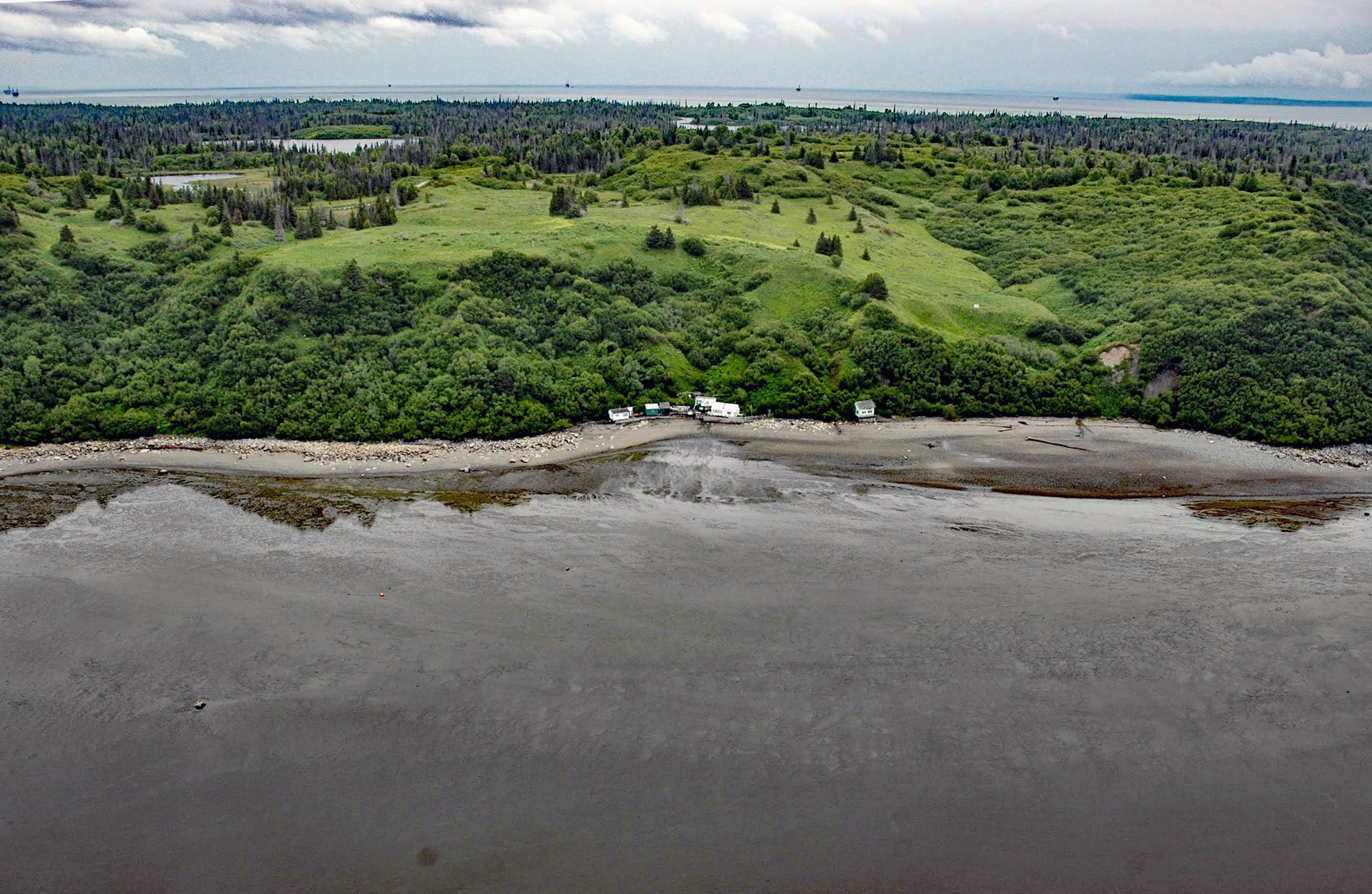
Kustatan is a historical Dena’ina community on West Foreland, on the west side of Cook Inlet near the mouth of the Kustatan River, about 71 miles (115 km) southwest of Anchorage and 20 miles (32 km) northwest of Kenai, Alaska. The last syllable ‘tan’ in the name means point or cape. The name was first published in 1880 by Ivan Petroff who was a Russian-born soldier, writer, and translator who for many years was regarded as a major authority on Alaska. The Kustatan River starts from a glacier terminus at an elevation of 2600 feet (793 m) in the Chigmit Mountains of the Aleutian Range and flows generally south for 31 miles (50 km) to a bight formed by West Foreland that becomes a vast mudflat over 2 miles (3.2 km) wide at low tide. West Foreland represents a major glacial moraine of gravel and sand that formed during the late Pleistocene as glaciers in Cook Inlet repeatedly advanced during the general retreat from maximum positions in the central basin.
A prehistorical cultural group called the Kachemak Tradition occupied most of the Cook Inlet Basin from 3,800 to 1,000 years ago. The Kachemak Tradition subsistence strategy focused on marine mammals, migratory waterfowl, seabirds, intertidal resources, and ocean fish. The withdrawal of the Kachemak Tradition people left Cook Inlet open to occupation by the Dena’ina Athabascans with a subsistence strategy based on boreal forest and open woodland resources plus freshwater fish and salmon migrating to the inland reaches of river systems. The first recorded encounter between the Dena’ina and Europeans occurred in May 1778 when the British naval vessels Resolution and Discovery, under the command of Captain James Cook anchored off West Foreland. Here they traded with one or more Dena’ina people who approached the ships in kayaks. Cook commemorated this interaction by naming the bay between West Foreland and North Foreland ‘Trading Bay’. At that time, the Cook Inlet Dena’ina lived in villages in late fall and winter. Each village contained one or more multifamily, semi-permanent houses. Known village sites along west Cook Inlet included Polly Creek, Harriet Point, Kustatan, Old Tyonek, North Foreland, and at the mouth of the Chuitna River. Most of the residents of Kustatan moved to Tyonek in the early 1900s.
Cook Inlet is an oil and gas region first identified by Russian explorers in the 1850s. Early exploratory drilling started in the 1950s and the Swanson River oilfield on the Kenai Peninsula was discovered in 1957. In 1962, Pan American Petroleum Corp discovered the Middle Ground Shoal oil field, the first offshore discovery in the Cook Inlet basin. The first offshore production platform was installed on this field by Shell in 1964. The following year, Unocal discovered the basin’s largest oil field at McArthur River on Trading Bay, estimated at 1.5 billion barrels, and Mobile Oil discovered the Granite Point field near the North Foreland. In 1968, Pan American Petroleum discovered the Redoubt Shoal oil field adjacent to West Foreland. Today, the field is operated by Glacier Oil and Gas and the unit includes the Osprey platform and the Kustatan production facilities. Read more here and here. Explore more of Kustatan and West Foreland here:

