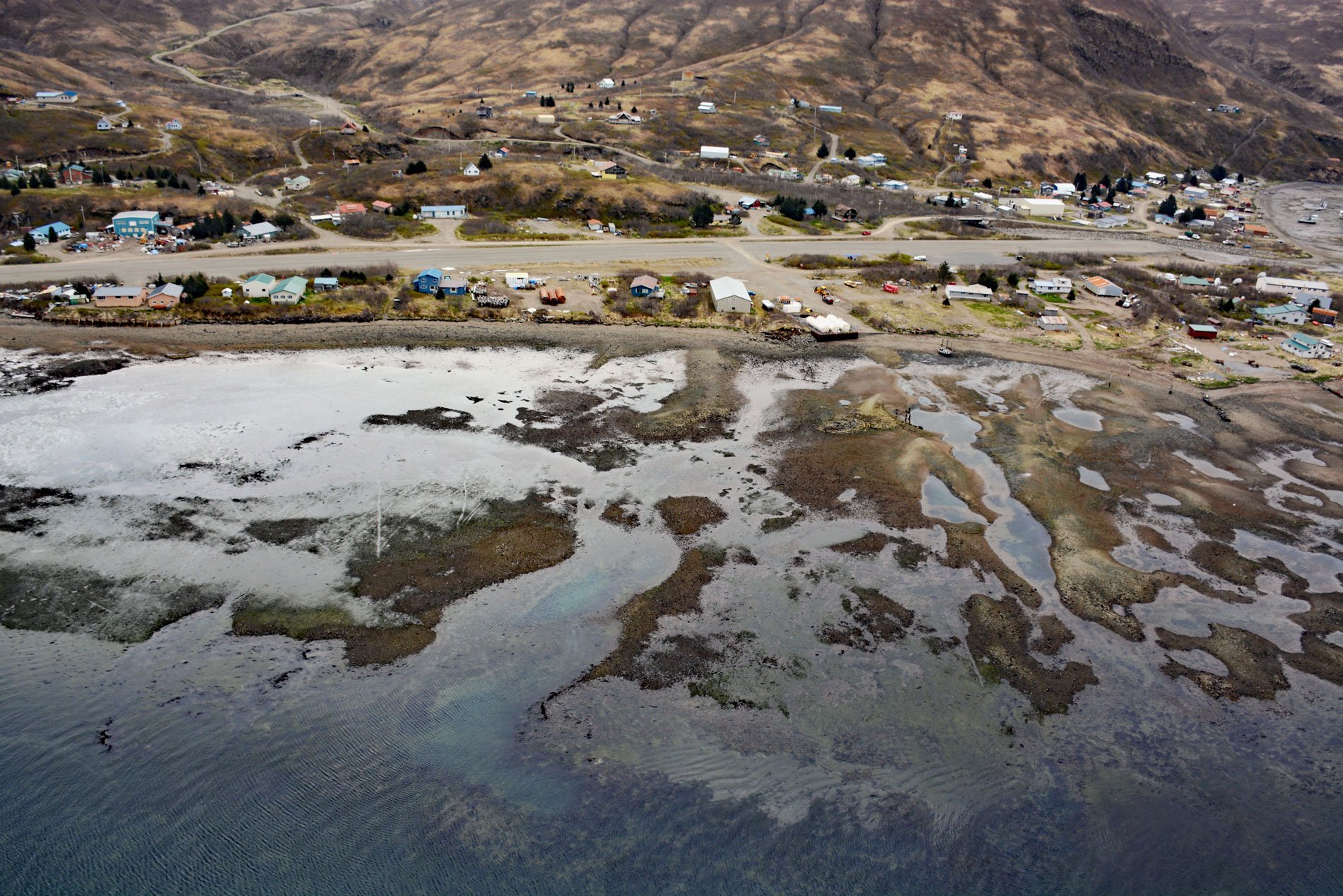
Chignik Lagoon is an embayment that trends southwest for 8.5 miles (14 km) from the head of Chignik Bay to the mouth of Chignik River on the Gulf of Alaska coast of the Alaska Peninsula, about 45 miles (73 km) south of Port Heiden and 5 miles (8 km) west-northwest of the community of Chignik, Alaska. The lagoon was named after Chignik Bay in 1899 by Lieutenant Commander Jefferson F. Moser, of the U.S. Navy, on the U.S. Bureau of Fisheries steamer Albatross. Chignik is from the Aleut language and means ‘big wind’. The lagoon is an estuary of the Chignik River that cuts through the Aleutian Range and drains a watershed of 222,152 acres (89902 ha). The mountains forming the northwestern shore of the lagoon represent the Naknek Formation which consists of marine sedimentary rock that developed during the Late Jurassic. The southern part of the eastern shore of the lagoon represents the Meshik Formation with volcanic rocks that developed during the Oligocene and Eocene, and the northern part represents the Tolstoi Formation with nonmarine sedimentary rocks including some coal that developed during the Eocene and Paleocene.
The central and lower Alaska Peninsula was first occupied by humans just before 5100 years ago, but there is little evidence of human occupation in the region for the next 1000 years which may be related to the devastating impact of the caldera-forming eruption of Mount Veniaminof estimated as occurring between roughly 4100 and 3900 years ago. The Chignik River provided a route between Bristol Bay and the Gulf of Alaska, and the Chignik region was a contact boundary between Aleut and Yup’ik language groups. Archaeological evidence suggests that both Unangan Aleut and Kanaigmuit Alutiiq peoples inhabited this part of the peninsula, primarily subsisting on sea otters, sea lions, porpoises, and whales. During the late 1700s and early 1800s, Russian fur traders began exploring the Aleutian Islands and Alaska Peninsula, and during the fur boom between 1767 and 1783, the sea otter population was decimated. Subsequently, the population of Alutiiq people was reduced by 50% due to introduced diseases and conflict. In 1867, Alaska was purchased from Russia and the Chignik salmon fishery quickly grew with many Euro-American migrants moving into the region establishing settlements at Chignik Bay, Chignik Lake, and Chignik Lagoon where an Alutiiq settlement, referred to as ‘Old Village’, was located on the northeastern shore of the lagoon.
In 1889, the first three canneries in the area were built at Chignik Lagoon. These were operated by the Chignik Bay Company cannery, the Shumagin Packing Company, and the Chignik Bay Packing Company. In 1892, the Chignik Lagoon canneries consolidated to form the Chignik Bay Packing Company. The community of Chignik Lagoon developed on the south or ‘flat side’ of the lagoon as a fishing village because of the large sockeye salmon runs in the lagoon and river. The commercial salmon fishery in the lagoon primarily used fish traps targeting sockeye returning to the Chignik River. By 1911, there were approximately 30 traps in the lagoon and more operated in Shelikof Strait from Chignik Bay northeast to Aniakchak Bay. The traps were very efficient, and very few salmon reached the spawning grounds causing the population to rapidly decline. By the 1940s, only three traps remained in the lagoon, and in 1959, all traps were prohibited. In addition to fish traps that were owned by the canneries, beach seines owned by individuals were used from shore to catch salmon for commercial safe. In 1932, Harry Crosby arrived at Chignik Lagoon and brought with him the first moving seine that could be set off the back of a moving boat. By 1959, seining dominated all commercial salmon fishing activities in the Chignik Area, and seines are now the only legal gear for commercial salmon fishing in the Chignik Management Area. Read more here and here. Explore more of Chignik Lagoon and the Alaska Peninsula here:

