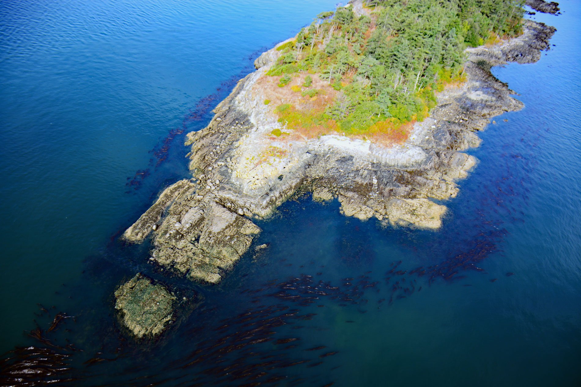
Halibut Island is about 0.4 miles (0.7 km) long and 0.1 miles (0.2 km) wide and 9.67 acres (3.9 ha), located off the east coast of Sidney Island in Haro Strait, about 14 miles (23 km) north-northeast of Victoria and 6 miles (10 km) east-southeast of Sidney, British Columbia. The island is known as Siscenum by the people of the Tsawout, Pauquachin, Tsartlip, and Tseycum First Nations. The name roughly translates to mean ‘sitting out for pleasure of the weather’. The island was a likely rest stop and a place to gather food while transiting in canoes among the Southern Gulf Islands.
The islands of the southern Salish Sea have been historically used by the Coast Salish and Nuu-chah-nulth peoples, known today as Lkwungen. Halibut Island supports Garry oak, arbutus, Douglas fir woodlands, and open wildflower meadows. Unlike many Salish Sea islands, there are no wild deer so in the spring the meadows are carpeted with camas, fawn lily, and chocolate lilies. The islands in general were a place to fish for halibut and cod, collect seabird eggs, gather plants for traditional medicines, and pick sea urchins and chitons from the exposed intertidal rock ledges. The island geology is sandstone that accumulated during the Turonian age, or about 90 million years ago. The bedrock was scraped by the last glaciation exposing fossils of bivalves and mollusks such as ammonites. These rock ledges now extend into the ocean creating a habitat that supports abundant and diverse marine algae and animals.
Bull kelp grows in dense beds on the nearshore submerged ledges surrounding Halibut Island. The scientific name for this kelp is Nereocystis (‘mermaid’s bladder’) luetkeana, named after the German-Russian explorer Fyodor Petrovich Lutke. This annual kelp is a brown alga that grows on bedrock and large boulders to depths of about 20 feet (6 m) and prefers locations with high-velocity currents. Because the bull kelp can tolerate currents, large beds of this kelp can influence coastal oceanographic patterns and can be ecosystem engineers by creating a habitat that allows other marine algae and animals to exist. Over the last century, they have and continue to be the focus of extensive ecological research. Read more here and here. Explore more of Halibut Island and Haro Strait here:

