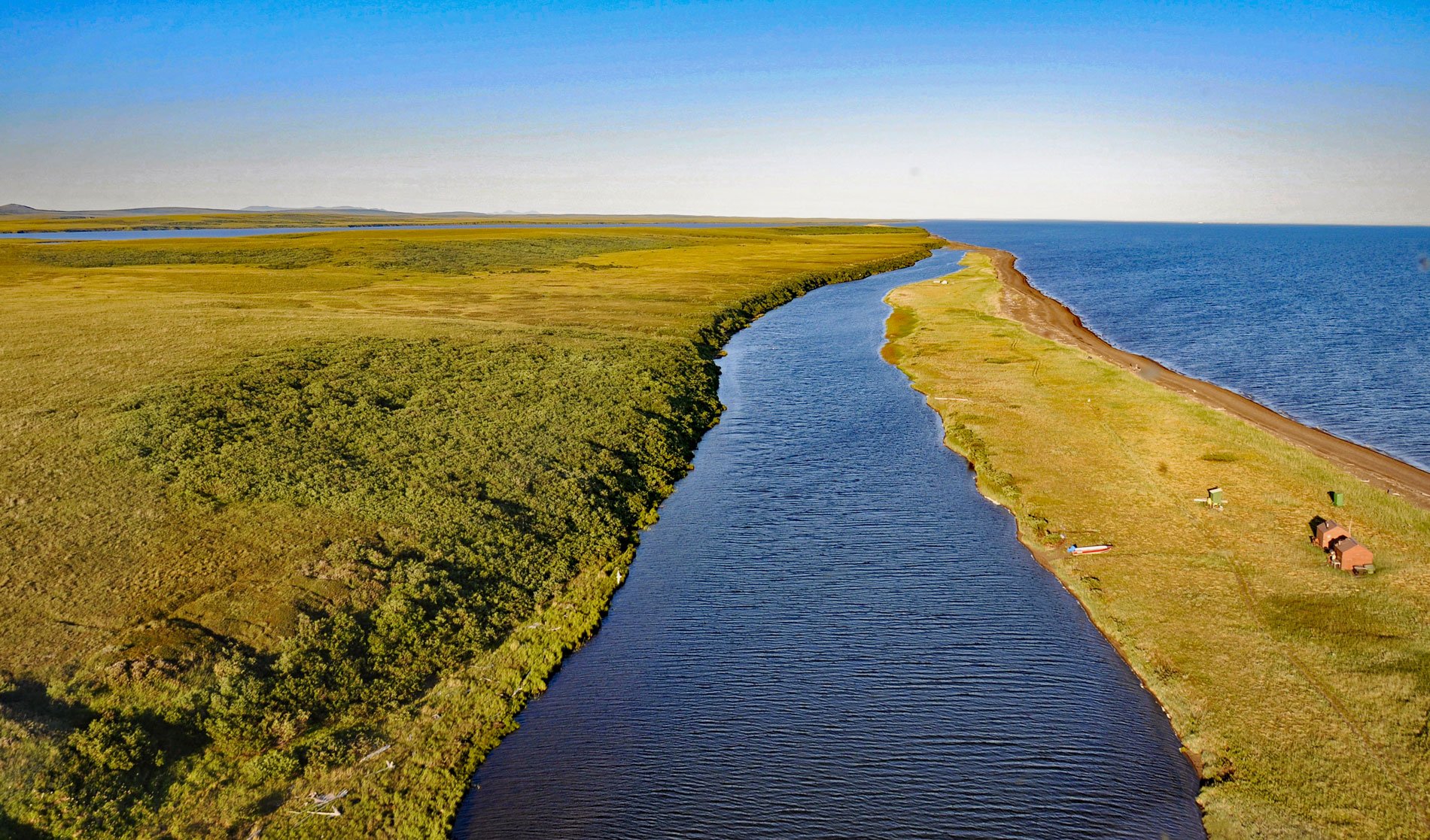
Tukrok River flows generally east-southeast for 7 miles (11 km) from Krusenstern Lagoon to Kotzebue Sound in Cape Krusenstern National Monument, about 166 miles (268 km) northeast of Wales and 23 miles (37 km) northwest of Kotzebue, Alaska. In the Iñupiat language, the name for the river means ‘inlet entrance’ and it was first published in 1950 by the U.S. Coast and Geodetic Survey. Cape Krusenstern is a sharp inflection of the coast on the Chukchi Sea that forms the northern shore of Kotzebue Sound. The cape comprises a series of accretionary beach ridges that represent depositional sediments consisting mostly of sand and gravel transported south by longshore currents, possibly as far as the sea cliffs near Cape Thompson, about 60 miles (100 km) to the north. The beach ridges contain an exceptionally complete and well-studied record of Arctic prehistory spanning the last 4,500 years.
Early humans that migrated across Beringia were subsistence hunters of marine mammals and likely stayed as close as possible to the coast, and the individual beach ridges at Cape Krusenstern can be approximately dated by archaeological evidence of their occupation. There is evidence of 5,000 years of occupation along the coast by the Iñupiat people and more than 9,000 years by earlier human cultures. The area was also used historically for trading between coastal and inland tribes. In the 1850s, Euro-Americans visited the Cape Krusenstern region in pursuit of whales. At the time of the Alaska Purchase in 1867, Alaska was generally roadless, and the coastal communities along the Chukchi Sea were only loosely connected by a network of trails established by local hunters. In 1905, the U.S. Congress established the Alaska Road Commission that flagged over 247 miles (398 km) of winter trails and built a series of emergency shelter cabins for winter travelers. Many of these survive today, including the Anigaaq cabin at the mouth of the Tukrok River that was built in 1925 and is now the Anigaaq Ranger Station maintained by the National Park Service as part of Cape Krusenstern National Monument.
Cape Krusenstern National Monument includes the coast of the Chukchi Sea from Hotham Inlet at the mouth of the Kobuk River in the south, to a point near Imikruk Lagoon near Kivalina in the north. The coastline is marked by a series of lagoons separated from the sea by barrier spits. The largest is Krusenstern Lagoon at Cape Krusenstern. Others include the Kotlik, Imik, and Aukulak lagoons. These shallow water bodies are seasonally productive ecosystems that represent important habitat for migratory fish and waterfowl. The lagoons also support a high abundance of prey fish and invertebrates which provide a food source for a variety of fish and wildlife. Many of the migratory species, like sheefish and sandhill cranes, are important subsistence species for Iñupiat and other rural residents of the region. Most lagoons connect to the Chukchi Sea only during periods of high freshwater runoff, or during coastal storms that facilitate breaching of the gravel berms that otherwise separate them from saltwater. Others remain constantly connected to the ocean, while some may not connect every year. Despite the remote and relatively pristine nature of these lagoons, changing climate as a result of global warming, coastal erosion, and human development in the Arctic may result in consequences for lagoon ecosystems and the people who utilize them. Read more here and here. Explore more of Tukrok River and Cape Krusenstern here:

