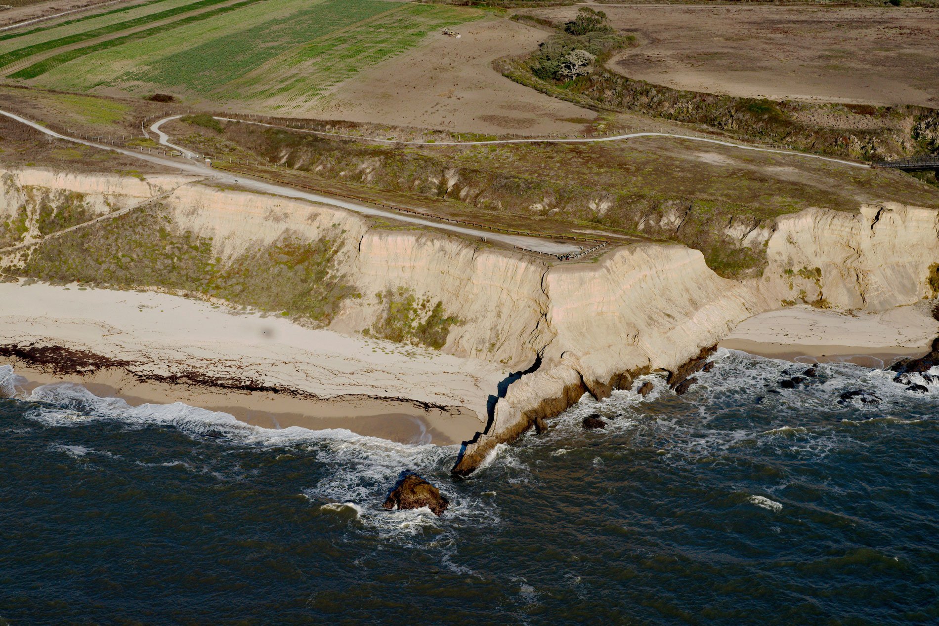
Cowell Ranch Beach is at the southern end of Half Moon Bay near the ghost town of Purissima, and the northern boundary of the historical Cowell Ranch, about 38 miles (61 km) northwest of Santa Cruz and 2.8 miles (4.5 km) south of the community of Half Moon Bay, California. The Cowell Ranch was one of several properties owned by industrialist Henry Cowell and comprised 1,270 acres (514 ha) of rolling, grassy coastal hills, eroding cliffs, and sandy beaches. The mainland adjacent to Cowell Ranch Beach represents a geologically complex region dominated by the San Andreas Fault to the east and the San Gregorio Fault to the west. The relatively flat coastal fringe is formed by a series of marine terraces that consist of hard mudstone, siltstone, and sandstone in the Purisima Formation that overlies Montara quartz diorite, and at higher elevations is overlain by older marine terrace deposits. During Pleistocene glacial periods, eustatic sea level is estimated to have dropped by as much as 490 feet (150 m), placing the coastline more than 3 miles (5 km) seaward of the present shoreline of Half Moon Bay. The marine terraces were formed during these periods of fluctuating sea levels by wave erosion, creating nearly horizontal platforms that were subsequently uplifted.
In 1849, Henry Cowell and his brother John left their hometown of Wrentham, Massachusetts to seek their fortune in the California goldfields. Henry began a successful drayage business that soon grew to include routes to Stockton and the Sierra gold country. He soon realized that the population boom started by the Gold Rush would lead to the construction of towns and cities. In 1865, Henry Cowell bought half ownership of the lime works at Santa Cruz from Albion Jordan, and in 1888, purchased the remaining half. He bought ships, established a cement trade with Belgium and bought large landholdings, ranches, and limestone deposits in 23 California counties. Cowell diversified his business holdings with ventures in cattle, logging, and real estate. In 1845, Henry Dobbel came to California via Cape Horn, and in the 1860s, built a house on the south bank of Purisima Creek. He employed 50 men who worked the surrounding fields planted with wheat, barley, and potatoes. By the early 1870s, the fledgling community of Purissima had a post office, several stores, a school, a one-story hotel known as Purissima House. Henry Dobbel went bankrupt after a series of crop failures and sold his estate in 1890 to Henry Cowell.
From 1907 to 1920, the Ocean Shore Railroad operated from San Francisco to Tunitas Creek, and ran along the coast at Cowell Beach before making a stop at Purissima. Mainline service was abandoned in 1920, but the railroad bed still exists is a few places as a secondary road that parallels California Highway 1. When Henry Cowell died in 1903, he owned 10,000 acres (4,047 ha) of land which was passed on to his youngest son Harry Cowell who continued operating the lime business until 1946. When Harry died in 1955, the estate went to the S.H. Cowell Foundation that distributed funds to the Cowell Ranch, Cowell Beach, and a large addition to Henry Cowell Redwoods State Park. Part of the ranch property was sold to the University of California for the creation of the new Santa Cruz campus in 1965. In 1988, the land was sold in 1988 to the Peninsula Open Space Trust. After permanently protecting the lands through a conservation easement, about 1,200 acres (485 ha) were sold to farming families for row crop agriculture and cattle grazing. The remaining lands which include a public trail and spectacular beaches were merged into the California State Parks system. Read more here and here. Explore more of Cowell Beach and Half Moon Bay here:

