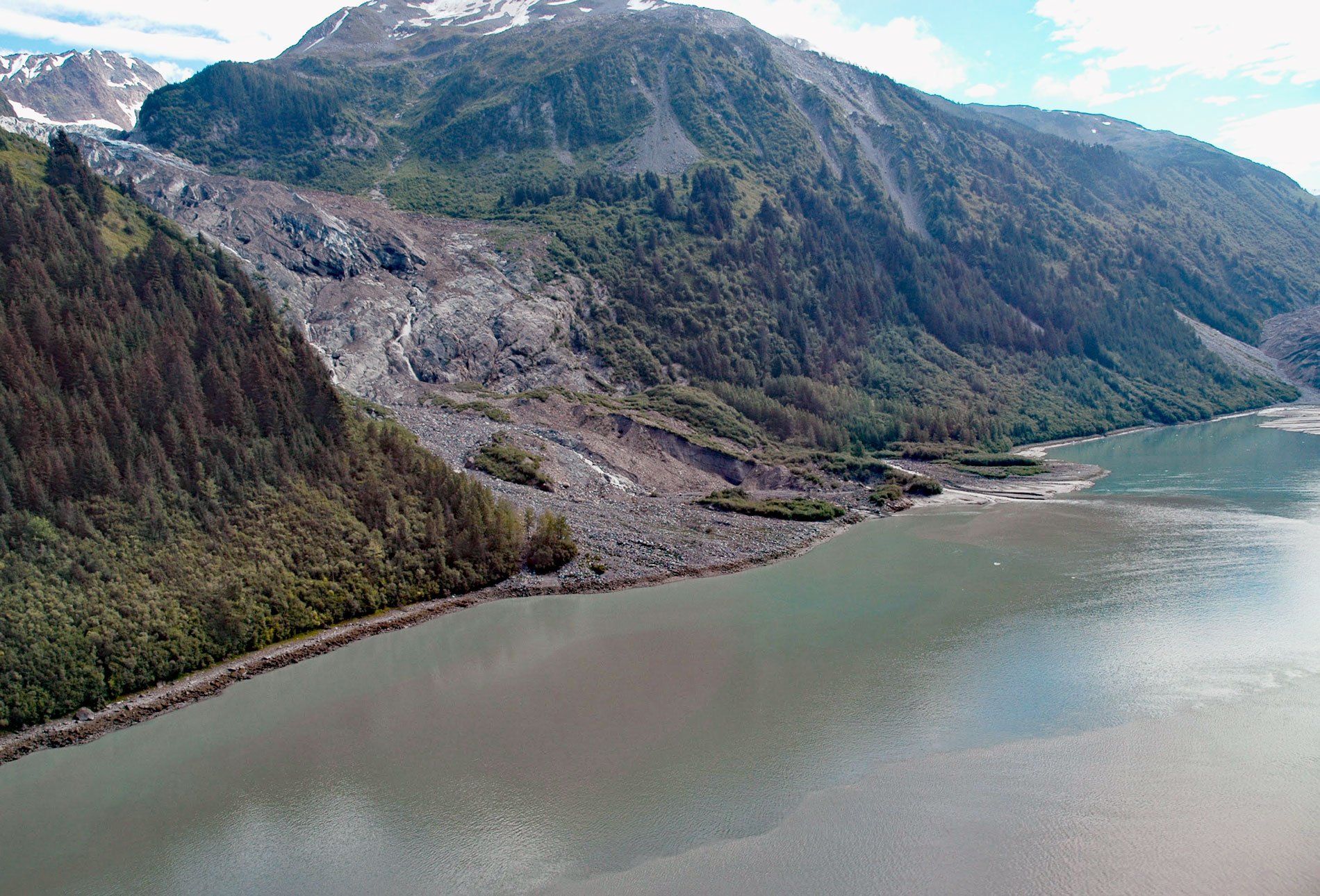
Cascade Glacier starts from the western slope of Peak 7788 (2,374 m) in the Fairweather Range and flows generally west for 2.6 miles (4 km) to the head of Lituya Bay in Glacier Bay National Park and Preserve, about 97 miles (156 km) southeast of Yakutat and 67 miles (108 km) northwest of Gustavus, Alaska. In 1786, Jean-François de Galaup, comte de Lapérouse called this the Middle Glacier. The current name was reported by the International Boundary Commission and published on a map dated 1894. The head of Lituya Bay is roughly aligned with the Fairweather Fault, and the Cascade Glacier is on the northeast side of the fault. The retreat of the glacier and general thinning of all the glaciers in the Fairweather Range has exposed bedrock representing the Valdez Group of the Southern Margin Composite terrane that developed during the Cretaceous. This geologic group consists of metasedimentary siltstone, volcanogenic greywacke, mudstone, and minor conglomerate. An igneous intrusion during the Cretaceous formed a pluton of granodiorite, now exposed along the edges of the Fairweather Fault in Lituya Bay.
When Lapérouse visited Lituya Bay, maps and drawings by expedition members show the locations of five glaciers at the head of the bay, two at the head of a northern inlet, two at the head of a southern inlet, and one in the middle. In 1894, when the boundary survey party visited Lituya Bay, the pairs of glaciers observed in 1786 in each inlet had coalesced and advanced about 3 miles (4.8 km), but the Cascade Glacier had retreated so that it no longer terminated at tidewater. In 1917, J.B. Mertie of the U.S. Geological Survey visited Lituya Bay and later wrote of observing only two glaciers that terminated at tidewater, Lituya Glacier in the northern Gilbert Inlet, and Crillon Glacier in southern Crillon Inlet. A topographic map compiled photogrammetrically from vertical aerial photographs acquired in 1948 and 1958 shows a small section of the Cascade Glacier terminus reaching the high tide shoreline, although it was mostly covered by rock debris. In 1972, a drawing made by Austin Post showed that Cascade Glacier had retreated to a stable position on the beach. In the time interval between these historical observations, Lituya Glacier and Crillon Glacier had advanced more than 1.8 miles (3 km), while Cascade Glacier had retreated. This anomaly can be explained by the difference in the size of the source icefields. Lituya and Crillon Glaciers start in the massive icefields of the Fairweather Range, whereas Cascade Glacier starts in a small cirque bowl with a limited ice accumulation zone.
Glaciers form where the accumulation of snow and ice exceeds ablation. A glacier usually originates from a landform called a cirque which is a depression between mountain peaks enclosed by arêtes. Snow collects and is crushed and compacted by the weight of more snow falling above it to form névé. In temperate glaciers like those in Lituya Bay, snow repeatedly freezes and thaws, changing into granular ice called firn. Under the pressure of the layers of ice and snow above it, this granular ice fuses into denser firn. Over a period of years, layers of firn undergo further compaction and become glacial ice. This glacial ice will continue filling the cirque until the mass of snow and ice is sufficiently thick and heavy that it overcomes friction and begins to move downslope by a combination of slope angle, gravity, and pressure. On steeper slopes, this can occur with as little as 50 feet (15 m) of ice. Read more here and here. Explore more of Cascade Glacier and Lituya Bay here:

