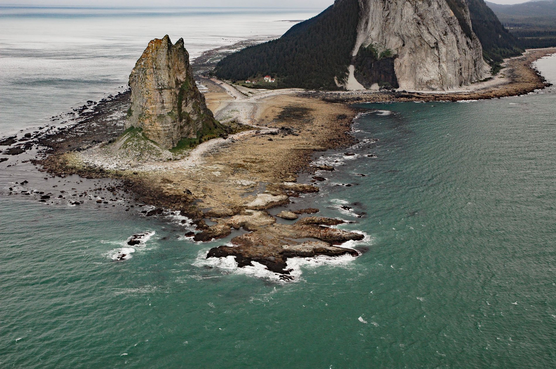
Cape Saint Elias comprises a prominent headland and Pinnacle Rock and is the site of a historic lighthouse at the southwest end of Kayak Island, 172 miles (277 km) west of Yakutat and 62 miles (100 km) southeast of Cordova, Alaska. The headland was named by Vitus Bering on July 20, 1741, the day of Saint Elias. Russian fur traders reputedly named the island because the longitudinal silhouette resembles an Alutiiq skin canoe. Captain James Cook visited the island in 1778, and claimed the land for England by burying a bottle with a paper and two small pieces of silver given to him by Sir Richard Kaye, and because of this, Cook named the island ‘Kaye’s Island’. Kayak Island extends 20 miles (32 km) into the Gulf of Alaska, and is separated by a channel less than 1 mile (1.6 km) wide from Okalee Spit, that projects 9 miles (15 km) from the mainland. The island is roughly aligned with Wingham Fault to the west and Ten Mile Fault to the east, and consists mostly of sedimentary rocks representing the Yakataga Formation that developed between the Miocene and Pleistocene and underlies much of the continental shelf between Middleton Island and Kayak Island. Cape Saint Elias and Pinnacle Rock are formed by a dacite plug that intruded the Yakataga Formation during the late Miocene and Pliocene.
The Chugach Sugpiaq, or Chugachigmiut, are a Pacific Eskimo people that speak a dialect of the Alutiiq language. Prior to Russian contact, there were at least nine distinct groups of the Chugach people inhabiting the southern coast of Alaska between Kachemak Bay to the west and Cape Suckling to the east. The Palugvirmiut, or Shallow Water People, were named after their principal village of Palugvik on Hawkins Island. They also occupied the southeastern edge of Prince William Sound including the eastern half of Hinchinbrook Island, Mummy Island, Wingham, and Kayak islands, but were excluded from the Copper River Delta and most of Controller Bay by the Eyak people who speak an Athabaskan language. The eastern part of Prince William Sound was also the northern extent of Tlingit migration from the south. Oral traditions recount fierce battles between the Chugach and Tlingit who were likely allied with the Eyak. In 1889, the Central Alaska Company built a salmon cannery at the site of a Chugach village at the southern end of Wingham Island on Kayak Entrance. The cannery made a fairly successful pack in the 1889 season, but the location was not ideal, and the cannery was moved to the Alaska Peninsula; however, the settlement and steamship landing had a post office until 1906.
Since the early 1800s, Pinnacle Rock, off the southwestern point of Kayak Island, has been an important landmark for navigators traveling between Southeast Alaska, Prince William Sound, and Cook Inlet. Due to fog, winter darkness, frequent storms, and uncharted reefs, the waters around Cape Saint Elias were regarded as one of the most dangerous along the entire Alaskan coast. Maritime traffic to Prince William Sound increased significantly following the discovery of gold in the Klondike and Nome. Between 1902 and 1906, twelve lighthouses were constructed in Alaska. In 1911, Congress approved construction of a light station at Cape Saint Elias. Construction began in early 1915, and by late fall, the lighthouse structure was nearly completed. The station was lighted and operational on September 16, 1916. In 1917, a fog signal was added. The station was equipped with a radio and the station keepers could transmit messages to Katalla, Cordova, Valdez, Seward, and later Anchorage, to inform residents of vessel arrivals. Due to rising maintenance costs and technological advances, the light station was automated in 1974. The building is now leased by the Cape Saint Elias Lightkeepers Association, a non-profit organization dedicated to preserving, restoring, and sharing the lighthouse. Read more here and here. Explore more of Cape Saint Elias and Kayak Island here:

