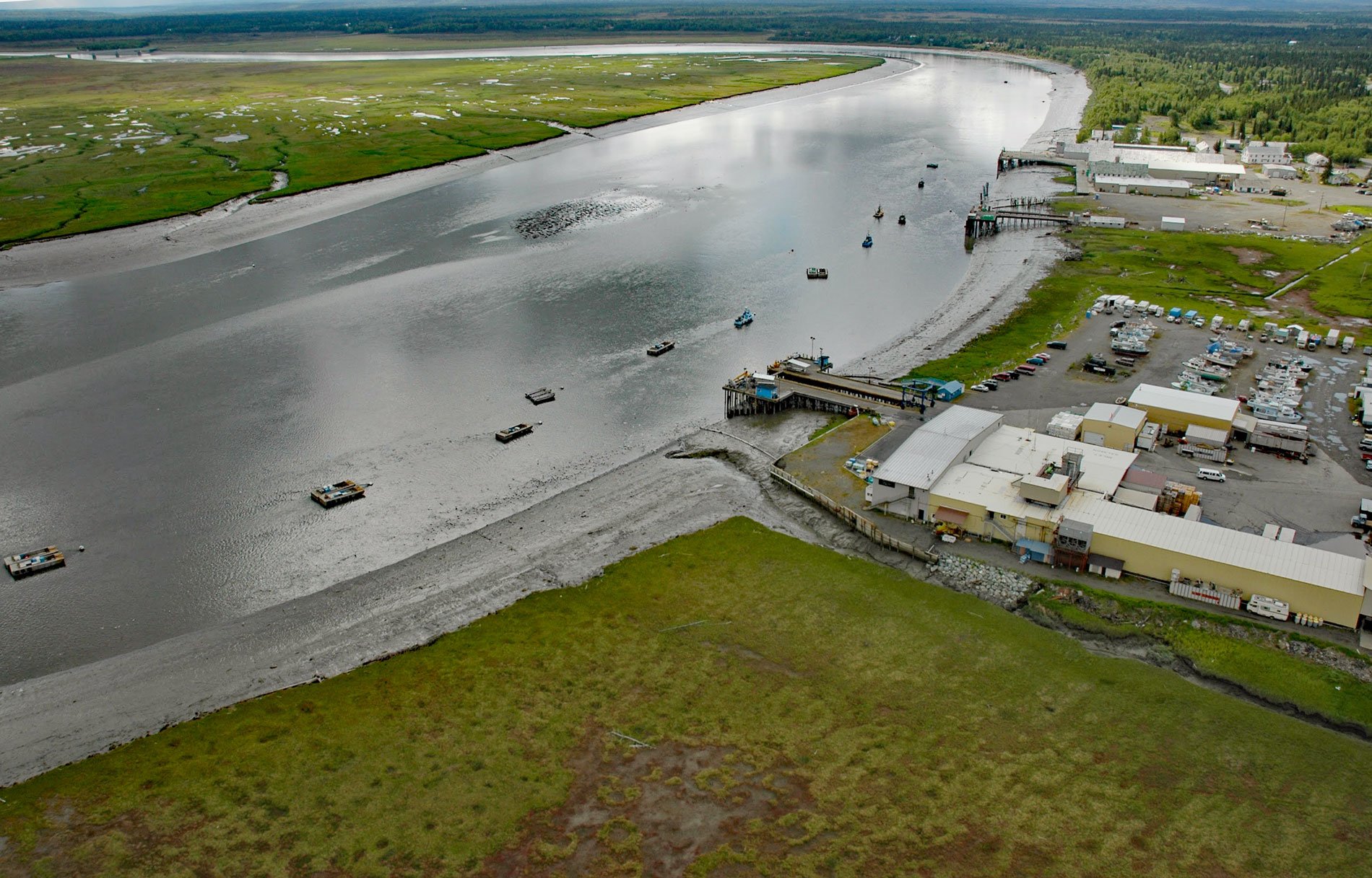
Kenai River flows into Cook Inlet on the western shore of the Kenai Peninsula, about 65 miles (105 km) southwest of Anchorage and at the community of Kenai, Alaska. In June 1787, Stepan Zaikov on Saint Pavel of the Lebedev-Lastochkin Company established a post at the mouth of the Kenai River called Pavlovskaia. Grigor Konovalov, the commander of Saint Georgii, built another fortified post here in August 1791. About a year later, the more permanent Redoubt Saint Nicholas was built at the top of the bluff overseeing the mouth of the river. In 1797, the Dena’ina defeated the Russian occupiers and the Lebedev contingent left Alaska. The fort site was taken over by agents of the Shelikov-Golikov Company, who operated a small trading post until the Alaska Purchase in 1867. In 1869, a U.S. military post was established here named “Fort Kenai” for the Kenaitze people living in the area.
In 1882, the Alaska Packing Company built the first cannery on Cook Inlet at Kasilof, and 6 years later the first salmon cannery was constructed on Kenai River. Fish traps were introduced to Cook Inlet in 1885 and were built along the beaches to take advantage of the salmon’s tendency to run along the shoreline. Most of the traps were constructed with large wooden pilings pushed into the seabed by steam-powered piledrivers. Winter ice would break any pilings sticking up out of the water so the structures had to be dismantled and rebuilt every year. These giant contraptions were very expensive and very efficient. Over a period of 70 years, 147 canneries were built in Southcentral Alaska. By 1952, many of the salmon runs were depleted and 93 canneries were abandoned, burned, or moved to different sites. When Alaska gained statehood in 1959, fish traps were outlawed and fishermen were employed by canneries to catch salmon using gillnets. Two styles of gillnetting are used in Cook Inlet. “Set” gillnets are 210 feet long and anchored in place along the shore. Some set nets are right on the beach and go dry at low tide, others are in deeper water. The anchors and bright buoys stay in the water all season and the nets are set out only during open fishing periods. “Drift” gillnets are 900 feet long and 16 feet deep. The drift nets require larger boats that work mostly out of the Kenai and Kasilof Rivers where they can anchor between fishing periods. The boats go offshore to set their nets and then float, or drift, with the current. Periodically the net is pulled back on board and the fish are picked out of the web and stored in the fish hold. At the end of the day, all the boats return to the rivers and wait their turn to sell their catches at the docks or at bigger boats called “tenders”. Upper Cook Inlet currently sustains about 1300 set and drift net fishing permits.
The Kenai River is the most popular sport fishing destination in Alaska, particularly for king or Chinook salmon. The king salmon fishery is not as prolific as in other Alaskan rivers, but the Kenai is known for its large fish. A typical king weighs 40–85 pounds (18–23 kg), with considerably larger specimens not uncommon, although in recent years the fishery has been closed or heavily restricted due to low returns. The Kenai River drains the central Kenai Peninsula and runs 82 miles (132 km) from Kenai Lake near the village of Cooper Landing, through the Kenai National Wildlife Refuge and Skilak Lake to Cook Inlet. Kenai Lake is fed by several glacial meltwater streams that give the lake and river an intense blue color. The upper river is about about 17 miles (27 km) long and runs through Kenai Canyon with fast-flowing whitewater rapids between Kenai Lake and Skilak Lake. The Russian River, famous for the run of red or sockeye salmon, empties into the Kenai River several miles west of Cooper Landing. Skilak Lake is 15 miles long (24 km) and the “Middle River” is the reach of 29 miles (47 km) between Skilak Lake and the Sterling Highway bridge near the town of Soldotna. The final 21 miles (34 km) from the bridge to the mouth at Cook Inlet is known as the “Lower River”, with the last 12 miles (19 km) being influenced by the tides. Read more here and here. Explore more of the Kenai River and Cook Inlet here:

