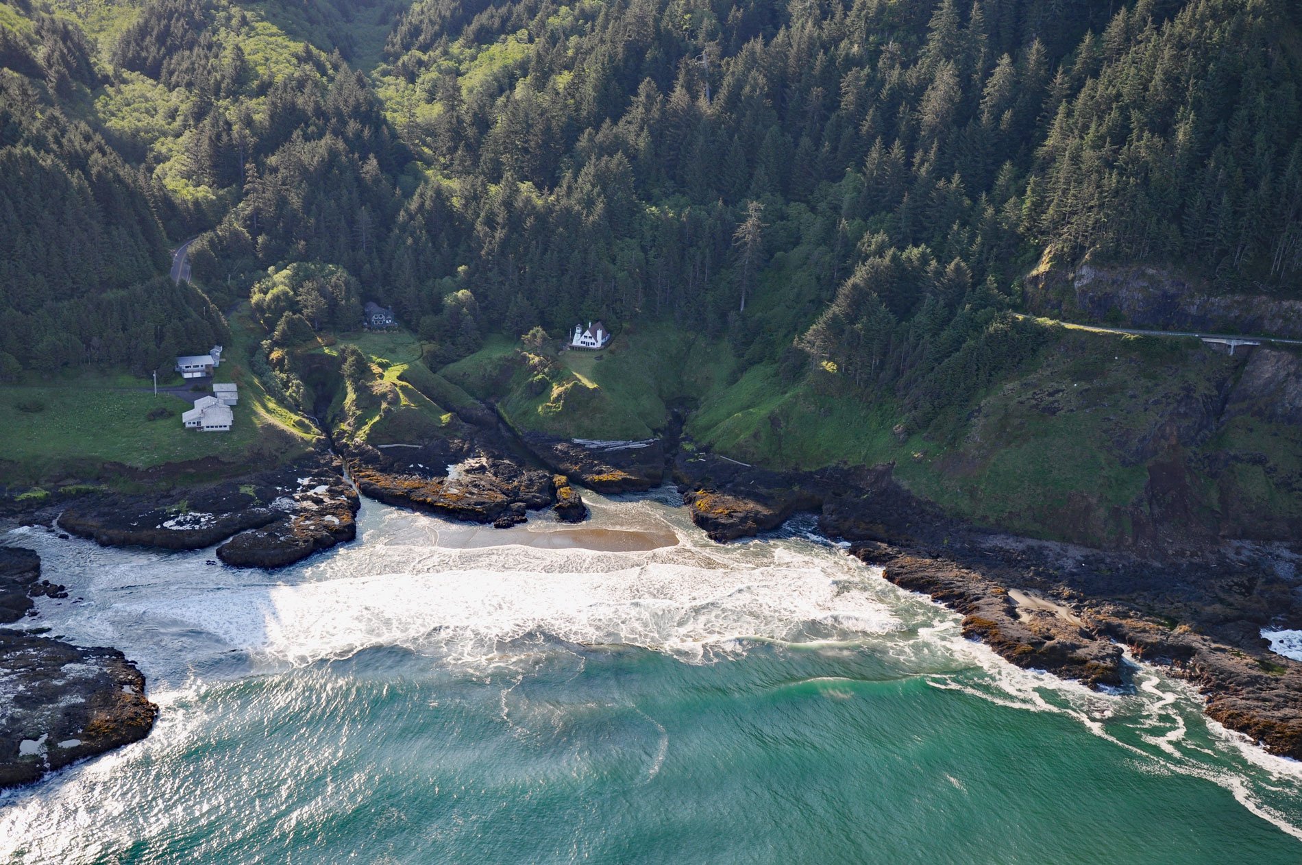
Cleft of the Rock Light is a privately owned lighthouse located on Cape Perpetua, at the mouth of North Cape Creek, about 21 miles (34 km) north of Florence and 2 miles (3.2 km) south of Yachats, Oregon. The lighthouse is named after the Fanny Crosby hymn He Hideth My Soul in the Cleft of the Rock. The light provides a navigation aid for vessels sailing the coast between Coos Bay and Yaquina Bay. The tower is 34 feet (10 m) high and the light elevation is 110 feet (34 m) above sea level which is visible for 16 miles (26 km).
Cape Perpetua is a scenic and natural wonder of the Oregon coast. At its highest point, the promontory rises to over 800 feet (240 m) above sea level, and on a clear day, over 70 miles (110 km) of Oregon coastline is visible. Archeological middens found here suggest that for thousands of years Native Americans hunted for mussels, crabs, sea urchins, and clams. The Alsea people had a seasonal camp or village near the base of Cape Perpetua, with other major villages located to the north, near Seal Rock, and along the Alsea River estuary. They called this place Halqaik which roughly translates to ‘uncovered place’ or ‘exposed place’. Cape Perpetua is where Captain James Cook on the HMS Resolution made landfall on March 6, 1778, after crossing the Pacific from Hawaii during his third and final voyage of discovery. He named the steep and rock-bound promontory Cape Perpetua, having first sighted it on March 7, Saint Perpetua Day.
Cleft of the Rock lighthouse was built in 1976 by former Tillamook Rock lightkeeper and historian James A. Gibbs. He is considered an authority on Pacific coast lighthouses and northwest shipwrecks and authored 21 maritime books including Lighthouses of the Pacific. The lighthouse tower for Cleft of the Rock was designed after the Fiddle Reef Light, which operated from 1898 to 1958 in Oak Bay, a city within the Capital Regional District of Victoria, British Columbia. The lighthouse is part of Gibbs’ home, which also houses a private museum. The grounds and tower are closed to the public. Read more here and here. Explore more of Cape Perpetua here:

