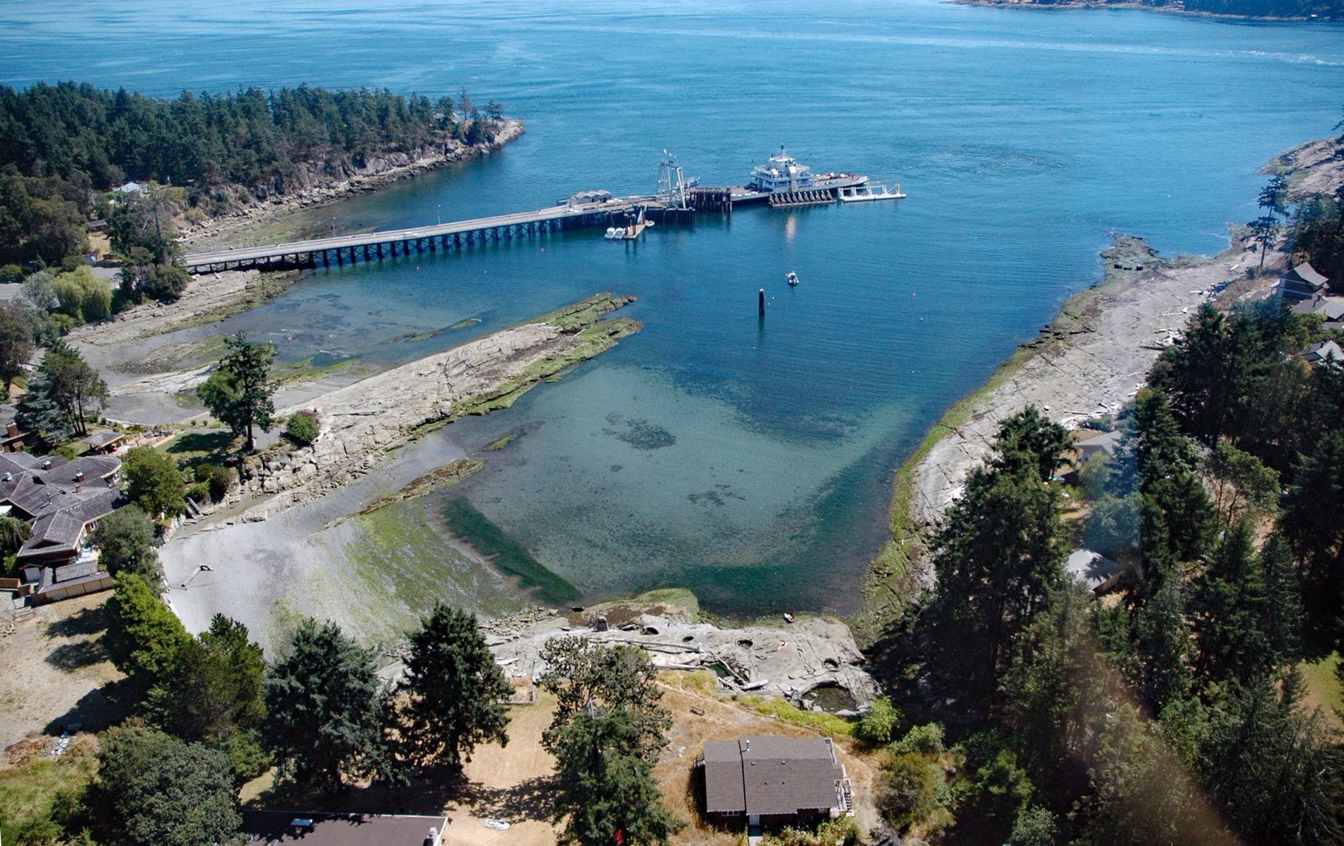
Sturdies Bay is an embayment near the northern entrance to Active Pass between Rip Point and Burrill Point on the southeast shore of Galiano Island, one of the southern Gulf Islands, about 19 miles (31 km) southwest of Delta and 16 miles (26 km) north-northwest of Sidney, British Columbia. Active Pass separates Galiano Island from Mayne Island and is one of the main shipping channels on the British Columbia coast. In 1904, the first charts of Active Pass were made following a coastal survey conducted by Commander John F. Parry of the Royal Navy on HMS Egeria. Sturdies Bay may have been named at that time.
Galiano Island was long inhabited by aboriginal people from the Penelakut First Nation and used by other Coast Salish including the Hwlitsum, and Tsawwassen First Nations. Midden pits at Montague Harbour suggest 3,000 years of habitation. The island is named for the Spanish explorer Dionisio Alcalá Galiano who explored the area in 1792. The first European settlement of Galiano Island was recorded in the 1860s with early homesteads concentrated at the southern end of the island. Many of the low-lying areas were cleared, and swampy areas and lakes were drained for agricultural purposes. By the 1920s, extensive areas of forested land on the island had undergone some degree of logging to remove the most valuable timber. In the 1960s, logging rights for about half of the island were acquired by MacMillan Bloedel for timber extraction. Many residents objected to industrial logging practices which led to legal disputes, and in 1989, the Galiano Conservancy was established as a community-based organization for acquisition, management, and conservation of land and habitat. Other historical industries include fishing and charcoal-burning, although today tourism and the arts provide the most employment.
Sturdies Bay was historically the location of a wharf where coastal steamers would deliver passengers and cargo to the island. A small cluster of businesses including a hotel and post office known as Galiano (Steamer Landing) became established to cater to this traffic. Sometime before 1965, the Galiano post office at Retreat Cove relocated here and the name subsequently changed to Sturdies Bay (Steamer Landing). In 1982, the name of the community changed to Sturdies Bay presumably because of the many other communities called “Steamer Landing” in British Columbia. Sturdies Bay is currently known primarily for the BC Ferries terminal which connects the island with other southern Gulf Islands as well as with the lower mainland. There is also a public dock serviced in the summer by an inter-island water taxi. The small settlement currently consists of several businesses, including four restaurants and an inn. Read more here and here. Explore more of Sturdies Bay and Galiano Island here:

