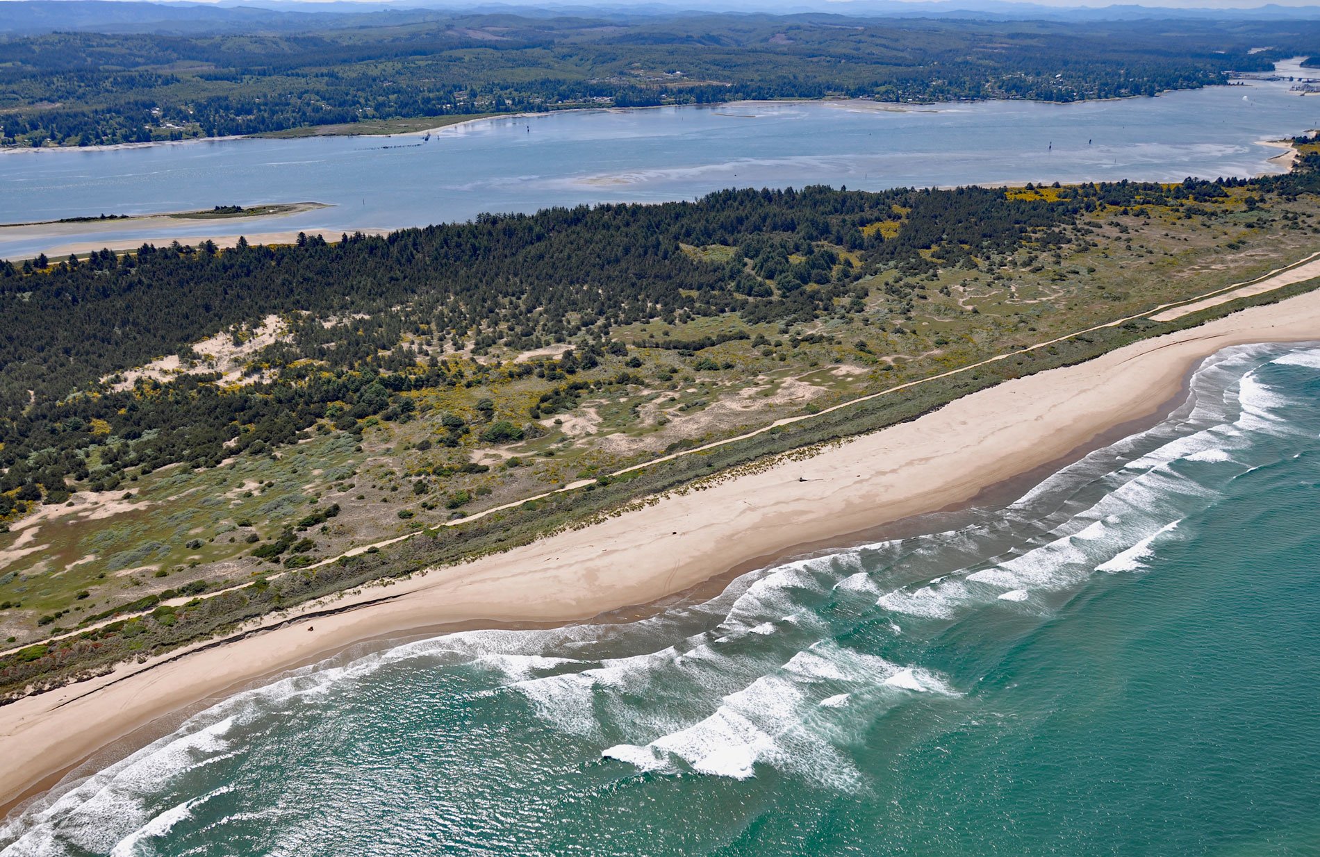
North Spit of Coos Bay is a sandy, vegetated peninsula separating the estuary of the Coos River from the Pacific Ocean, and the site of Camp Castaway, about 3.8 miles (6 km) west of North Bend and 1 mile (1.6 km) north of Charleston, Oregon. The spit was the site of a historical encampment following a 19th-century shipwreck. The U.S. Bureau of Land Management currently administers 1,864 acres (754 ha) of public domain lands on the spit, mostly acquired from the U.S. Army Corps of Engineers in 1984. The estuarine side of the spit is comprised of narrow sand beaches, mudflats, and salt marshes and the Pacific side is mostly sandy beaches. The interior of the peninsula is characterized by stabilized and shifting sand dunes, freshwater wetlands, and upland stands of shore pine and Sitka spruce. Non-native European beach grass and Scotch broom dominate much of the deflation plain.
Camp Castaway was established on January 3, 1852, by the survivors of the wreck of Captain Lincoln, a U.S. transport 3-masted schooner probably about 150 feet (46 m) long and 34 feet (10 m) wide, with a draft of 9-10 feet (3 m). On December 28, 1851, Captain Lincoln departed San Francisco Bay and set sail for Port Orford on Oregon’s south coast to reinforce a group of settlers with soldiers and food to fight the Qua-to-mah band of the Siletz at Battle Rock. The plan was for the schooner to eventually sail hundreds of miles farther north and deliver the remaining cargo to Fort Steilacoom on Puget Sound near present-day Tacoma, Washington. There were 45 people aboard including a crew of 8, plus 35 troopers and 2 officers of U.S. 1st Dragoon Company C. However, almost immediately after departure the ship began taking on water as it beat its way north along the coast through fierce winter storms. Captain Lincoln reached Port Orford on January 1, 1852, but the leaky ship could not be navigated to shore in the storm and was allowed to drift north. To avoid sinking, the captain decided to beach the ship north of Cape Arago. In the dark, the crew had no way to know whether the fast-approaching land was sand or rocks. At about 3 am, the ship struck a sandbar about 200 yards (183 m) from shore. Then another wave swept the deck and the vessel broached and grounded on the sand beach of North Spit. The troops and crew used spars, booms, and sailcloth from the schooner to build a tent encampment for shelter and for protecting the cargo from winter rains and blowing sand. They named the temporary military post “Camp Castaway”. The camp endured for four months in the open dunes with help from the Coos Tribe who traded and provided fresh foods. The army eventually delivered several mules to haul small supplies and sent another schooner in May to pick up the larger items. The camp was packed up, its remnants looted, and the 35 dragoons walked to Port Orford.
On July 20, 1861, James Lawson and a team with the U.S. Coast Survey established a theodolite position they named “Wreck Station” reflecting the scattered remains of a shipwreck and camp that had been abandoned there some years before. Lawson didn’t realize it at the time, but Wreck Station was located on the site of Camp Castaway. At the time of Camp Castaway, the shoreline dunes in this region were mostly barren and it wasn’t until 1890 that the U.S. Army Corps of Engineers systematically introduced European dune grass to stabilize the sand. In 2009, Scott R. Byram with the Archaeological Research Facility at the University of California, Berkeley recovered the coordinates of Wreck Station. In March 2010, a brief surface survey of the location led to the identification of a small number of sand-polished iron fragments and one cobble of nonlocal origin, possibly a ballast stone. In August 2010, they return with ground-penetrating radar and found copper nails, percussion caps from muskets, glass, and band iron fragments with some containing rivets. During the summer of 2012, more extensive archaeological excavations took place under the direction of Professor Mark Tveskov of Southern Oregon University, along with James Delgado and Robert Schwemmer of the NOAA Maritime Heritage program. They concluded that the site is was the location of Camp Castaway, and the findings revealed much about this event and the history of early U.S. presence on the Oregon coast. Read more here and here. Explore more of the North Spit and Coos Bay here:

