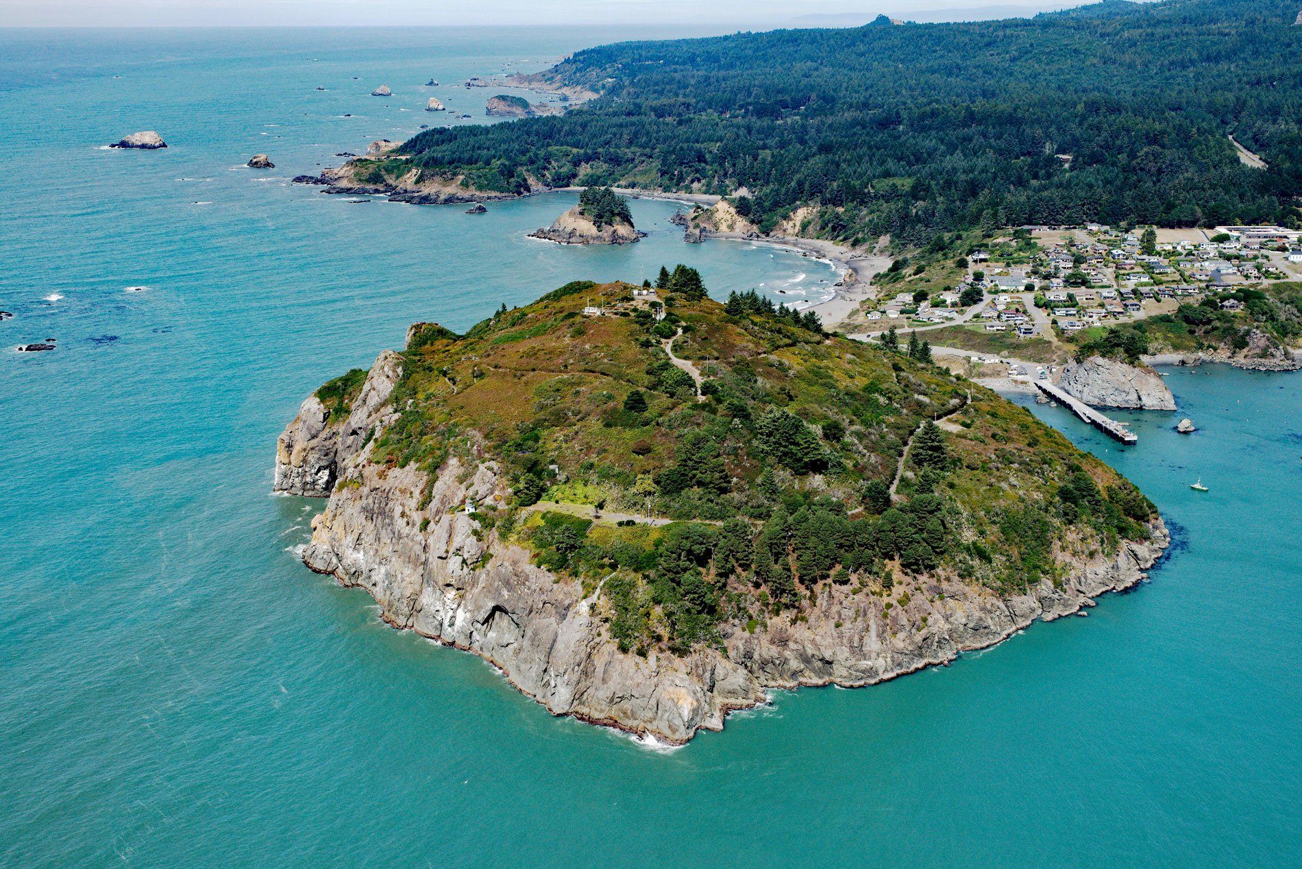
Trinidad Head is a prominent headland joined to the mainland by a narrow isthmus adjacent to the town of Trinidad and protecting Trinidad Bay, about 48 miles (77 km) south of Crescent City and 18 miles (29 km) north of Eureka, California. The bay is one of the few sheltered harbors on the coast and has a long history of use. Before 1700 AD, the Yurok people inhabited the historical village of Tsurai on bluffs overlooking the bay. In 1579, Sir Francis Drake on the Golden Hind made landfall near Cape Arago, Oregon, and then sailed south while searching for a suitable harbor and reputedly stopping in or near Drakes Bay to repair his ship. In 1595, Portuguese explorer Sebastião Rodrigues Soromenho, on the Manila Galleon San Agustin was sent from the Philippines to survey the coast of what became Oregon and California and then to complete the trip to Acapulco, Mexico. He made landfall between Point Saint George and Trinidad Head but proceeded south to Drakes Bay. The first Europeans to visit Trinidad Bay were Lieutenant Bruno de Heceta on the Santiago and Lieutenant Juan Francisco de la Bodega y Quadra on the Sonora of the Spanish Navy. Their ships anchored in Trinidad Bay on June 9, 1775. On 11 June, which was Trinity Sunday, a wooden cross was erected and the area was named “la Santisima Trinidad”. In 2017, Trinidad Head was added to the California Coastal National Monument.
In 1849, Josiah Gregg joined the California Gold Rush by sailing from Mazatlán to San Francisco and then went to the placer mines at Rich Bar on the Trinity River. In November, a party of ill-provisioned miners led by Gregg left Rich Bar intending to find “Trinity Bay” by crossing unknown territory through the coast range by following the line of latitude westward. About six weeks after they started, they emerged from the redwood forests and saw the ocean at the mouth of a watercourse which they called the Little River. They turned north and camped at a headland they called Gregg’s Point, but is now known as Trinidad Head. After exploring the area they turned south towards San Francisco. News of this route to the goldfields spread quickly. The protected harbor at Trinidad Bay provided a vital landing for miners traveling to the Klamath, Trinity, Salmon River, and Gold Bluff mines. In 1850, the first settlers arrived on the schooner James R. Whitting and founded the town of Warnersville, named in honor of R.V. Warner who was one of the original settlers. This name was changed to Trinidad in 1851. As the gold rush slowed, Trinidad supported multiple sawmills, and ships used a wharf on Trinidad Head to load passengers and cargo.
In 1871, a lighthouse was built consisting of a white square brick tower, only 20 feet (6.1 m) above ground, but at an elevation of 196 feet (60 m) above the sea. Despite the great height above the sea, a giant wave temporarily stopped the light on December 28, 1914. A gale had been blowing continuously for a week and was accompanied by a very heavy sea from the southwest when a wave fell over onto the top of the bluff and struck the light tower. The lens immediately stopped revolving when the lens was thrown off level but service was restored by the lightkeeper in about 30 minutes. Trinidad Head Lighthouse is now automated with a drum-type Fresnel lens in the tower and the only remaining fog bell house in California. In the early 1920s, one of many shore whaling stations in the Pacific Northwest operated in Trinidad Bay, the lightkeepers would act as lookouts for gray whales migrating along the coast. As many as 29 whales a week were hauled ashore in the bay for processing until the station closed in 1929. Read more here and here. Explore more of Trinidad Head here:

