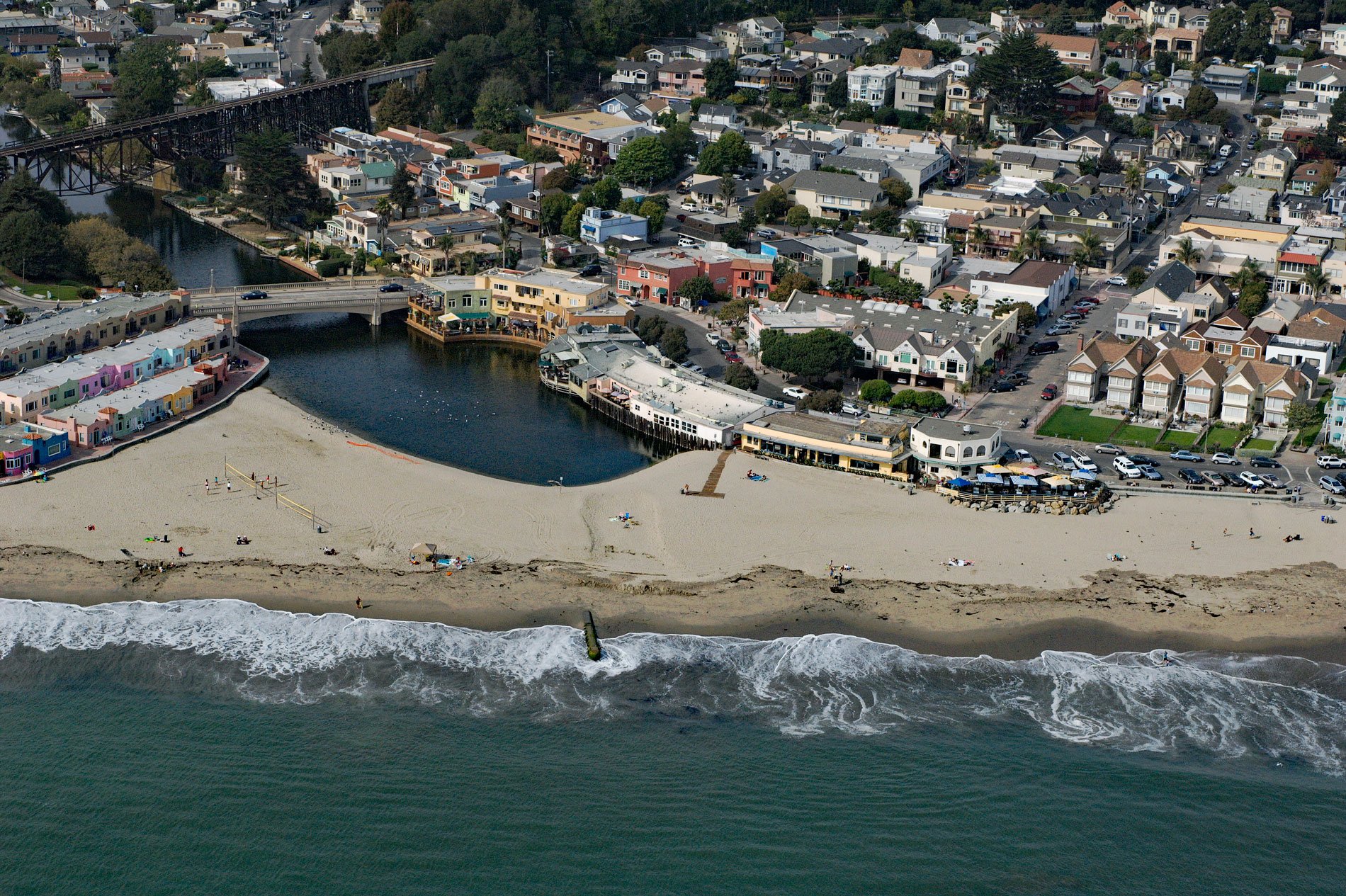
Soquel Creek runs through Capitola, a community adjacent to Santa Cruz on the north coast of Monterey Bay, about 75 miles (120 km) south of San Francisco and 26 miles (42 km) north of Monterey, California. Soquel Creek has a drainage area of about 25,600 acres (10,360 ha) and a length of about 16 miles (26 km). The highest elevations of the watershed are along the San Andreas Rift in the Santa Cruz Mountains. Soquel Creek flows west and then south from the watershed divide, around the northern portion of Soquel Demonstration State Forest and then the western portion of the Forest of Nisene Marks State Park, and then south through the community of Soquel and into Capitola Village where it empties into Soquel Cove in Monterey Bay. Originally called the Rosario del Beato Serafin de Asculi, Soquel Creek was later given a title that sounded like Suquer, the leader of a nearby Uypi settlement. This territorial group was among the culturally diverse tribes known collectively as the Ohlone who are Native American people that inhabited the California coastal margin from San Francisco Bay to Big Sur. Colonial-era records also document efforts to render into Spanish the variations of the name including Sauquel, Shoquel, Osocali, Osocales, Osoquales, and Usacalis. In 1602, Sebastián Vizcaíno explored and named the area that is now Monterey and was the first to encounter the Ohlone people. The Portolà expedition was a voyage of exploration in 1769–1770, and the first recorded European land entry and exploration of the interior of present-day California. It was led by Gaspar de Portolá, governor of Las Californias, the Spanish colonial province that included California, Baja California, and other parts of what is now Mexico and the United States. The expedition led to the founding of Alta California and contributed to the legitimacy of Spanish territorial claims in the disputed and unexplored regions along the Pacific coast of North America. Under the leadership of Father Junípero Serra, the Spanish Franciscans erected seven missions inside the Ohlone region, including Mission Santa Cruz founded in 1791, and brought most of the Ohlone into these missions to live and work with the intent of introducing Spanish religion and culture to the Ohlone.
In 1833, a Mexican land grant of 1,668 acres (675 ha) called Rancho Soquel was given by Governor José Figueroa to María Martina Castro y Amador. The Rancho Soquel grant included the creek and adjacent lands along Monterey Bay. Her brother, Rafael Castro was granted the adjacent Rancho Aptos to the south. In 1844, Martina applied for a grant of the adjoining land known as the Soquel Augmentation of 32,000 acres (12,950 ha). The much larger Soquel Augmentation grant lay inland from Rancho Soquel and Rancho Aptos and comprised mainly forested mountain land. The huge area included the eastern side of the Soquel Creek watershed, most of the Aptos Creek watershed, Trout Gulch and much of Valencia Creek. The grant was approved in 1844 by Governor Manuel Micheltorena. In 1846, John Hames and John Daubenbiss were contracted to build a sawmill on the banks of Soquel Creek and extract the valuable timber from the new lands, but this sawmill was washed away by a storm in 1847. In 1848, Alta California was ceded to the United States following the Mexican-American War, and the Treaty of Guadalupe Hidalgo provided that the land grants would be honored. As required by the Land Act of 1851, a claim was filed with the Public Land Commission for the Soquel grant in 1852, and the Soquel Augmentation grant in 1853, and the grants were patented to Martina Castro in 1860. Martina gave each of her remaining eight children an undivided one-ninth of the Rancho Soquel grant, and sold most of the remaining land to Frederick A. Hihn in the 1860s, including much of the redwood forest area and the waterfront along Soquel Bay.
The original settlement now known as Capitola grew out of what was then called Soquel Landing. Soquel Landing got its name from a wharf located at the mouth of Soquel Creek. This wharf served the early ranchos as an outlet for the produce grown and lumber milled from the redwood forests. In 1849, Frederick A. Hihn emigrated to California during the Gold Rush and after an unsuccessful stint as a miner, returned to San Francisco where over the next several years he tried a handful of entrepreneurial activities, including selling candy, operating hotels, and owning both a drug store and a soap factory. In 1851, he moved to Santa Cruz where he became the leading land developer. In the 1860s, he acquired much of the former Rancho Soquel, and by 1869, Hihn owned the property in the vicinity of the wharf at Soquel Landing and decided to develop it as a seaside resort. In 1874, he leased the waterfront land to Samuel A. Hall and the area became known as Camp Capitola. Once Capitola prospered, Hihn took over direct control of the enterprise and started selling residential lots in 1882. Over time, the old camping spot grew into “Capitola by the Sea”, a vacation spa with a 160-room hotel, hot saltwater baths, and electric streetcar service from Santa Cruz. Hihn died in 1913, and after World War I, his daughter sold Capitola to Henry Allen Rispin, a speculator from San Francisco. In 1927, Rispin was debt-ridden and left Capitola after the start of the Great Depression and never returned. Capitola’s community of permanent residents stepped forward to guide Capitola in the following decades. Capitola is now a popular tourist town and is known as the oldest beach resort on the U.S. West Coast. Read more here and here. Explore more of Soquel Creek and Capitola here:

