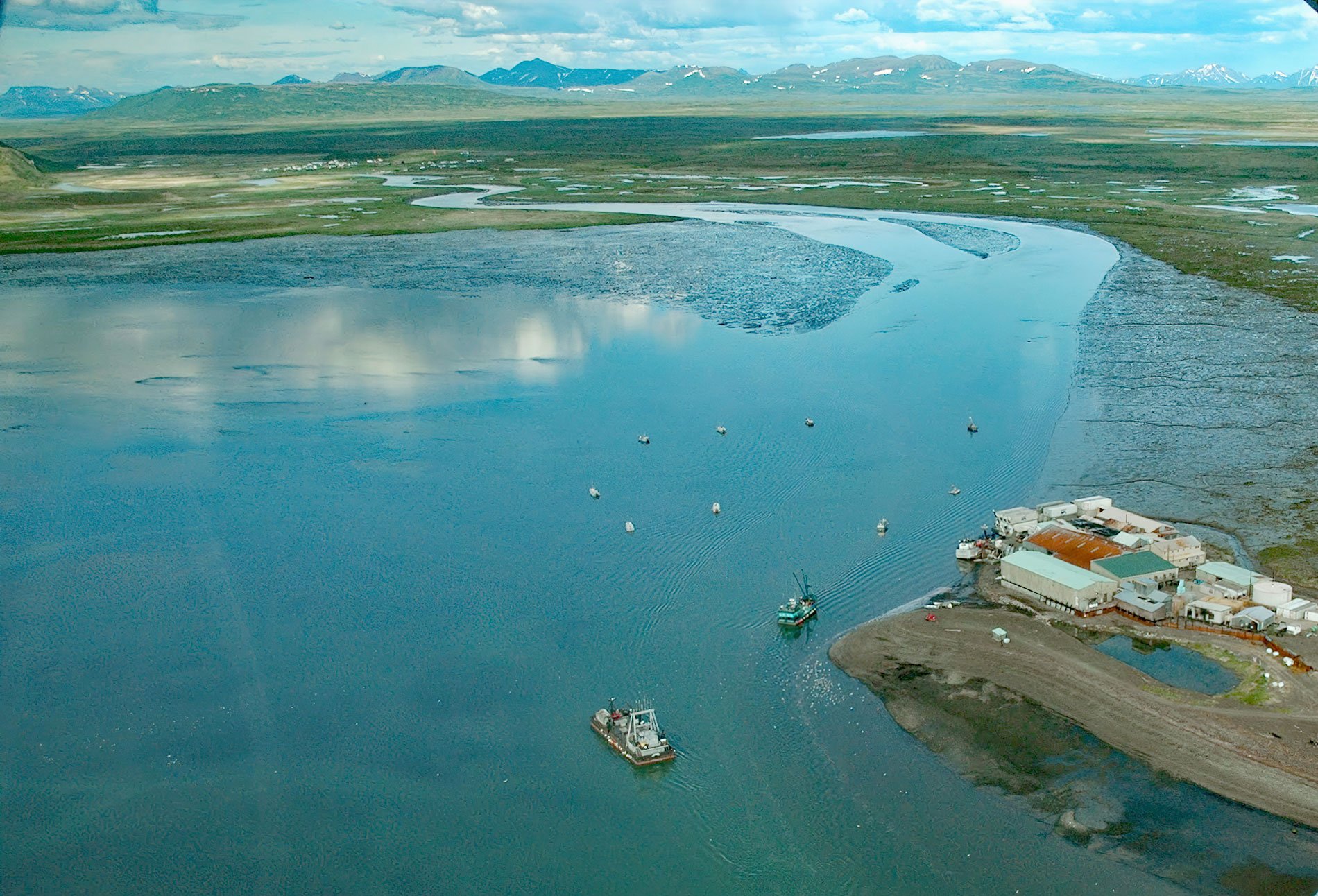
Togiak River starts at Togiak Lake and drains a watershed of 1,279,512 acres (517,800 ha), flowing generally southwest for 58 miles (93 km) to a wetland marsh about 4 miles (6 km) wide where the river channel splits, with the east channel flowing past the village of Twin Hills to Togiak Bay, and the main channel flowing 11 miles (18 km) to the village of Togiak, about 130 miles (210 km) southeast of Bethel and 64 miles (103 km) west of Dillingham, Alaska. The entire river is within the Togiak National Wildlife Refuge and the northern reach is within the Togiak Wilderness. Togiak National Wildlife Refuge encompasses 4.7 million acres (1,902,024 ha) in Southwestern Alaska between Kuskokwim Bay and Bristol Bay. The refuge is bordered on the north by Yukon Delta National Wildlife Refuge and on the east by Wood-Tikchik State Park. The northern 2.3 million acres (930,778 ha) of the refuge are designated as the Togiak Wilderness. The wilderness area includes pristine rivers, clear mountain lakes, and the Ahklun Mountains and Wood River Mountains. Like the majority of wildlife refuges in Alaska, Togiak Refuge is roadless. The Togiak River supports an important salmon fishery, and large catches are landed during the summer for subsistence and a commercial cannery. The river is also popular for sport fishing, which is a significant source of local income. All five species of Pacific salmon, as well as Dolly Varden char and rainbow trout, are present. The current village of Togiak is on the west side of Togiak Bay near the mouth of the Togiak River main channel. The original village of Togiagamute was on the eastern shore near the mouth of the Togiak River east channel and is now the site of a fish processing plant.
Archaeological evidence indicates that the region has been continuously occupied for at least 2,000 years and that human presence may date back 4,000 to 5,000 years. The current population is mostly Yup’ik people descended from the Togiagamiut who settled here primarily for the abundance of available food. The Togiagamiut people depended on the fish and wildlife including marine mammals, moose, caribou, and brown bear found in the interior mountains and valleys. From their winter villages along the rivers near the coast, hunters and their families traveled into the interior, where they spent several months in the spring and fall, picking berries and hunting. In midsummer, they would return to their villages to fish salmon. The food they gathered would hopefully tide them over the coldest months of winter when the weather conditions prevented food gathering. Captain James Cook was probably the first European to visit when he entered Bristol Bay on July 9, 1778. Russian explorers reached Bristol Bay in the 1790s, but the first contact they had with the Togiagamiut people did not occur until around 1818 when a party of Russian American Company traders established a post on the Nushagak River. It was from this post that trade was established with the Togiagamiut. The Togiak area became a draw for other Togiagamiut people in the vicinity especially after the devastating influenza pandemic of 1918-19 which wiped out many neighboring villages. The pandemic and heavy winter snowfalls at Togiagamiut influenced residents to relocate to the west side of the bay and establish the new village of Togiak. However, the new location was prone to flooding and in 1964, some residents of Togiak relocated again and established the community of Twin Hills, about 3 miles (5 km) northeast of the original village of Togiagamute on the east channel of the Togiak River.
In 1883, the Arctic Packing Company constructed the first saltery on the Nushagak River, about 65 miles (105 km) east of Togiak. The following year, the saltery was converted into a salmon cannery and within a few years, the river systems of Bristol Bay were recognized as having the highest runs of sockeye salmon anywhere in the world. Between 1884 and 1887, 16 canneries were built, and by 1896, 29 canneries packed nearly one million cases of salmon, with 48 one-pound cans per case. The impact of the canneries was overwhelming. Because of this dramatic increase over a decade, the U.S. Fish Commission was pressured to consider conservation measures. For years, the Revenue Cutter Service in the U.S. Treasury, which was the regulatory agency for Alaska’s fisheries in the 1800s, had emphasized the need for regulating the harvest. In 1897, Alaska salmon research finally came to the political forefront and the USS Albatross, under the command of Lieutenant Commander Jefferson F. Moser, was sent to determine the conditions of salmon in the different and widespread regions of Alaska. This was initiated so that suitable laws for the protection of the fishery might be framed. The outcome was the U.S. Fish Commission developed a plan to manage the different stocks in the diverse areas of Alaska and this became the basis for the investigation of the Alaska salmon streams and its industry for many years. Togiak Bay developed relatively late, probably because the bay is very shallow which limits navigation to small boats with shallow draft. In 1950, a salmon cannery was established by Togiak Fisheries at Togiagamiut, or Old Togiak, which is now connected by road to Twin Hills. Today, the facility is operated by North Pacific Seafoods. Read more here and here. Explore more of the Togiak River and Togiak Bay here:

