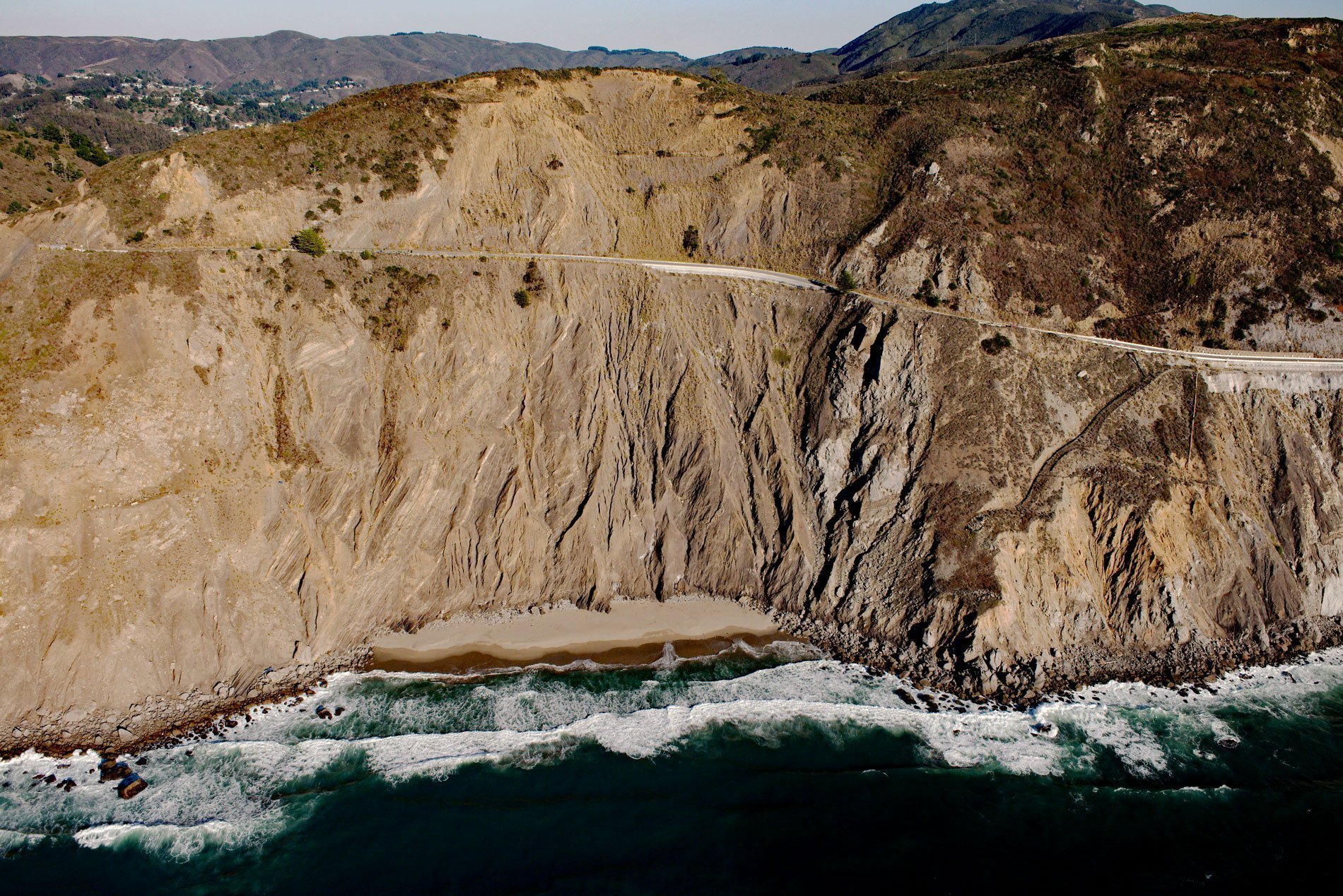
Devil’s Slide is on the western flank of San Pedro and Montara Mountains in the San Pedro Headlands, along 2.5 miles (4 km) between San Pedro Creek to the north and Martini Creek to the south, characterized by impressively steep slopes with gradients ranging between 30% and 50%, about 3 miles (5 km) north of Montara and 1 mile (1.6 km) southwest of the Linda Mar District of Pacifica, California. The area is named for being prone to slope failures ranging from rockfalls to deep-seated catastrophic landslides. The ongoing slope instability at Devil’s Slide forced the abandonment in 2013 of 1.4 miles (2.3 km) of the Pacific Coast Highway. The bedrock underlying Montara Mountain is part of the Salinian terrane which is composed of granitic plutonic rocks. These rocks are part of a batholith formed during the Cretaceous as a subduction-related magma intrusion that was subsequently displaced northward by right-lateral offset along the San Andreas fault system. The plutonic basement rocks at Devil’s Slide vary from quartz diorite to granite but are collectively referred to as the Montara Granodiorite. San Pedro Mountain consists of marine sedimentary rocks formed during the Paleocene that are adjacent to the Montara Granodiorite and exposed at the surface as layers of highly weathered sandstone, shale or mudstone, and conglomerate with an estimated total thickness of 3800 feet (1160 m). Several modes of slope failure occur at Devil’s Slide. Rockfalls are the most common and occur within the Paleocene sedimentary units. Debris flows occur within the weathered sections of the Montara Granodiorite and the highly weathered and sheared components of the Paleocene sedimentary units. The most catastrophic are the deep-seated failures that commonly occur within the Paleocene sedimentary units, and have displaced the former highway grade with both creeping and episodic slip events.
The Indigenous Peoples of the San Francisco Peninsula were the Ramaytush of the Ohlone people with a population of about 1,400. The Ramaytush were divided into ten independent bands, including the Aramai that probably numbered no more than 50 people between two villages, one village was called Timigtac situated near present-day Rockaway Beach and the other was Pruristac near present-day Pacifica. In 1769, Pruristac was one of the small villages that the first Spanish explorers of the Portolá expedition visited in San Pedro Valley. The explorers were greeted by 25 Aramai after crossing Montara Mountain from the south and when they reached the valley floor they received food that the local people brought to them from their village. Two weeks later, on their return south through the San Pedro Valley, the Spaniards noted that the Aramai people were gone. In 1786, San Pedro y San Pablo Asistencia, a satellite or ‘sub-mission’ to Mission San Francisco de Asís, was established in the San Pedro Valley at the village of Pruristac, and the Aramai were some of the first Native people to be absorbed by the church. In 1834, the mission lands were secularized after the Mexican War of Independence. In 1839, Governor Juan Alvarado granted Rancho San Pedro with 8,926 acres (3,612 ha), and all of the buildings of the Asistenciato, to Francisco Sanchez, the Commandante of the San Francisco Presidio and eighth alcade of the City of San Francisco. Sanchez retained ownership of the property after California was ceded to the United States in 1848. During World War II, the Devil’s Slide area of San Pedro Mountain was the location of a military triangulation station and observation site as part of the harbor defense of San Francisco. In the days before radar, a ship’s precise location could only be determined by triangulation. Military personnel used binoculars and compasses to search for ships at sea and relay their coordinates to a command post. There were six military structures at Devil’s Slide including three steel-reinforced concrete observation posts, two concrete and earth bunkers, and a reinforced steel observation tower.
San Pedro Mountain has long been an obstacle to transportation, and from 1848 to 1937, five different road alignments have been attempted but each route has been plagued by landslides. The earliest attempts were little more than improvements to existing primitive trails used by horses and later wagons. In 1905, construction began on the Ocean Shore Railroad that was intended to connect San Francisco and Santa Cruz along the Pacific coastline but the line was never completed. A major tunnel was built at Devil’s Slide and there were numerous bridges and trestles along the route. In 1906, the San Francisco earthquake caused significant damage and the railroad never recovered from losses and mainline operations stopped in 1920. The California State Route 1 of the Pacific Coast Highway was built between 1936 and 1937 and from the onset, highway engineers recognized the slope instability issues at Devil’s Slide. The first major landslide destroyed much of the road in 1940, and within its first 10 years of operation, the Pacific Coast Highway was closed at Devil’s Slide for more than 200 days. Another large slide in 1995 forced the road’s closure for almost two years. The road closures influenced the growth of neighboring towns and prompted a realignment of the highway. In 2013, the old road was closed and replaced with the Tom Lantos double-bore tunnel that routes the highway through San Pedro Mountain. In 2014, the 1.3 miles (2.1 km) long Devil’s Slide Trail was opened to the public which converted the old section of the roadway into a pedestrian and bicycle route. Read more here and here. Explore more of Devil’s Slide and Pedro Point here:

