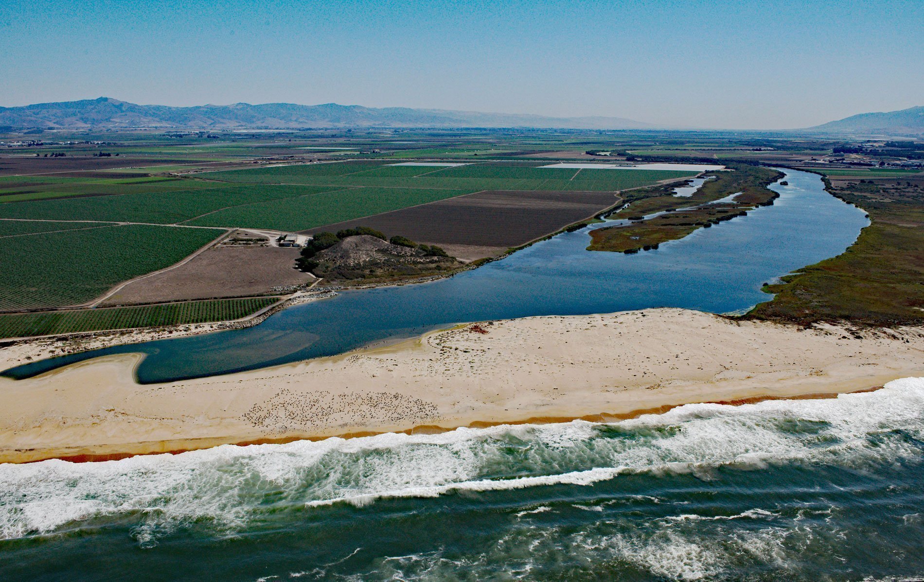
The Salinas River starts in the central California Coast Ranges and drains a watershed of 2.7 million acres (1 million ha), flowing 175 miles (282 km) generally northwest to Monterey Bay, about 12 miles (19 km) north-northeast of Monterey and 3 miles (5 km) west-southwest of Castroville, California. The final reach of the river forms a lagoon protected by 367 acres (148.5 ha) of the Salinas River National Wildlife Refuge. The river is named after the Indigenous Salinan people who lived by hunting and gathering before Spanish colonization. The northern Salinas Valley is cut in granite and other crystalline rocks such as biotite schists and limestone. The granite intruded into the schists as magma which metamorphosed the limestone. The valley was subsequently filled with sediments during the Pliocene and Miocene ages. These sediments were covered by unconsolidated alluvial fans, marine clays, and wind-blown sand deposits from the Pleistocene to the Holocene age which now holds a vast volume of groundwater. Since the early 1940s continuous groundwater pumping along the coastal area of the Salinas Valley has lowered the water pressure to levels that allows seawater encroachment which has caused degradation of the available groundwater quality. The Salinas River outflow to Monterey Bay is usually blocked by beach sand and dunes except during winter high river discharge. The river’s connectivity to the ocean depends on flow discharge, which is a function of precipitation and upstream water extraction. Under low flow conditions such as during prolonged droughts, sand bars build at the river mouth constricting and often blocking it entirely. When this occurs, the estuarine portion of the Salinas River temporarily becomes a freshwater lagoon. Estuarine conditions return when high discharge events breach the sand barrier and ocean connectivity is re-established.
In 1769, when the Portola expedition first encountered the river, it was reported as watering a luxuriant plain filled with fish. In the 18th and early 19th centuries, the river valley provided a route for travelers called El Camino Real, which became the principal overland route from southern to northern Alta California used by Spanish explorers, missionaries, and early settlers. Spanish colonial missions San Miguel Arcángel, San Antonio de Padua, and Nuestra Señora de la Soledad were all founded within the Salinas Valley in the late 18th century. After the Mexican War of Independence in 1821, the mission lands were secularized and the area near the mouth of the Salinas River became part of Rancho Bolsa Nueva y Moro Cojo. The rancho was 30,901 acres (12,505 ha) and combined three Mexican land grants that included Rancho Bolsa Nueva y Moro Cojo given in 1844 by Governor Manuel Micheltorena to María Antonia Pico de Castro, Rancho Bolsa del Potrero y Moro Cojo granted in 1822 by Governor Pablo Vicente de Solá to Joaquín de la Torre, and the land in between was granted by Governor Juan Alvarado to Simeon Castro in 1837. The rancho extended from Moss Landing inland to present-day Prunedale, and south to Castroville where at the time the land was crisscrossed by a network of sloughs and swamps. By the mid-19th century, Chinese immigrants had established a presence in Castroville and they were instrumental in clearing the slough, wetlands, and marshes to grow crops. As a result of the 1906 San Francisco earthquake, the Salinas River mouth at Monterey Bay was diverted 6 miles (9.7 km) south from an area between Moss Landing and Watsonville to a new channel just north of Marina. The Old Salinas River channel which diverts north behind the dunes along the ocean is used as an overflow channel during the rainy season.
Irrigation in the Salinas Valley began with the gravity systems of the Spanish missions and was followed by the construction of diversion ditches in the late 1870s and early 1880s. The first large water claim was made in 1882 by Max J. Brandenstein who constructed 6 miles (10 km) of the San Bernardo and Salinas Valley Canal and Irrigation Company canal to irrigate alfalfa. Seventy claims to water from the Salinas River and its tributaries were filed prior to 1901. Gravity irrigation soon proved to be an unreliable form of water supply for the growing demands of the agriculture industry and storage ponds and pumping stations were built. The historical increase in agriculture and settlement in the area and the related increase in water consumption have had a significant impact. The use of river water for irrigation makes the Salinas Valley one of the most productive agricultural regions in California; however, as of the end of 2016, the river has been transformed into little more than a dry-bedded run-off feature for most of its length. The Salinas River water is contaminated due to agriculture and industrial effluent, primarily pesticides and nitrates originating from the surrounding farmlands. The water also experiences periods of eutrophication and severe algal growth. Groundwater now accounts for more than 95 percent of the water used in the Salinas Valley. Increasing demand for high-quality water for agricultural, domestic, and municipality uses has made the search for a solution to the seawater encroachment problem a critical objective in all county and state water resources agencies connected with the Salinas Valley groundwater basin. Read more here and here. Explore more of the Salinas River and Monterey Bay here:

