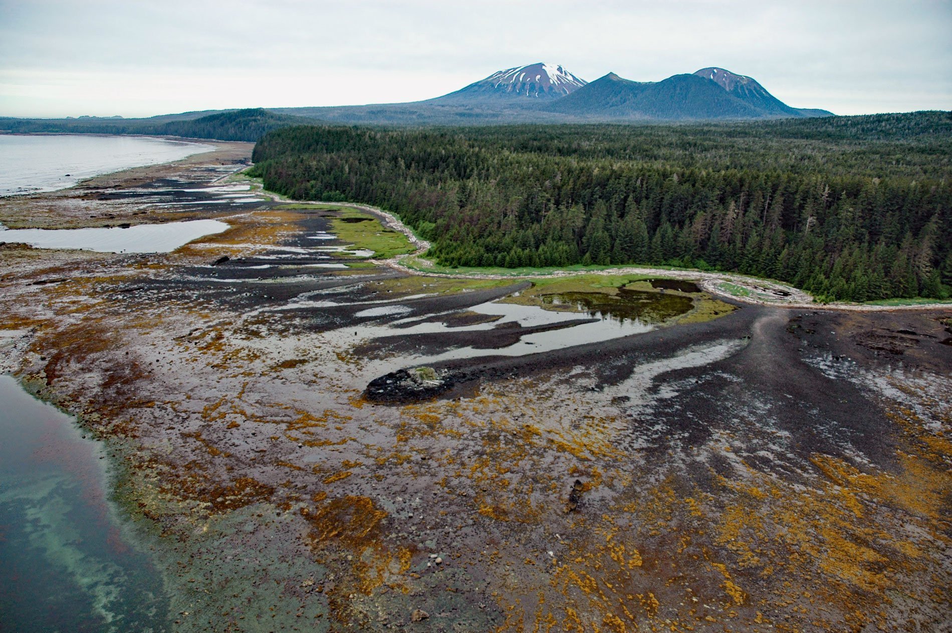
Mount Edgecumbe is a dormant volcano with an elevation of 3,201 feet (976 m) on the southern coast of Kruzof Island, about 100 miles (161 km) southwest of Juneau and 16 miles (26 km) west of Sitka, Alaska. In 1775, the volcano was named Montana de San Jacinto by Don Juan de la Bodega y Quadra. In 1778, it was named Mount Edgecumbe by Captain James Cook of the Royal Navy probably after Mount Edgecumbe at the entrance to Plymouth Harbor, England. The name was later adopted by Captain George Vancouver. The Russians named the mountain Gora Svataya Lazarya or Saint Lazarus Mountain and it was first climbed in July 1805 by Captain U.T. Lisianski of the Imperial Russian Navy.
The Indigenous Tlingit people considered the mountain to be sacred. In the Tlingit language, the mountain is called L’ux, which means ‘to flash’ or ‘blinking’, purportedly because the Tlingit people first discovered it while it was smoking or erupting; however, there is no evidence for historic eruptions in Russian documents or in native oral traditions. The latest significant eruptive activity was postglacial and produced voluminous pyroclastic deposits. Deposits produced by late Pleistocene-early Holocene activity of the Edgecumbe volcanic field have been found as far away as Juneau and Lituya Bay, 124 miles (200 km) to the north.
In the 1930s, a trail to the top of the mountain was built by the Civilian Conservation Corps as part of a New Deal program to ease the Great Depression. Today, the Mount Edgecumbe Trail is roughly 6.8 miles (11 km) long and maintained by the U.S. Forest Service. The trail ascends through taiga and muskeg before becoming steep and ending in a barren landscape of snow and red volcanic ash above the treeline, at about 2,000 feet (610 m). A three-sided cabin at about Mile 4 (6 km) on the trail was also built by the Civilian Conservation Corps. The trail is moderately difficult and can be muddy in places, the last 3 miles (5 km) are a steep climb, and bears may be present. Read more here and here. Explore more of Mount Edgecumbe and Kruzof Island here:

