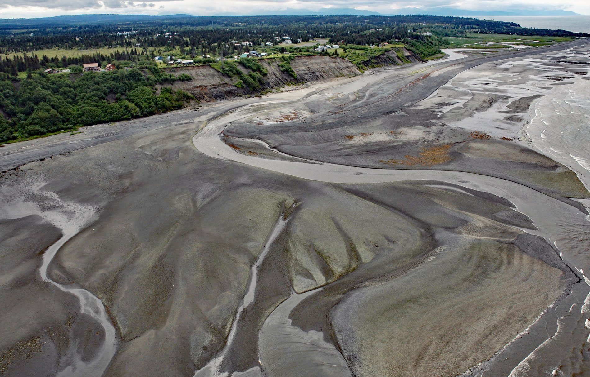
Anchor River is on the Kenai Peninsula and flows west for about 30 miles (48 km) from Bald Mountain to a lagoon at Anchor Point on the eastern shore of Cook Inlet, at the northern edge of Kachemak Bay, about 14 miles (23 km) northwest of Homer, Alaska. The middle reach of the river passes through the Anchor River and Fritz Creek Critical Habitat Area, designated to protect fish and wildlife. The lower river reach intersects North Fork Road and then the Sterling Highway before flowing by the community of Anchor Point and the Anchor River State Recreation Area. Anchor Point does not have a harbor, instead, a service at the beach uses tractors to launch and recover boats from Cook Inlet.
Anchor Point is a spit named by Captain James Cook of the Royal Navy because an anchor was lost off a point when he was exploring the area in 1778; however, this name appears to have originally been applied by Cook to a point of land farther north. The river was the site of some gold mining activity in the 1890s. Settlers began homesteading in the early 1900s. They came from Homer, Kenai, and Ninilchik and survived by hunting, fishing, and farming. Many of their descendants still live in the area. Wildlife abounds around the Anchor River, with moose, beaver, mink, bald eagles, a variety of ducks along the river, harbor seals, sea otters, and beluga whales near shore in Cook Inlet. Today, a large portion of the Anchor Point economy relies on the Anchor River which is a popular tourist destination for steelhead and salmon. The wide sandy beaches are also popular for razor clams. Anchor Point is the most westerly community on the U.S. highway system.
There are two Alaska State Parks in the area, the Anchor River State Recreation Area stretches along both banks of the lower river to the beach, and five miles north of Anchor Point is the Stariski State Recreation Site. The Anchor River State Recreation Area is a popular spot for camping and fishing in the summer months, during salmon runs, and catch-and-release steelhead fishing. The beach at the recreation area offers spectacular views of the Aleutian Range, including the volcanoes Mount Augustine, Mount Iliamna, and Mount Redoubt. Read more here and here. Explore more of the Anchor River here:

