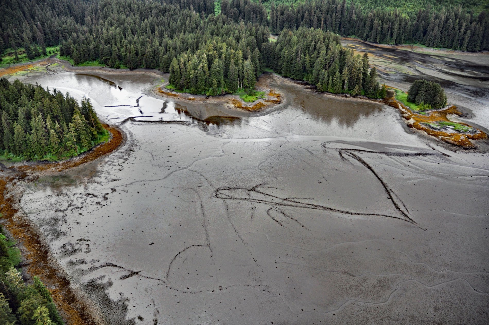
Port Camden is an embayment on the northeast coast of Kuiu Island, about 36 miles (58 km) south-southwest of Petersburg, and 61 miles (98 km) northwest of Wrangell, Alaska. Kuiu Island lies between Kupreanof Island to the east and Baranof Island to the west. The island is 65 miles (105 km) long, and 6 to 14 miles (10-23 km) wide and is nearly cut in two by Port Camden and Bay of Pillars. The island was first charted by Joseph Whidbey and James Johnstone, two of Captain George Vancouver’s crew during the 1791-95 expedition. Port Camden was named by Vancouver on August 10, 1794, probably in honor of Charles Pratt, the Earl of Camden at that time.
Several examples of intertidal stone fish traps occur in Port Camden. Fish traps have been used for thousands of years all over the world and the remains of historic and prehistoric structures of different forms can still be found near salmon streams from Washington to Alaska. The two basic designs are a straight wall that acts as a weir, and the other is a semi-circle and less frequently a V-shape structure. The lowest point in the arc of the semi-circle or the point of the V is nearest to the low water line. A circular basket trap was probably inserted in the gap to capture fish.
The semi-circle and the V forms were open on the upper side toward the shoreline. Traps were built at different levels in the intertidal zone forming a terrace-like pattern. The arrangement of the terraced traps allowed fishing to continue during the different tidal heights. The cascading structures at this site conceivably allowed for fishing through the entire six hours of the ebb tide. Read more here and here. Explore more of Port Camden here:

