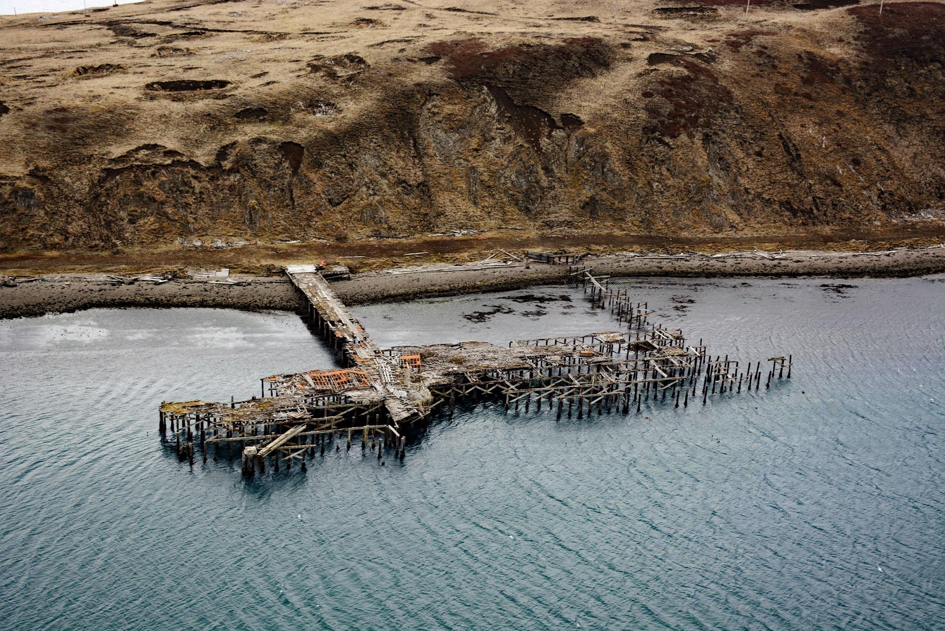
Mutton Cove is an embayment on Unalaska Island, about 0.3 miles (0.5 km) across, situated on the northern shore of Chernofski Harbor and protected by Observatory Point to the west, about 64 miles (103 km) northeast of Nikolski and 53 miles (85 km) southwest of Dutch Harbor, Alaska. The cove was named in 1937 by the U.S. Coast and Geodetic Survey presumably for a sheep ranch and transfer station operating there at that time. Unalaska Island, like all of the Aleutian Arc, is volcanic and the geology of the southwestern tip consists mostly of the Unalaska Formation, comprised of slightly metamorphosed andesite and basalt extrusive rocks and sills, and sedimentary rocks ranging in coarseness from argillite to conglomerate.
Chernofski Harbor extends southeast into Unalaska Island for 4 miles (6.4 km) from Umnak Pass, an important channel between the Bering Sea and the North Pacific Ocean. The embayment was the site of an ancient Unangan Aleut village that was occupied for more than 2,000 years prior to Russian contact. Chernofski Harbor was presumably named after the village which was given the Russian family name of Chernof. In 1790, Lieutenant Gavril Sarichev was treated by a shaman in Chernofski who performed a healing ritual and the village name first appeared on a Russian chart published in 1792. In 1831, the Russian Priest Ioann Veniaminov described the village as consisting of 4 huts, and in 1848 the Chapel of the Epiphany of Our Lord was constructed. In 1861, when Friar Innokentii Shayashnikov visited the village the chapel roof had been blown away during a storm. In 1919, the Umnak Livestock Company started a sheep ranch on the southwest coast of Chernofski Harbor at Mailboat Cove. In 1928, the village was abandoned after many of the residents succumbed to influenza and other diseases. The few remaining people dismantled the chapel and moved items of religious value to the Kashega church. Several dozen residents moved to Kashega, and others, including the chief, moved to the village of Unalaska.
In December 1942, the U.S. Army began construction of Fort Glenn on nearby Umnak Island, and Chernofski provided the nearest natural harbor for the transshipment of supplies. In January 1942, Chernofski Harbor was officially established as part of the Fort Mears military installation at Dutch Harbor on Amaknak Island. To support the Fort Glenn operations, a main pier, three barge landings, a repair dock, and several support buildings and infrastructure were constructed along the perimeter of Mutton Cove. By 1945, Chernofski Harbor was no longer needed for the war effort, and the military vacated the site. In 1949, 66,415 acres (26,877 ha) of the former military facility were relinquished to the Bureau of Land Management, and the remaining 2,885 acres (1,168 ha) were transferred in 1955. The ruins in Mutton Cove consist of docks, a coal pile, buildings, communications towers, a submarine net, barbed wire, petroleum, oil, and lubricant drums, pipelines, and batteries. Most of the remaining debris can be found on both sides of Mutton Cove and on Cutter Point. Read more here and here. Explore more of Mutton Cove and Chernofski Harbor here:

