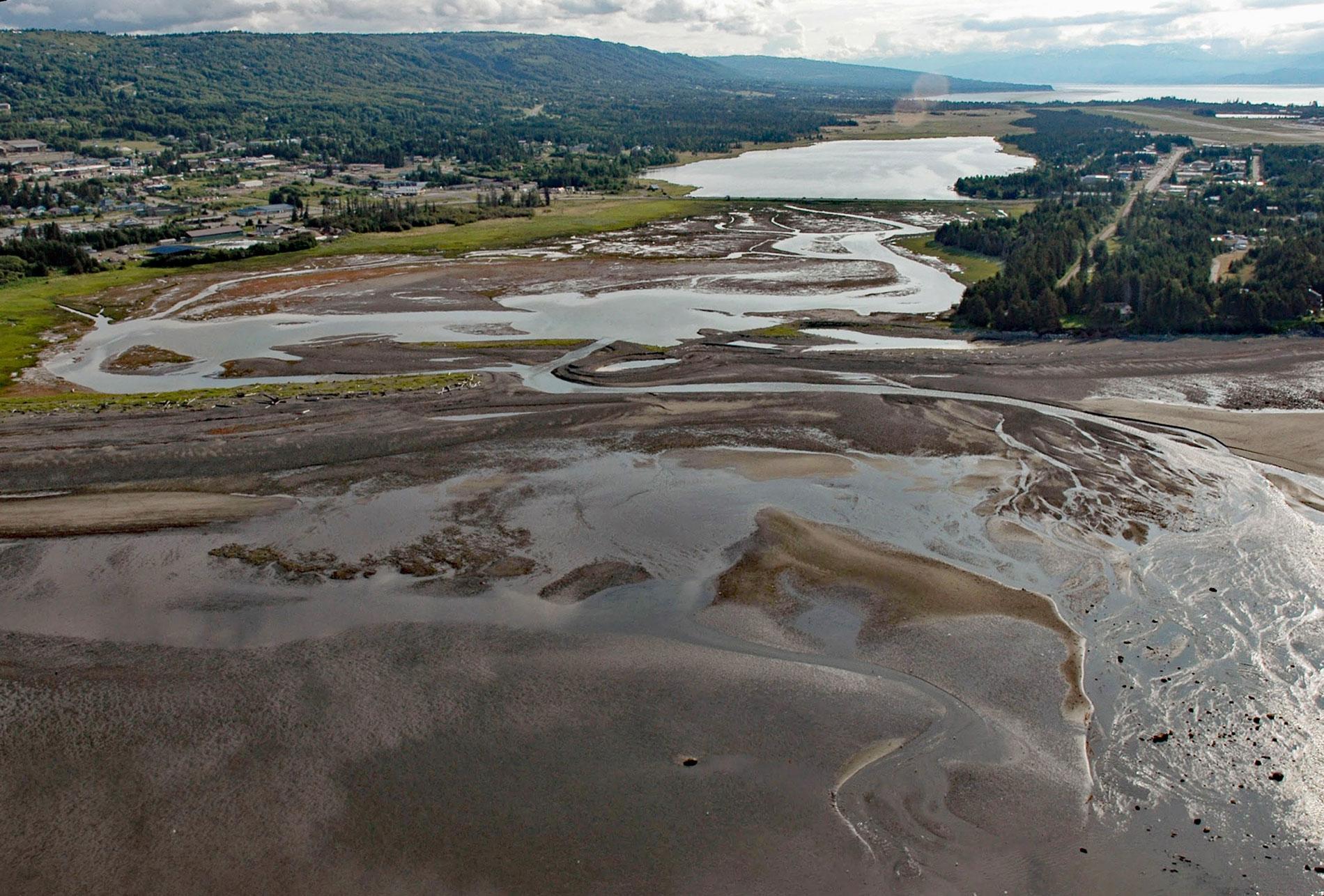
Beluga Slough is formed by Bishops Beach and is the tidal estuary of a historical stream called Palmer Creek that drained a watershed on the southern flank of Diamond Ridge on the northern shore of Kachemak Bay in the community of Homer, about 121 miles (195 km) southwest of Anchorage and 15 miles (24 km) north-northeast of Seldovia, Alaska. The slough was originally called Duck Lake in 1899 and renamed Beluga Lake in 1904 on a map by Ralph W. Stone which was published by the U.S. Geological Survey. The slough is surrounded by salt marshes and is partially enclosed by a beach ridge composed of sediments eroded from the steep buffs situated to the northwest and subsequently transported across the mouth of the slough by alongshore waves forced by northwest winds in Cook Inlet. During the winter when there is minimal freshwater discharge from the watershed and maximal wave energy in Cook Inlet, the beach ridge will often build to completely enclose the slough, so that in the spring a freshwater lake will form behind the beach ridge. The lake will persist until the water pressure causes an outburst flood, and thereafter, tidal flushing maintains an open channel. The tidal slough historically extended northeast from Bishops Beach for over 1 mile (1.6 km) with a vast wetland that extended another mile from the head of tide. At high tide, the lower portion of the slough historically was navigable by small boats, and this led to the early development of Homer.
Coal was discovered in the area in the late 1890s and exported from Coal Point at the end of the Homer Spit where the settlement of Homer was first established. Both the town and spit were named for Homer Pennock, a promoter and reputedly a con man who took a group of gold seekers to Cook Inlet in 1896. The spit had no freshwater and was particularly inhospitable in winter. Early settlers preferred the mainland for agriculture and raising livestock and Beluga Slough was used to land boats at high tide where a community was established on the north shore at present-day Old Town. In 1899, the Cook Inlet Coal Fields Company built a railroad from the coal mines to Bishops Beach, across the tidal channel and along the Homer Spit to a deep water wharf. The company surveyed an alternate route across Beluga Slough, but this was never built. In 1900, James Wickersham was appointed the territorial judge of Alaska. He was based in Eagle but traveled extensively throughout the territory, and after a visit to Kachemak Bay, he envisioned a large city and future state capital. In 1938, the Homer Civic League made the first attempt to build a primitive road and bridge across Beluga Slough for easier access to the spit and an airstrip. In 1941, the Alaska Road Commission constructed a permanent causeway with a tide gate across the estuary of Palmer Creek, effectively blocking the tidal exchange and creating Beluga Lake that is used exclusively as a floatplane base. During World War II, the Civil Aeronautics Authority constructed a long runway at the Homer airstrip using beach gravel excavated from Munson Point so that fighter planes could refuel enroute to the Aleutian Islands.
Judge Wickersham and four companions made one of the first summit attempts on Mount McKinley in 1903. He became the Alaska delegate to the U.S. House of Representatives in 1909 and was instrumental in the passage of the Organic Act of 1912, which granted Alaska territorial status. He visited Kachemak Bay often and lobbied for the area to become a military logistical center for lower Cook Inlet. In 1921, he tried to interest the Secretary of the Navy Josephus Daniels and Secretary of Interior Albert Fall in the idea of building a major North Pacific naval base at Kachemak Bay. He wanted them to withdraw the Homer Spit and some lands on the north shore and lay out a townsite, selling enough lots to pay for the necessary surveying. Secretary Daniels’ preference was for locating a base in Hawaii instead which led to the eventual construction of Pearl Harbor. Wickersham also tried to interest his New York friends in buying the Alaska Railroad and utilizing Homer as a rail terminal, but this would require building 150 miles (241 km) of additional track and they declined the project. Wickersham eventually bought two parcels of land on Kachemak Bay from the homesteads of John F. Mullen and J.H. Lamb with military land warrants, but never lived there. Read more here and here. Explore more of Beluga Slough and Bishops Beach here:

