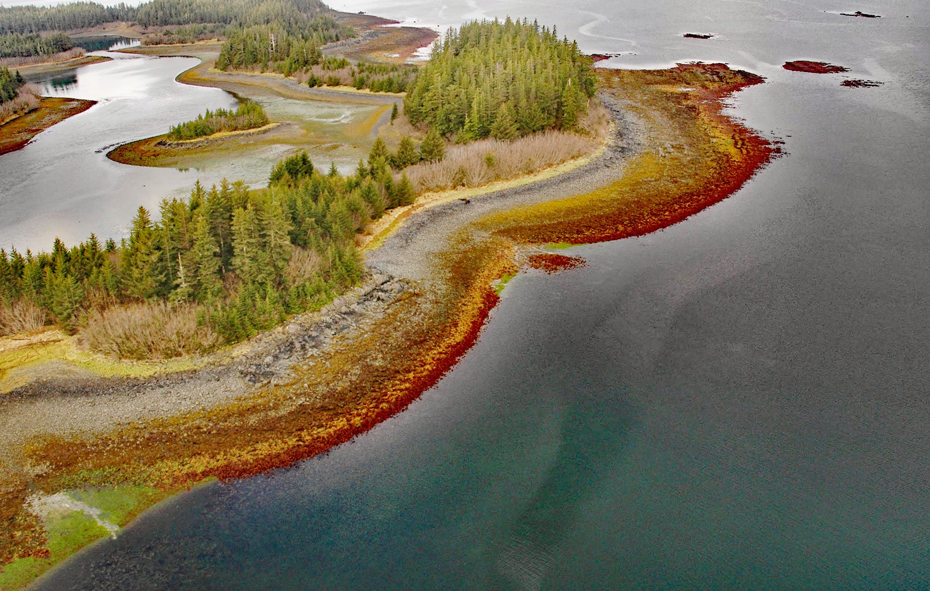
Stockdale Harbor is on the northwest coast of Montague Island in Prince William Sound, about 62 miles (100 km) southeast of Whittier and 54 miles (87 km) southwest of Cordova, Alaska. In 1776, Nathaniel Portlock joined HMS Discovery as master’s mate under the command of Charles Clerke and served on the third Pacific voyage of James Cook. During the expedition, in August 1779, he was transferred to HMS Resolution under the command of Cook, and where he served with George Dixon. The furs obtained during the voyage were sold for good prices when the expedition called at Macao. In 1785, Richard Cadman Etches and partners, including Portlock and Dixon formed a partnership called the King George’s Sound Company, to further develop the fur trade. In September 1785, Portlock and Dixon sailed from England with Portlock in command of King George and Dixon in command of Queen Charlotte. Dixon and Portlock sailed together for most of their three-year voyage. Stockdale Harbor was named in 1787 by Portlock for John Stockdale who with George Goulding later published Portlock and Dixon’s account of the voyage, based in part on letters written by William Beresford, the trader on the expedition.
The tidal range in Stockdale Harbor can exceed 16 feet (5 m) and at extremely low tides, most of the intertidal zone is exposed. Intertidal zones exist anywhere the ocean meets the land, from steep, rocky ledges to long, sloping sandy beaches and mudflats that can extend for hundreds of meters. The horizontal banding seen on the beaches in Stockdale Harbor results from the types of marine plants and animals that live at specific elevations on the beach. Intertidal plants and animals have developed adaptations to tolerate a range of atmospheric and oceanic conditions. These adaptations have evolved to provide a competitive advantage for food, space, or sunlight. Many intertidal plants and animals are permanently attached to the rocks and can live only at certain elevations on the beach. They depend on the rise and fall of the tides for access to food or nutrients and protection from predators. Mobile animals such as sea stars, crabs, and fishes, will take advantage of the high tides to feed in the intertidal and then seek shelter in pools, crevices, or deeper water at low tide. Four physical divisions each with distinct characteristics and ecological differences divide the intertidal zone. The spray zone is submerged only during extremely high tides, or in combination with wave runup during severe storms, or just by spray caused by breaking waves and high winds. This zone is often inhabited by a lichen that can appear as an almost continuous dark band. Below the spray zone is the high intertidal zone that is usually only submerged once a day during the daily high tides but otherwise remains dry for long periods. It is inhabited by hardy sea life that can withstand pounding waves but must also tolerate long exposure to air and sun, such as barnacles, marine snails, and limpets. Below the high zone is the middle intertidal zone that is submerged twice a day. It is inhabited by a greater diversity of animals such as mussels, sea stars, and some anemones. Marine algae that can tolerate exposure to air are also found here such as rockweed that appears as a golden brown band. Below the middle zone is the low intertidal zone that is usually submerged but may be exposed once a day during the lowest daily tide. Marine life is more abundant and diverse in the low zone because of the long inundation period.
This zonation is of great interest to marine biologists since sea creatures arrange themselves vertically in the intertidal zone depending on their abilities to compete for space, avoid predators such as birds from above and fishes from below, and resist drying out when exposed to the air and sun. Residents of the higher intertidal zones can either close themselves up in their shells to remain moist and ward off predators or are very mobile such as crabs and fishes that retreat to lower submerged zones when the tide goes out. In the lower parts of the intertidal zone, many plants and animals attach themselves to the rock. Larger marine life, such as seals, sea lions, and fish, find foraging for food ideal at high tide in the intertidal zone, while a large variety of shorebirds, looking for their meals, stroll hungrily over the intertidal zone at low tide. Intertidal communities of plants and animals may include dozens of different and sometimes codependent species uniquely adapted to a particular combination of environmental conditions. Studies have shown that these groups of plants and animals will develop repeating patterns when physical conditions are the same, but different patterns appear when physical conditions change so that the effects of climate change will be manifested in these ecological communities. Read more here and here. Explore more of Stockdale Harbor and Montague Island here:

