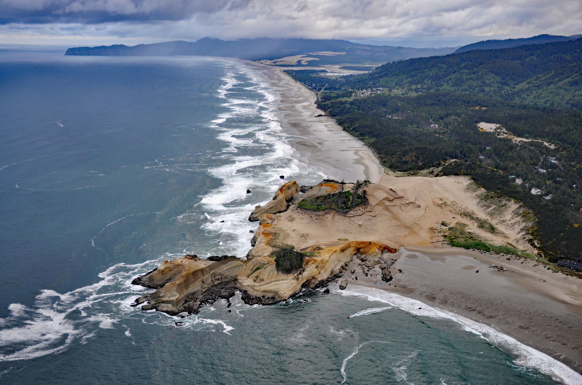
Cape Kiwanda is a sandstone headland with an elevation of 240 feet (73 m), protected by a basalt island known as Haystack Rock lying 0.5 miles (0.8 km) to the southwest, about 18 miles (29 km) south-southwest of Tillamook and 1 mile (1.6 km) northwest of Pacific City, Oregon. In 1792, Captain George Vancouver was the first European to chart the island probably because it made for a distinctive navigational aid. Beginning in 1854, George Davidson of the U.S. Coast and Geodetic Survey assisted in documenting the estuaries and features of the Oregon coast. In 1867, the cape was named Haystack Point, and in later reconnaissances of 1883 and 1887, it was named Sand Cape and Cape Kiwanda respectively, the latter presumably after Chief Kiwanda, a well-known Nestucca chieftain who lived in the area. The island is locally known as Chief Kiwanda Rock since there are three sea stacks in Oregon named Haystack Rock. The one in Cannon Beach is the most famous of the three, even though the island off of Cape Kiwanda is actually larger. The headland is on the Three Capes Scenic Route, a coastal drive that includes Cape Meares and Cape Lookout. A trail leads to the top of Cape Kiwanda with views of Nestucca Bay to the south and Cape Lookout to the north.
Before the coast was settled by Euro-Americans, the Nestucca area was populated by the Nestugga (now Nestucca) and the Killamook (now Tillamook) tribes. The Willamette Valley had been settled since the early 1800s. In 1845, a wildfire was started by a settler named Johnson while clearing land in the Williamette Valley near Champoeg. The fire burned westward into the Coast Range and eventually extended from Tillamook southward 60 miles (96 km) to Newport and from the Willamette Valley for 40 miles (64 km) to the ocean beaches, encompassing 1,500,000 acres (607,029 ha), the largest area of old-growth destroyed by a single forest fire in the United States. In the 1870s, settlers started arriving on the coast on small steamships such as Della, Elmore, and Gerald C., that could navigate the coastal rivers, bays, and bars between San Francisco and Astoria. In 1875, Joseph Woods settled on the north bank of the river and a community soon became established as a major depot and trading hub for new settlers. Salmon were so plentiful in Nestucca Bay, a commercial cannery was built in 1886 by Linewebber and Brown and packed 12,000 cans of salmon a year. In 1893, Thomas Malaney homesteaded on the south bank opposite Woods and platted a townsite called Ocean Park. After a severe flood in 1894, Malaney moved the town further south to higher ground. In 1895, visitors from the Willamette Valley stayed at a hotel called Sea View. The town had a fishing dock, dance hall, and a store. A hand-operated ferry shuttled pedestrians, wagons, buckboards, and eventually autos across the river to the ocean beach. In 1904, Thomas Brooten found a shale composed of mineralized kelp, potash, iodine, and the fossilized remains of “microorganisms”. In 1905, he opened the Brooten Kelp Ore Resort which flourished until the 1920s when an outbreak of tuberculosis eventually closed the enterprise. In 1909, a post office was established with the name Pacific City to avoid confusion with Ocean Park in Washington State.
The geology of Cape Kiwanda is unusual because unlike the majority of northern Oregon coastal headlands, it is not made of basalt from the lava flows that inundated the coast about 15 million years ago. About 18 million years ago, the entire western coast of North America did not exist as it is now. The continent’s western edge was closer to modern-day Idaho, and what we see today was an ancient ocean floor, hundreds of miles from land. This coastal ocean had been eroded and scoured and was accumulating sediments that became lithified into layers of sandstone and mudstone, now called the Astoria Formation, that extends from the central Oregon coast up to Washington. About 15 million years ago, a series of huge volcanic eruptions produced lava flows that seared their way across the landscape from Idaho and into the ocean creating many of the coastal features seen today at Cape Perpetua, Cape Meares, and Tillamook Head. Some of those volcanic flows were so strong they plunged into the softer sediment of the Astoria Formation and then re-erupted, which possibly explains features like Haystack Rock. However, much of those lava flows left the Kiwanda area alone, allowing this sandstone headland to stay undisturbed by the molten lava. Over the following dozens of millions of years, land and ocean floor levels rose and fell relative to sea level causing erosion to create the features and shapes we see today. Wave action quickly erodes sandstone and the headland would have disappeared long ago but for the basalt Haystack Rock which was once much larger and protected the cape from southerly storms. Read more here and here. Explore more of Cape Kiwanda and Pacific City here:

