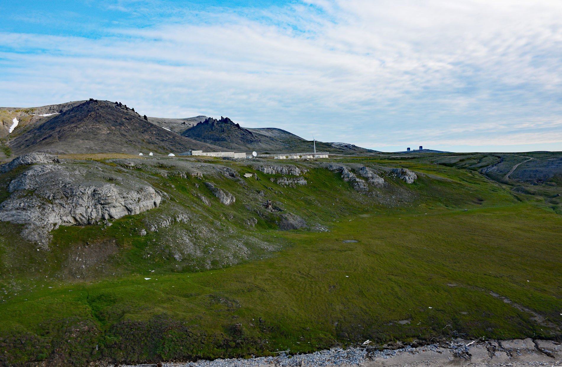
Tin City is a historical mining community on Cape Prince of Wales, located at the mouth of Cape Creek and adjacent to Cape Mountain on the Seward Peninsula, about 103 miles (166 km) northwest of Nome and 6 miles (10 km) southeast of Wales, Alaska. Cape Prince of Wales was named by Captain James Cook on May 9, 1778. The Seward Peninsula separates Norton Sound to the south in the Bering Sea from Kotzebue Sound to the north in the Chukchi Sea. The entire peninsula is about 210 miles (330 km) long and was named after William H. Seward, the U.S. Secretary of State who negotiated the Alaska purchase from Russia in 1867. Cape Mountain has a summit elevation of 2,289 feet (698 m) and is the northern terminus of the Continental Divide of the Americas. It was named in 1900 by Alfred Hulse Brooks of the U.S. Geological Survey. Cape Creek has its headwaters on the mountain’s eastern side and flows southward for approximately 2 miles (3.2 km) to the Bering Sea. Cape Mountain is now the Tin City Long Range Radar Station, part of a network of surveillance and communications facilities for the defense of North America. A primitive road of about 8 miles 913 km) connects the radar facility with the Inupiat Eskimo village of Kingegan, more commonly known as Wales.
Tin ore in both lode and placer form is broadly distributed in the western part of the Seward Peninsula. In 1900, the first discovery of placer tin in Alaska was made on Buhner Creek at the western extremity of the peninsula. This discovery generated interest in the possibility of finding commercial ore bodies of tin, and in 1901 and 1902 considerable prospecting for placer tin was carried on in this region. Lode tin was first discovered at Cape Mountain in July 1902, by W.C.J. Bartels. Believing that his company had a tin ore prospect worth $100,000,000, Bartels arrived in New York from Nome to collect and ship around Cape Horn all the necessary mining equipment. In 1903, a mining camp was established at the base of Cape Mountain and the Tin City post office was opened in 1904. Considerable underground work was done on the Cape Mountain prospect and a few small shipments of ore were made. By 1907, two companies were operating a stamp mill, a machine that crushes rock for further processing and extraction of the metal ore. Tin City consisted of a few widely scattered houses at the mouth of Cape Creek. Another lode tin prospect at Lost River, located about 25 miles (40 km) southeast of Tin City, had also been under development for several years and was more commercially viable. By 1909, the Tin City post office was closed when the Cape Mountain mines were idled.
Tin City Air Force Station was a continental Defense Early Warning Line radar facility during the Cold War and one of the ten original radar surveillance sites constructed to establish an air defense system in Alaska and Canada for NORAD. Construction began in September 1950 and was completed in December 1952 by Gaasland & Company, a military contractor who built many of the Alaska DEW Line stations. The facility was originally known as Cape Prince of Wales Air Force Station and the name was changed to Tin City Air Force Station in 1957. Tin City was the closest U.S. military installation to the former Soviet Union and only 150 miles (241 km) from a military airbase at Provideniya, Russia. The radars were located at the summit of Cape Mountain at an elevation of 2,275 feet (694 m). The military airstrip at Tin City consisted of a weather shack and a gravel runway 4,700 feet (1,433 m) long with no navigation aids. The approach was dictated by prevailing winds from the south over the Bering Sea and the runway ended at a cliff 150 feet (46 m) above the beach. In 1957, severe downdrafts caused a twin-engine C-45 to crash into the side of the cliff. A ground support station was located at the base of Cape Mountain in a small canyon between the airstrip and radar site. The support station consisted of a power and heating plant, water and fuel storage tanks, a gymnasium, and office buildings. The buildings were connected by enclosed portals so no one needed to go outside in winter unless necessary. The summit radar site was connected to the base station by a road and an aerial tramway 7,200 feet (2,195 m) long, reputedly the longest in North America. All large equipment was required to be disassembled then re-assembled at the top camp radar station. The tramway cables were constantly breaking because of high winds and ice, and fog and the extreme cold made repairs hazardous. Ice 16 inches (41 cm) thick accumulated on the cables in winter. The U.S. Air Force colocated a White Alice Communications System with the DEW Line station to communicate with Campion Airforce Station in Galena, Alaska. In May 1967, the Peter Kiewit & Sons Company was contracted to build a new concrete and steel composite building of 68,400 square feet (6,354 sq m) to replace the 20 original wood-frame buildings. Over the years, the radar equipment at the station was upgraded or modified to improve efficiency and accuracy. In 1983, the station was re-designated as a Long Range Radar Site, leaving only contractor personnel to maintain the site radar. Two floors of the composite building were isolated and mothballed. In 1998, the U.S. Air Force initiated Operation Clean Sweep to remediate and restore the land at former military bases. Site remediation of the Tin City radar and support stations and the White Alice communication station was completed by 2005. In 2015, the Pentagon budgeted $126 million to upgrade Tin City and other coastal radar stations in Alaska in response to the reactivation of 14 Russian airfields. Read more here and here. Explore more of Tin City here:

