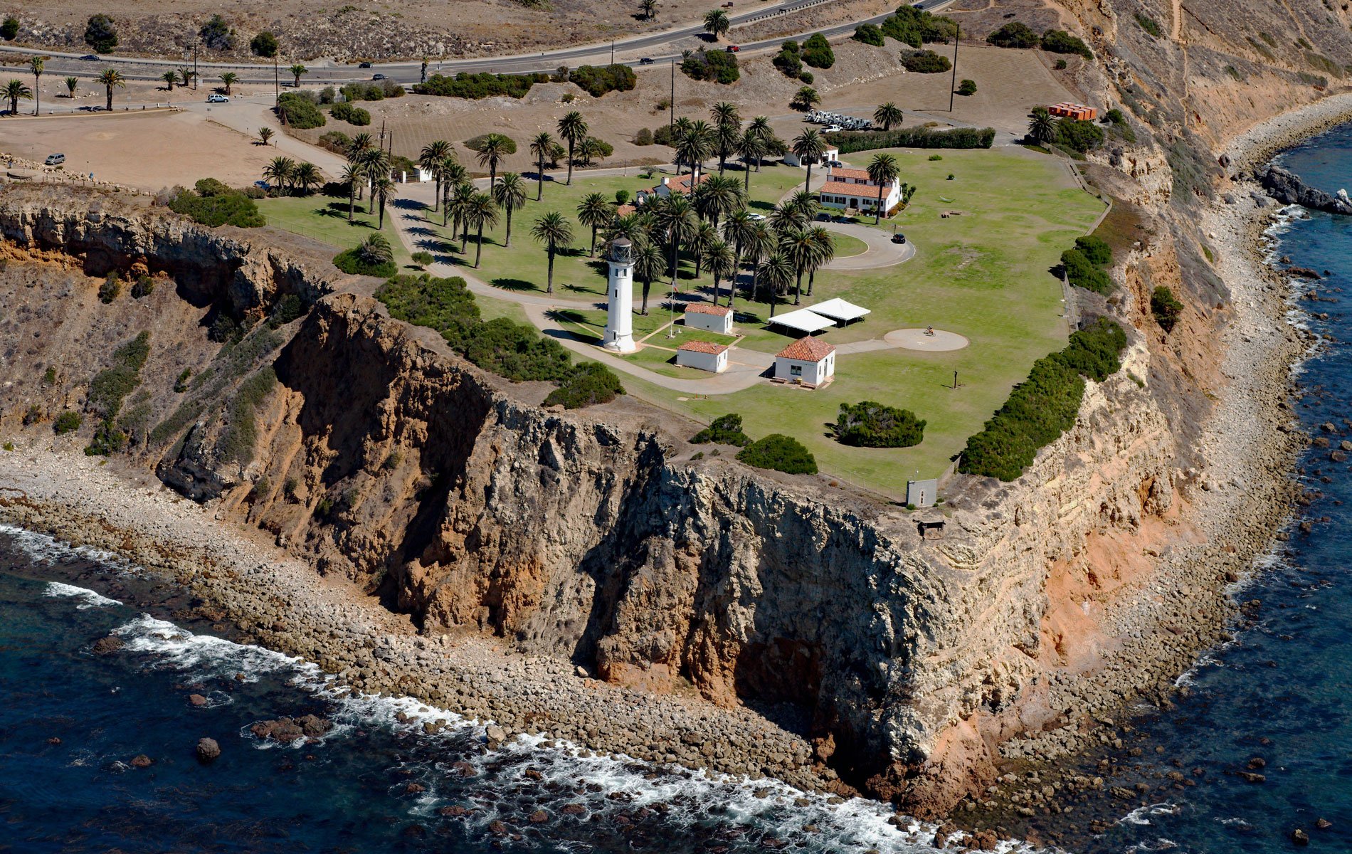
Point Vicente is on the Palos Verdes Peninsula between Long Point to the southeast and Resort Point to the northwest, about 20 miles (32 km) south-southeast of Santa Monica and 12.5 miles (20 km) west of Long Beach, California. The Palos Verdes Peninsula is the most prominent coastal feature between Point Loma to the south and Point Conception to the north. The peninsula was the homeland of the Tongva-Gabrieliño people for thousands of years. Their first contact with Europeans occurred in 1542 with Juan Cabrillo. When Captain George Vancouver sailed along this coastline on November 24, 1793, he named the southwest tip of the peninsula Point Vicente, in honor of Padre Vicente de Santa Maria of the Mission Basilica San Buenaventura located 63 miles (101 km) to the northwest. Vicente de Santa Maria joined the Franciscans at age seventeen and was sent to labor in the mission fields of Alta California. He explored most of San Francisco Bay on the San Carlos and wrote detailed first-hand accounts of the journey and of the Indigenous Peoples of the Bay Area prior to Spanish colonization. He later served at Mission San Francisco de Asis in San Francisco and Mission Basilica San Buenaventura in Ventura, California, where he died in 1806. In 1834, Mexican Governor José Figueroa awarded Juan Capistrano Sepúlveda and José Loreto Sepúlveda a parcel from the huge original 1784 Spanish land grant of Rancho San Pedro. It was named Rancho de Los Palos Verdes, or “ranch of the green sticks”, and was used primarily as a cattle ranch.
According to California Place Names, the name of the point first appeared on maps in 1844, and the U.S. Coast and Geodetic Survey adopted the name in 1852 but misspelled it as Vincent which was not corrected until 1933. Point Vicente Lighthouse was built in 1926 following years of complaints by shippers about the dangerous waters around the Palos Verdes Peninsula. Point Vicente is located just 7 miles (11 km) from the lighthouse on Point Fermin, but ships approaching from the north are unable to see that light as it is blocked by Point Vicente. Despite the point’s prominence, funding for a lighthouse to mark this turning point into the harbors of San Pedro and Long Beach was not approved until 1916. Delays in acquiring the land postponed construction until 1922, and then the high cost of material and labor further delayed the project until 1924. The white cylindrical brick light tower is 67 feet (20 m) tall and built on the edge of a cliff 130 feet (40 m) high. The most striking feature in the lighthouse is the classical third-order rotating Fresnel lens located in the lantern. This particular lens was manufactured around 1910 in Paris, France. The light station was operated and maintained by the U.S. Lighthouse Service until 1939 when that agency was merged with the U.S. Coast Guard. The lighthouse was manned until 1971 when it was automated.
Point Vicente State Marine Reserve is a marine protected area that extends offshore from the Palos Verdes Peninsula and together with the Abalone Cove State Marine Conservation Area includes 12,717 acres (1100 ha). These areas protect the only south-facing headland on California’s south coast. These south coast areas protect natural habitats and marine life by limiting the removal of wildlife from within their boundaries. Species afforded protection are lobsters, sea urchins, rockfish, and rocky intertidal (tide pool) inhabitants. Habitats include dense kelp forests, extensive and complex rocky reefs, and migration waters for a host of marine mammals including humpback whales, gray whales, and blue whales. Point Vicente State Marine Reserve prohibits the taking of any living marine resources. Abalone Cove State Marine Conservation Area allows the recreational taking of pelagic finfish, including Pacific bonito and white seabass by spearfishing, market squid by hand-held dip net, commercial take of coastal pelagic species and Pacific bonito by round haul net, and swordfish by harpoon. Abalone Cove and Point Vicente are two of 36 marine protected areas adopted by the California Fish and Game Commission in December 2010. The new marine protected areas were designed by local divers, fishermen, conservationists, and scientists who comprised the South Coast Regional Stakeholder Group. Their job was to design a network of protected areas that would preserve sensitive sea life and habitats while enhancing recreation, study, and education opportunities. The south coast marine protected areas went into effect in January 2012. Read more here and here. Explore more of Point Vicente and Palos Verdes here:

