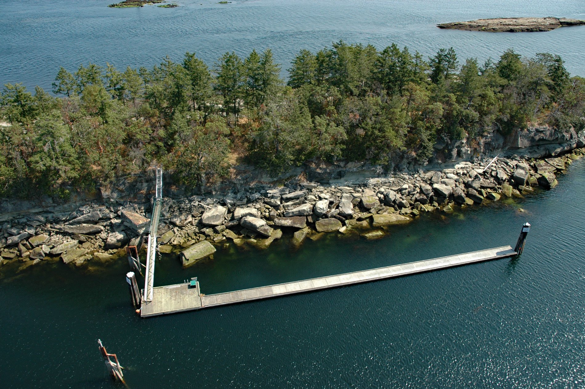
Kendrick Island is near the eastern entrance to Gabriola Passage, 0.1 miles (0.2 km) off the northeast coast of Valdes Island and surrounded by Wakes Cove Provincial Park, about 28 miles (45 km) southwest of Vancouver and 12 miles (19 km) east-southeast of Nanaimo, British Columbia. The island is uninhabited, about 1 mile (1.6 km) long, and an average of 0.25 miles (0.4 km) wide, and owned by the West Vancouver Yacht Club. It is currently undeveloped except for a dock and several mooring floats. Kendrick Island is named for Captain John Kendrick, possibly by Captain George Vancouver who sailed by here in 1792. Valdes Island is one of the Gulf Islands located in the Strait of Georgia between Gabriola and Galiano Islands, and about 10.5 miles (17 km) southeast of Nanaimo. Valdes Island covers an area of 5,760 acres (2,331 ha) and is approximately 1.5 miles (2.4 km) wide and 9 miles (14.5 km) long, and is one of the largest and least developed of the Gulf Islands. It is named after Spanish explorer Cayetano Valdés y Flores, who first came to the region in 1791 as a lieutenant serving under Captain Alessandro Malaspina on the ship Descubierta. Valdes returned later in 1792 as captain of the Mexicana to explore the area with Dionisio Alcalá Galiano who captained the Sutil. The island was given its name in 1859 by George Henry Richards, captain of HMS Plumper.
John Kendrick was an American sea captain during the American Revolutionary War and was involved in the exploration and maritime fur trading of the Pacific Northwest. In 1787, a syndicate led by Boston merchant Joseph Barrell financed the Columbia Expedition with the ship Columbia Rediviva and the sloop Lady Washington. The command of the expedition was given to Captain Kendrick, then 47 years old who commanded the Columbia, and Lady Washington was commanded by Robert Gray, then 32 years old and with only one eye. The combined crews of the two ships numbered about 40 men, most hailing from Cape Cod, Boston, Rhode Island, and the North Shore of Massachusetts. Many were veterans of the Revolutionary War. In 1789, Kendrick was present at Nootka Sound when the Spanish naval officer José Esteban Martínez seized several British ships belonging to a commercial enterprise called King George’s Sound Company owned by a partnership of companies under John Meares and Richard Cadman Etches. This incident nearly led to war between Britain and Spain and became the subject of lengthy investigations and diplomatic inquiries of what was called the Nootka Crisis. As a result, the British were driven out of the fur trade and Kendrick recognized that the Americans had a window of opportunity on the northwest coast. On July 15, 1789, Kendrick and Gray left Nootka Sound and sailed south to Clayoquot Sound, where they switched vessels. Kendrick ordered Gray to take Columbia Rediviva to China with all their acquired furs, and Kendrick would take Lady Washington north to continue trading. Gray returned to Boston via Canton and later commanded another expedition on Columbia Rediviva that would enter and name the Columbia River.
Wakes Cove Provincial Park is located at the north end of Valdes Island and is still undeveloped, lacking any facilities for campers, and can only be accessed by private vessels and floatplanes. Wakes Cove Park is surrounded by water with Gabriola Passage to the north, the Strait of Georgia to the east, and Pylades Channel to the west. TimberWest Forest Corporation and Wardill Marine Holdings Limited hold marine industrial leases for log handling and storage along the foreshore to the west of the park. To the east, the West Vancouver Yacht Club owns Kendrick Island and leases a section of the foreshore between the island and Valdes Island. In addition, due to the significant commercial marine traffic traveling through Gabriola Passage, a Towboat Reserve is also located between the park and Kendrick Island to accommodate refuge for tugboats with the ever-changing tides and weather conditions in the area. Gabriola Passage, which lies between Gabriola Island and Valdes Island, is the smallest of three main passages leading from the Strait of Georgia into the calmer inner waters adjacent to the Gulf Islands. The passage is about 394 feet (120 m) wide at its narrowest point with an average maximum depth of 98 feet (30 m). Tidal currents can run up to 8 knots (15 kph) creating whirlpools, standing waves, and eddies. The strong tidal currents provide ample flushing and abundant nutrients to support a diversity of species including sponges, corals, calcareous tubeworms, hydroids, bryozoans, sea stars, nudibranchs, chiton, North Pacific Giant Octopus, and several fish and shellfish species. Fisheries and Oceans Canada has established a Rockfish Conservation Area in Gabriola Passage where fishing is closed to protect several species of rockfish and their habitat. Read more here and here. Explore more of Kendrick Island and Wakes Cove here:

