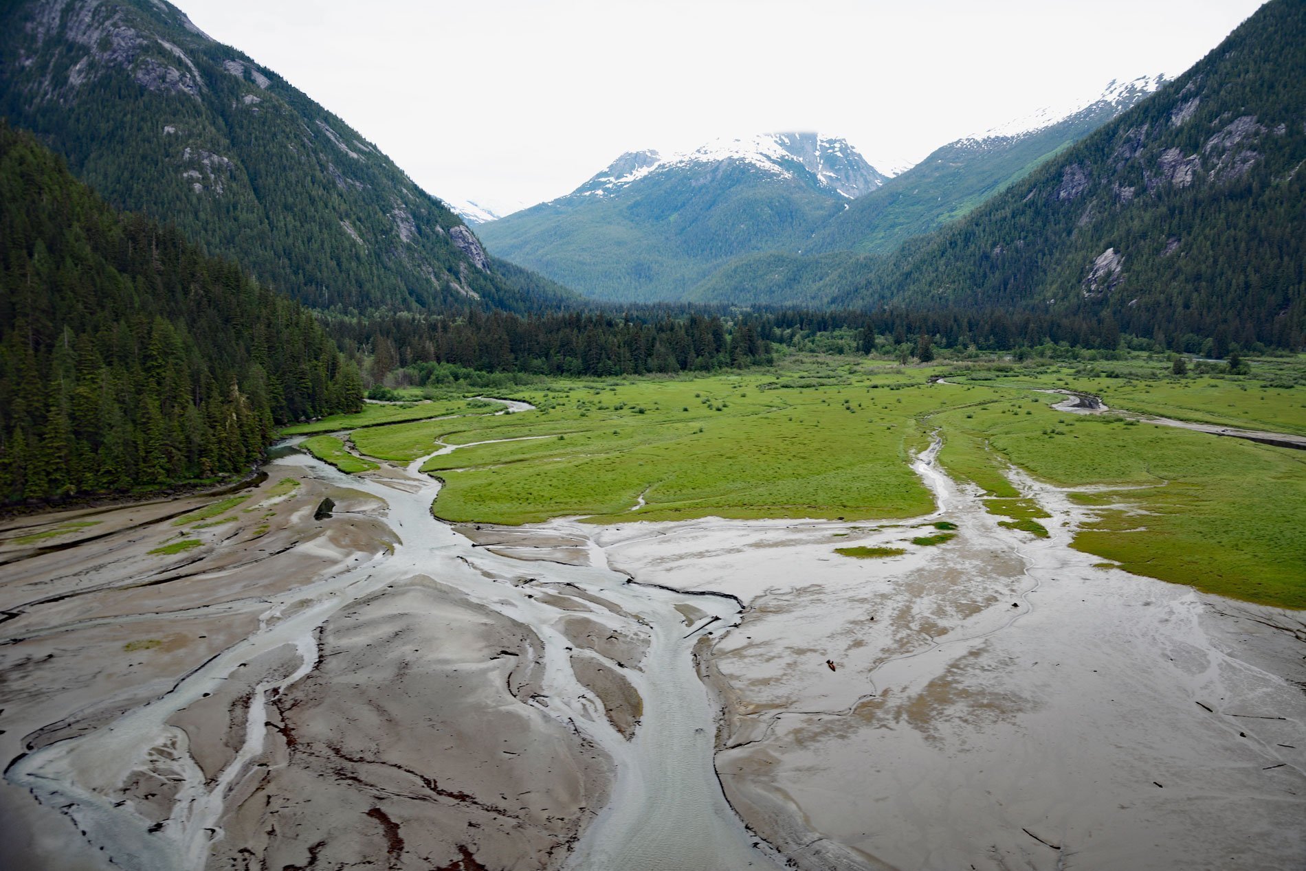
Kowesas River flows generally north for 22 miles (35 km) draining a watershed of 101,807 acres (41,200 ha) in the Coast Mountains to the head of Chief Mathews Bay, sometimes spelled Chief Matthews Bay, on the southwest shore of Whidbey Reach at Courageux Point in Gardner Canal, about 112 miles (180 km) southeast of Prince Rupert and 17 miles (27 km) south-southwest of Kemano, British Columbia. The bay extends about 3.5 miles (5.5 km) southwest from Garder Canal and dries at low tide for about 0.5 miles (0.8 km) from its head. The bay was labeled Kowesas Bay on British Admiralty Charts before 1927. Gardner Canal is a fjord 56 miles (90 km) long and is one of the principal inlets of the northern British Columbia coast. The entrance is behind Hawkesbury Island and is accessed via Devastation Sound or Varney Passage. It was named in 1793 by Captain George Vancouver in honor of his friend and former commander, Alan Gardner, who was in command of HMS Courageux in 1792. Lieutenant Joseph Whidbey was the first to chart the fjord during the Vancouver Expedition. The Coast Mountains consist of deformed igneous and metamorphosed rocks. The mountains are built of several different terranes of different ages that originated from diverse locations in the proto-Pacific basin. In addition, oceanic crust under the Pacific is being subducted at the southern portion of the range to form a north-south line of volcanoes that form part of the Northern Cordilleran Volcanic Province, the most volcanically active area in Canada. The Coast Mountains batholith is a composite continental batholith that intruded into the terranes of western British Columbia and southeastern Alaska and is exposed along Gardner Canal and Chief Mathews Bay where the intrusion is known as the Chief Matthew’s pluton.
The Pacific Northwest coast at one time had the most densely populated areas of indigenous people ever recorded in Canada. The land and waters provided rich natural resources through cedar and salmon, and highly structured cultures developed from relatively dense populations. Within the Pacific Northwest, many different First Nations developed, each with their own distinct history, culture, and society. Some cultures in this region were very similar and share certain elements, such as the importance of salmon to their cultures. Prior to contact, and for a brief time after colonization, some of these groups regularly conducted war against each other through raids and attacks. Through warfare, they gathered captives for slavery. The Haisla inhabited Douglas and Devastation Channel. The Kitlope called themselves Henaksiala and inhabited Gardner Canal and the upper Princess Royal Channel. The Haisla social system is based on matrilineal clans. There were eight clans including Eagle, Beaver, Crow, Killer Whale, Wolf, Frog, Raven, and Salmon. Each clan has its own chief, its own resources areas, and its own winter village. The remoteness of some villages, situated far up northern inlets, enforced isolation on the Haisla and Henaksiala until the 1890s when a mission and residential school were established at the Haisla village of Kitamaat. Missionaries and government agents believed that certain aspects of traditional culture would prevent the assimilation of Indigenous Peoples to European Canadian culture and should therefore be banned. They used their influence to force the abandonment of feasts and dancing called potlatches. Additionally, traditional communal houses were pulled down and the children were forbidden to speak the Haisla language. During the same period, the decline in population shattered the clans and lineages and disrupted orderly lines of succession to titles and property in the traditional social order. The modern Haisla First Nation is an amalgamation of Haisla and Henaksiala which came together in 1947.
Chief Mathews Bay has a small estuary notable for its diverse plant communities, particularly the salt marsh meadows and intertidal species abundance. According to Henaksiala tradition, there was a settlement or camp at the head of the bay. The boggy flatland on the north side of the river mouth is called Tla’mid where wild crab apples, blueberries, huckleberries, salmonberries, and roots can be picked. On the south side of the entrance is Ma’alinuxw mountain where the Haisla historically hunted mountain goats. All five species of Pacific salmon, as well as herring spawn in the Kowesas River and several smaller creeks that drain into the bay. There was also a historical oolichan or eulachon, also called candlefish, run in the river. The eulachon is an anadromous smelt that spawns in the lower reaches of coastal rivers and streams. Within the Pacific, the distribution of eulachons, like most of the other smelts, is Boreal and eulachons are found only on in the eastern Pacific, from northern California to the eastern Bering Sea and their distribution coincides closely with areas known as the coastal temperate rain forest. Eulachons have declined throughout much of their range, especially in the last 20 years. The causes of the declines are uncertain; however, climate change is implicated as a cause of a general decline, but other factors cannot be overlooked, including local habitat alterations and bycatch in commercial trawl fisheries. The decline of eulachons is a concern for many First Nations, for whom the eulachon is of major cultural significance, especially as a source of an important traditional staple called ‘grease’. The status of eulachons also concerns fisheries managers and the commercial fishing industry because eulachons are common as bycatch in shrimp trawls in some areas. The decline of eulachons has prompted specific management actions to limit eulachon bycatch, and such actions may reduce potential shrimp catches in some areas. Read more here and here. Explore more of Chief Mathews Bay here:

