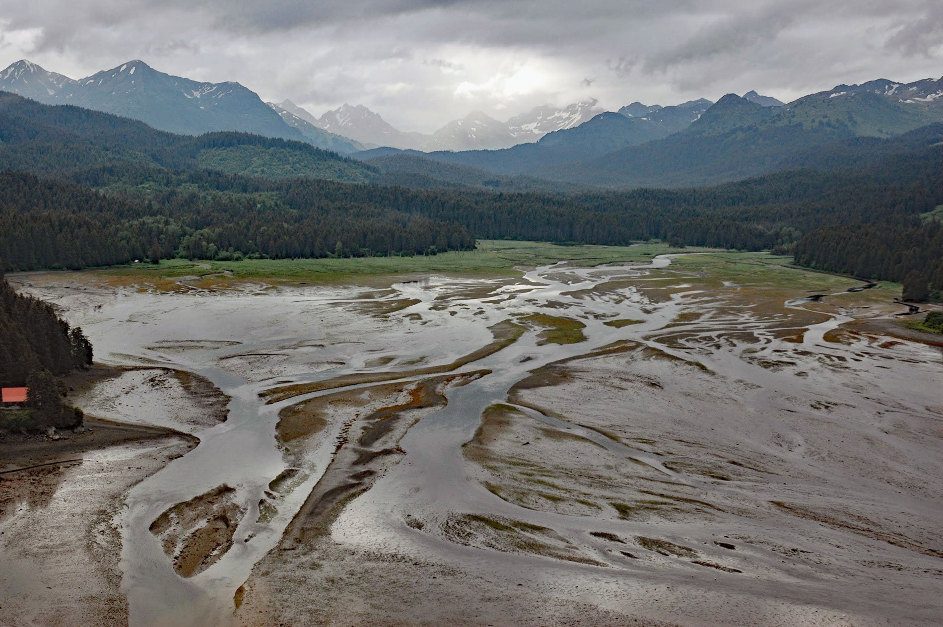
Seldovia River drains a watershed of 16,980 acres (6,872 ha) and flows generally northwest for 5 miles (8 km) from Seldovia Lake in the Kenai Mountains to Seldovia Bay on the south shore of Kachemak Bay and Lower Cook Inlet, about 18 miles (29 km) south-southwest of Homer and 3.6 miles (6 km) south-southeast of Seldovia, Alaska. The name is derived from the Russian word for ‘herring’, and first appears on charts referring to Seldevoi Point and is attributed to Captain Illarion Archimandritov who was sent by Mikhail D. Tebenkov to make surveys of Cook Inlet from 1848 to 1850 for the Russian-American Company. The Dena’ina name for the bay was ‘Chesloknu’ according to the U.S. Coast and Geodetic Survey in 1883. Most of the Seldovia River watershed is underlain by rocks of the McHugh Complex. Southern Alaska is underlain by a complex amalgam of accreted terranes, including the Wrangellia composite terrane or superterrane to the north and the Chugach-Prince William superterrane along the Gulf of Alaska coast. During much of the Mesozoic, the two superterranes formed a magmatic arc and accretionary wedge, respectively, above a circum-Pacific subduction zone. The Border Ranges fault runs along the axis of Kachemak Bay forming the local boundary between the Wrangellia and Chugach-Prince William superterranes. The Chugach terrane contains two major units, the mostly inland McHugh Complex exposed along the southern shore of Kachemak Bay, and the Valdez Group exposed along the outer coast and the perimeter of Prince William Sound. The McHugh Complex underlying the Seldovia River watershed is composed mainly of greywacke and conglomerate with one notable igneous intrusion called the Snow Prospect. The ultramafic intrusion, meaning rocks very low in silica, is predominantly dunite with infrequent but locally abundant layers of chromitite. Ultramafic intrusions occur in at least seven known places within the McHugh Complex, the most well-known are the Red Mountain and Claim Point ore bodies that were historically mined.
Dena’ina Athabaskans inhabited both sides of the Cook Inlet shoreline and were the only Athabaskans to live on salt water. Those that lived in Kachemak Bay adopted a maritime culture presumably through contact with the Alutiiq Sugpiat of the outer coast. The Kachemak Bay Dena’ina utilized harpoons to hunt sea mammals from skin boats while clad in waterproof parkas, but also retained aspects of their original land hunting tradition which differentiated them from their Alutiiq neighbors. In Kachemak Bay, there was an ethnic frontier between the Dena’ina and Alutiiq near Seldovia. Very little is known about the Alutiiq-speaking people who occupied the southern coast of the Kenai Peninsula prior to European contact. Apparently, they were distinct from, although linguistically related to, the Chugach Alutiiq of Prince William Sound. Their name in Chugach means ‘those who lived towards the open sea’. Limited archaeological data indicate that their utilization of the outer coast may have been most intensive in the recent past. Their major villages on the outer coast had been abandoned by the 1890s and their descendants live in present-day Nanwalek, Port Graham, and Seldovia. In 1787 or 1788 a Russian fur trading post named Aleksandrovskaia was established in Seldovia Bay by hunting parties under Evstratii I. Delarov, of the Shelikhov-Golikov Company, the precursor of the Russian-American Company. The Russian Orthodox Saint Nicholas Church was started in 1820 and may have been built on top of an older aboriginal village site. In the late 1800s and early 1900s, Seldovia was an important stop for deepwater ships sailing from Seattle. Passengers would usually transfer to smaller shoal draft vessels before continuing north in Cook Inlet.
Kachemak Bay exhibits a biological productivity significantly higher than elsewhere in lower Cook Inlet. Major sea mammals include harbor seals, harbor and Dall porpoises, sea otters, sea lions, belugas, orcas, and other lesser whales such as the minkes and humpbacks. Sea otters have only recently reestablished themselves in Kachemak Bay after being eliminated from the area in the early 1900s, and today there is an estimated population of about 6,000. Kachemak Bay lacks major salmon streams; however, 25 streams have anadromous fish runs. Kachemak Bay drainages support pink and chum salmon in harvestable amounts. Coho salmon runs to Kachemak Bay drainages are small and difficult to access. Chinook salmon return to some tributaries but not in harvestable amounts. The Seldovia River has all five species of Pacific salmon. Pink and chum salmon are the major species of salmon spawning in the river, followed by coho. These runs don’t show up until around the fourth of July, with coho being the latest. There are also very small natural returns of Chinook and sockeye salmon. To provide salmon fishing opportunities in late May and June, hatchery-produced early-run Chinook salmon have been introduced in Halibut Cove Lagoon since 1974, Homer Spit since 1984, and Seldovia Bay since 1987. Chinook and coho salmon are stocked in Seldovia to provide an alternative to heavily fished local stocks. Chinook salmon smolt were first released in the Seldovia Harbor in 1987 to create a new sport fishery. This is a terminal harvest fishery where all fish are intended for harvest and none spawn at the stocking location. To produce a run of approximately 3,000 adult fish, the annual stocking goal through 2006 was 105,000 early-run Chinook salmon smolt. Like other locations around Kachemak Bay and Cook Inlet, runs to Seldovia have been poor since 2008 primarily because of the low survival of stocked fish from bird predation and poor ocean conditions. Read more here and here. Explore more of Seldovia River here:

