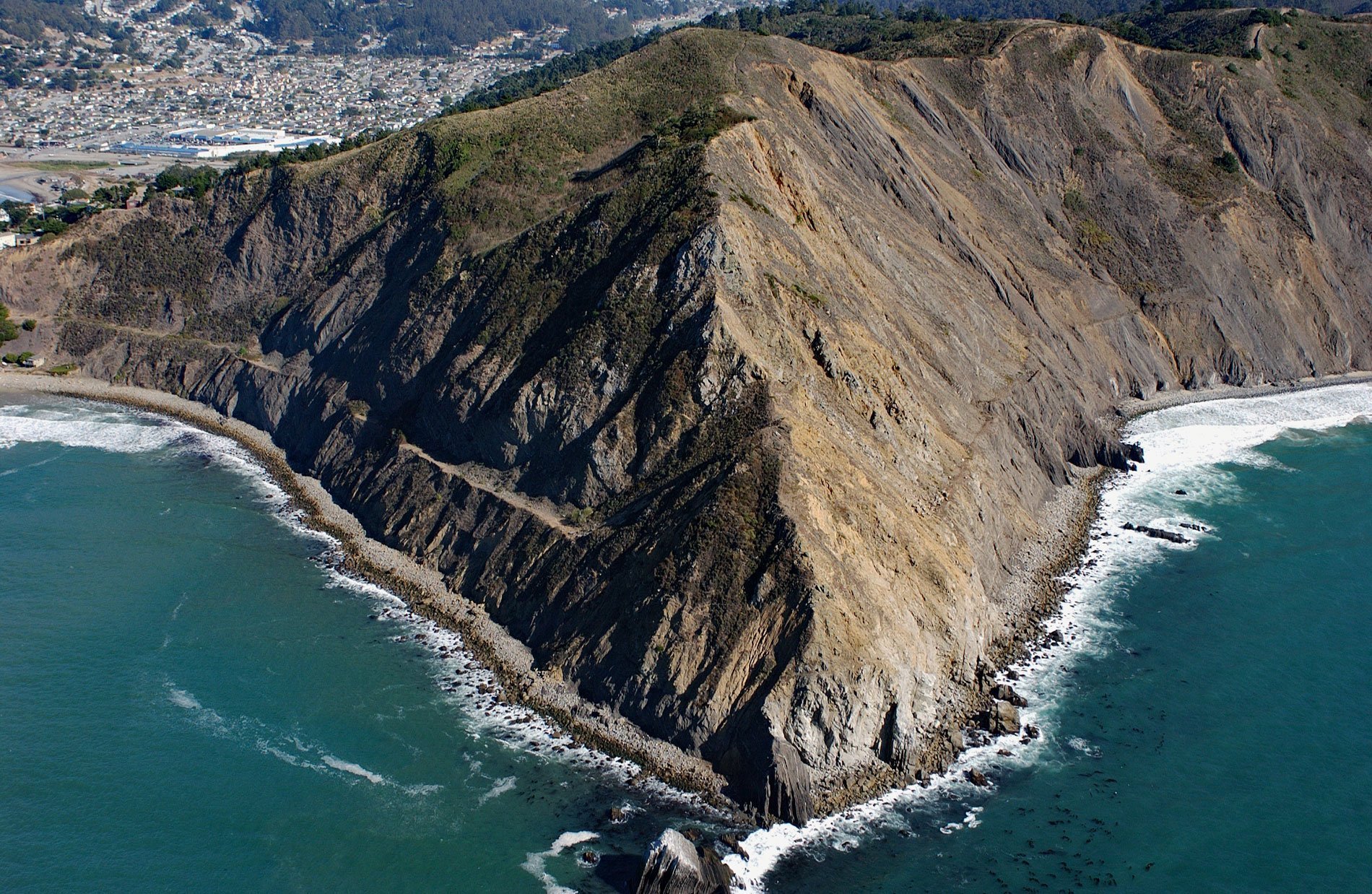
Point San Pedro forms the northwestern extent of Pedro Point Headland on San Pedro Mountain which reaches an elevation of about 624 feet (190 m) and has steep cliffs on both the northern and southern flanks, and forms the southern slope of the San Pedro Creek watershed, about 3.6 miles (5.8 km) north of Montara and the southern municipal boundary of Pacifica, California. San Pedro Rock is a small island off the end of Point San Pedro that is accessible only during low tide. The Spanish form of the name Saint Peter was very popular for place names during the Spanish colonial times. It was given to about twelve geographic features and five land grants. The point was originally named Punta del Angel Custodio or ‘guardian angel by Juan Crespí, a Franciscan missionary and explorer of Alta California with the Portolá expedition in 1769. San Pedro is mentioned as a rancho of Mission Dolores as early as 1791. The ‘San’ has been dropped by common usage but is still seen on maps published by the U.S. Geological Survey. In 1957, the community of Pedro Point was incorporated into the City of Pacifica. Pedro Point Headlands Park was recently created and offers views of San Pedro Rock and the city of Pacifica. San Pedro Mountain consists of marine sedimentary rocks formed during the Paleocene. The north-facing slope of the headland and all of San Pedro Rock is mostly shale and sandstone with a formation thickness estimated to be about 2,500 feet (762 m). The south-facing slope is sandstone and conglomerate with a thickness of about 1,300 feet (396 m). The pebble to cobble conglomerate appears to decrease from possibly 300 feet (91 m) thick on San Pedro Mountain to about 4 feet (1.2 m) thick at Point San Pedro. Much of the San Pedro Creek watershed is unconsolidated Holocene deposits of sand, silt, clay, and rock fragments accumulated by slow downslope movement and small landslides of weathered rock debris and soil from San Pedro Mountain.
The historical Indigenous Peoples of the San Francisco Peninsula were the Ramaytush of the Ohlone people with a population of about 1,400. The Ramaytush were divided into ten independent bands, including the Aramai that probably numbered no more than 50 people between two villages. One village was called Timigtac situated near present-day Rockaway Beach and the other was Pruristac near present-day Pacifica. In 1769, Pruristac was one of the small villages that the Portolá expedition visited in San Pedro Valley. The explorers were greeted by 25 Aramai after crossing San Pedro and Montara Mountains from the south, and when they reached the valley floor they received food that the local people brought to them from their village. Two weeks later, on their return south through the San Pedro Valley, the Spaniards noted that the Aramai people were gone. In 1786, San Pedro y San Pablo Asistencia, a satellite or ‘sub-mission’ to Mission San Francisco de Asís, was established in the San Pedro Valley at the village of Pruristac, and the Aramai were some of the first Native people to be absorbed by the church. In 1834, the mission lands were secularized after the Mexican War of Independence. In 1839, Governor Juan Alvarado granted Rancho San Pedro with 8,926 acres (3,612 ha), and all of the buildings of the Asistenciato, to Francisco Sanchez, the Commandante of the San Francisco Presidio and eighth alcade of the City of San Francisco. Sanchez retained ownership of the property after California was ceded to the United States in 1848, and the land was subjected to extensive cattle grazing. From 1907 to 1920, the Ocean Shore Railroad followed the edge of the headlands with a tunnel through its promontory. The railroad was closed due to a lack of funding, partially as a consequence of high maintenance costs for this landslide-prone route along the coastal cliffs. The tunnel has since collapsed but the original railroad bed remains. Starting in 1970, the Pedro Point Motorcycle Club used the headland and the scars left by motorcycle trails have been exacerbated by subsequent erosion.
For many decades Pedro Point Headlands was the site of unrestricted off-road vehicle use resulting in erosion scars and gullies. The erosion caused sediment to flow into San Pedro Creek significantly impacting threatened steelhead trout. The erosion also resulted in landslides, which threatened to flow onto Highway 1 and the future California Coastal Trail. In 1989, the effort to preserve the Pedro Point Headlands began when the California Coastal Conservancy, the Trust for Public Land, and the Peninsula Open Space Trust provided technical assistance to Pacifica residents in establishing a local land conservation organization. The resulting Pacifica Land Trust immediately turned its attention to the 246 acres (100 ha) of Pedro Point Headlands which was threatened at the time by a subdivision plan. An agreement was reached with the owners of the Pedro Point property on a phased acquisition plan. In August 1992, the California Coastal Conservancy granted the City of Pacifica funds for the acquisition of a land parcel for the purpose of public access. In 1995, additional funds were acquired to purchase a second parcel of land for the same purpose. Since then, improved public access has been facilitated by additional vehicle parking lots on adjacent land to the south. In 2005, the boundaries of the Golden Gate National Recreation Area were expanded to include Pedro Point, and the U.S. National Park Service expressed interest in accepting the properties, but only after issues of parking and improved public access are resolved. While this is being implemented, the Pacifica Land Trust is organizing the local community to restore the beauty and health of Pedro Point Headlands. Over 3 miles (5 km) of trails on the headlands are being restored with funding provided by the California Coastal Conservancy to provide hikers easier access to Point San Pedro. Read more here and here. Explore more of Point San Pedro and Pacifica here:

