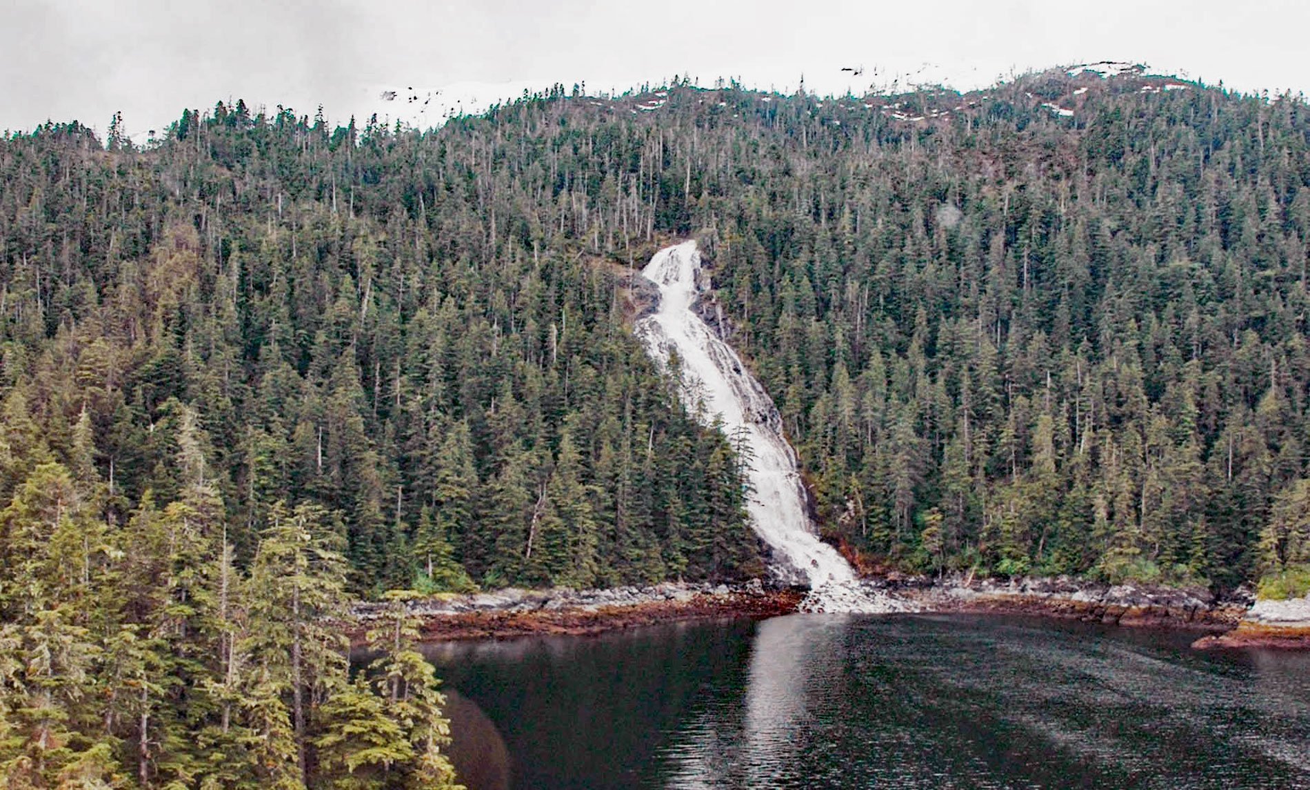
Kasnyku Falls is a waterfall located on Kasnyku Creek that drains Kasnyku Lake from an elevation of 650 feet (198 m) on the northeast coast of Baranof Island and flows about 1 mile (1.6 km) to Waterfall Cove on Chatham Strait, about 23 miles (37 km) south-southwest of Angoon and 21 miles (34 km) northeast of Sitka, Alaska. The upper part of the outlet creek is a canyon filled with large talus blocks and the stream from Kasnyku Lake flows underground to a small pond nearly 0.3 miles (0.5 km) downstream, and then in the lower part of the canyon, the stream cascades to sea level. Kasnyku Lake is 393 feet (120 m) deep, 1.7 miles (2.7 km) long, and 0.3 miles (0.5 km) wide and is surrounded by a small watershed of 2,944 acres (1,191 ha) mostly represented by deglaciated cirques, all in Tongass National Forest. The lake was named in 1923 by the U.S. Forest Service, presumably for Kasnyku Bay. Kasnyku is a Tlingit name reported in 1895 by Lieutenant Commander Edwin K. Moore of the U.S. Navy on the U.S. Coast and Geodetic Survey steamer Carlile P. Patterson. Baranof Island is in the northern Alexander Archipelago of Southeast Alaska and was named in 1805 by Captain Yuri Lysianskyi after Alexander A. Baranov, the governor of Russian America and chief administrator of the Russian-American Company. The island is rugged, mountainous, and extremely glaciated and lies within the Chilkat-Baranof Mountains section of the Pacific Border Ranges geological province. The northeast coast of Baranof Island is comprised of rocks assigned to the Chugach terrane, an accretionary wedge that consists of sedimentary rocks originally deposited by turbidity currents in a deep ocean trench and volcanic rocks derived from a subducting oceanic plate. The bedrock surrounding Waterfall Cove is an igneous intrusive called tonalite that developed between the Late Paleocene and Oligocene periods on the geological time scale, or 43 to 23 million years ago, and is mainly represented by the Kasnyku Lake pluton that underlies about 64,000 acres (25,900 ha) of Baranof Island and an additional area of unknown extent under Chatham Strait.
The Tlingit people have occupied the rugged mainland and the Alexander Archipelago of present-day Southeast Alaska since at least 1000 AD. According to their oral tradition, the place of origin of the Tlingit was in the vicinity of the Nass and Skeena rivers in present-day British Columbia. From there, they gradually migrated northward, but not southward since that territory was inhabited by the warring tribes of Haida and Tsimshians. The northern coastal strip was also already occupied for at least 10,000 years by a more ancient people of possibly Athapaskan origin who were assimilated by the Tlingit during their northward expansion. Archaeological evidence suggests that one of the largest Tlingit settlements at Klukwan was still an Athapaskan settlement as recently as 300 years ago. Russian fur traders began exploring the coasts of Alaska in the second half of the 18th century. The Russian-American Company facilitated the fur industry by regulating settlements and exchanging merchandise. In 1799, Russians established a fort at Sitka which led to the first violent encounters with the Tlingit. The Russians were initially defeated and learned that the Tlingit lived by the law of blood feud. Frequent wars between clans of different tribes, often in response to insults, led to the development of sophisticated armament and tactics. Tlingit warriors were clad in armor made of hides and wood slats, brandishing heavy clubs, daggers, bows and arrows, and later adopted European firearms. The Tlingit successfully maintained their independence from colonization in subsequent decades, even as their interest in European products increased. In the 1830s, a devastating smallpox epidemic disrupted the social hierarchy by undermining the power of the shamans and the aristocracy. The Alaska Purchase of 1867 further disrupted the social order by introducing distilled liquor. From 1870 to 188o, commercial fishing proliferated providing jobs for the Tlingits and tourism created a market for Native artifacts as well as arts and crafts. By the late 19th century, the village of Angoon was providing jobs, schools, and churches and had become the only permanent northern Tlingit settlement on Chatham Strait.
Southeast Alaska has relatively high amounts of precipitation and mountainous terrain which makes for potential hydroelectric generation sites. Over the years, many communities have sought to develop some of the hydroelectric potential to meet the electric loads of their residents and businesses. Those communities that have managed to develop hydroelectric projects generally have relatively low power costs, whereas the communities without hydroelectric generation rely almost exclusively on diesel generators and have comparatively high power costs. Because of the rugged terrain and generally long distances between communities, transmission interconnections are few and expensive to build. Potential hydroelectric power sites have been explored on the east side of Baranof Island since 1929. One proposed site is at Kasnyku Lake; however, the storage capacity of the lake is currently too small, and hydroelectric power development would require the construction of a dam at the lake outlet above the Kasnyku Creek gorge to raise the water level by at least 100 feet (30 m). Water would be diverted through a bored tunnel with a portal on the north shore of Kasnyku Lake near the lake outlet and extending to tidewater at Ell Cove just north of Waterfall Cove. A tunnel along this route would be approximately 2,900 feet (884 m) long and would convey water to a powerhouse installation at Ell Cove through a penstock about 1,400 feet (426 m) long. Read more here and here. Explore more of Kasnyku Falls and Waterfall Cove here:

