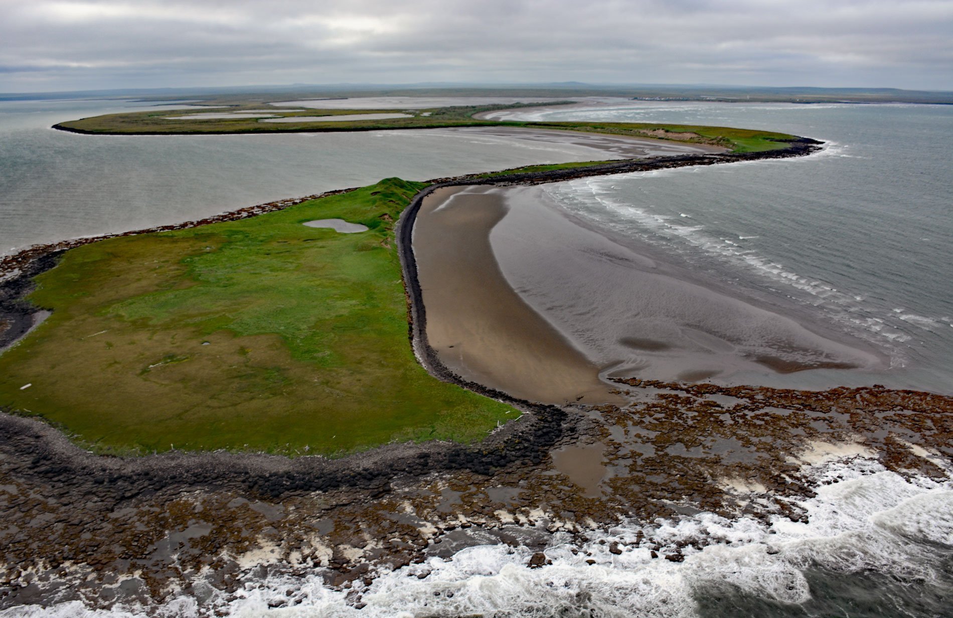
Cape Etolin is a point of land extending about 4.6 miles (7.4 km) north into the Bering Sea on the northern coast of Nunivak Island, about 50 miles (80 km) west of Nightmute on the mainland and 4 miles (6 km) north-northeast of Mekoryuk, Alaska. The cape was named ‘Mys Etolina’ on early Russian charts for Captain Adolph K. Etolin who explored this area in 1822 and was governor of the Russian American colonies from 1841-45. The point is formed by volcanic rocks and most of Nunivak Island is dominated by thin pāhoehoe lava flows that form a carapace over Cretaceous sedimentary rocks forming a plateau rising to an elevation of 500 ft (160 m) with four maars and about 60 cinder cones. The widespread lava flows originate from small shield volcanoes that cover much of the island, the highest being Roberts Mountain with an elevation of 1,675 feet (510 m). Two of the maars have about 656 feet (200 m) of relief, with floors near sea level. Eruptions occurred during five broad periods of activity that began 6.1 million years ago and continued until about 150,000 years ago. The bulk of the volcanic field was formed during two Pleistocene eruptive periods that ended about 300,000 years ago. The most recent eruptions produced a series of alkalic basalt lava flows and ash deposits from cinder cones and maars along an east-west zone in the southern part of the island.
Nunivak Island is 60 miles (97 km) wide and 49 miles longitudinally and separated by Etolin Strait with a distance of 18 miles (29 km) from the Yukon-Kuskokwim Delta. The island was discovered on July 21, 1821, by Captain Mikhail N. Vasilyev of the Imperial Russian Navy and was named after his ship Otkritie meaning ‘Discovery’ and this was recorded on early Russian maps. Adolf K. Etolin and Vasiliy S. Khromchenko of the Russian-American Company found the island at about the same time. Etolin was a Swedish-speaking Finn, born in Helsinki in Swedish Finland, and became a naval officer, explorer, and administrator in the Russian Empire. Etolin traveled from Russia to America for the Russian American Company with Vasily Golovnin on the Kamchatka in 1817 and served from 1818 to 1825 as a shipmaster. He was part of a group that surveyed the Bering Sea in 1822 to 1824, and then became the adjutant for the Chief Manager or ‘Governor’ of Russian America in 1834, and became Chief Manager himself from 1840 to 1845. From 1847 to 1859, he was a member of the board of the Russian-American Company in Saint Petersburg, Russia.
Wild caribou inhabited Nunivak Island from prehistorical times until the late 1800s. Caribou populations were once estimated to be 25,000 animals; however, by 1904 the population had crashed and was extirpated due to starvation in severe winters and overhunting. In the early part of the 20th century, Nunivak Island was considered open range and in 1920, reindeer were first introduced to the island by the Lomen Company, an American meatpacker founded in 1914 by brothers Alfred and Carl J. Lomen. From 1920–1929, the Lomen Brothers invested in the purchase of more reindeer herds, and the crossbreeding of caribou and reindeer, and they built several slaughterhouses and processing facilities in Alaska including Cape Etolin. The company dominated the export market of reindeer meat and skins for the United States. In 1929, with the stock market crash and the beginning of the Great Depression, the market for reindeer meat began to decline. They also began to have trouble with cattle producers who lobbied Congress to impose barriers to the promotion and sale of reindeer meat. In 1929, Nunivak Island Reservation was established by executive order for the purpose of conducting experiments on hybridizing reindeer and caribou, as well as propagating musk oxen for introductions elsewhere in Alaska. In 1940, Congress changed the name to Nunivak Island National Wildlife Refuge. In 1980, it was incorporated within the comprehensive boundaries of the newly created Yukon Delta National Wildlife Refuge. Read more here and here. Explore more of Cape Etolin and Nunivak Island here:

