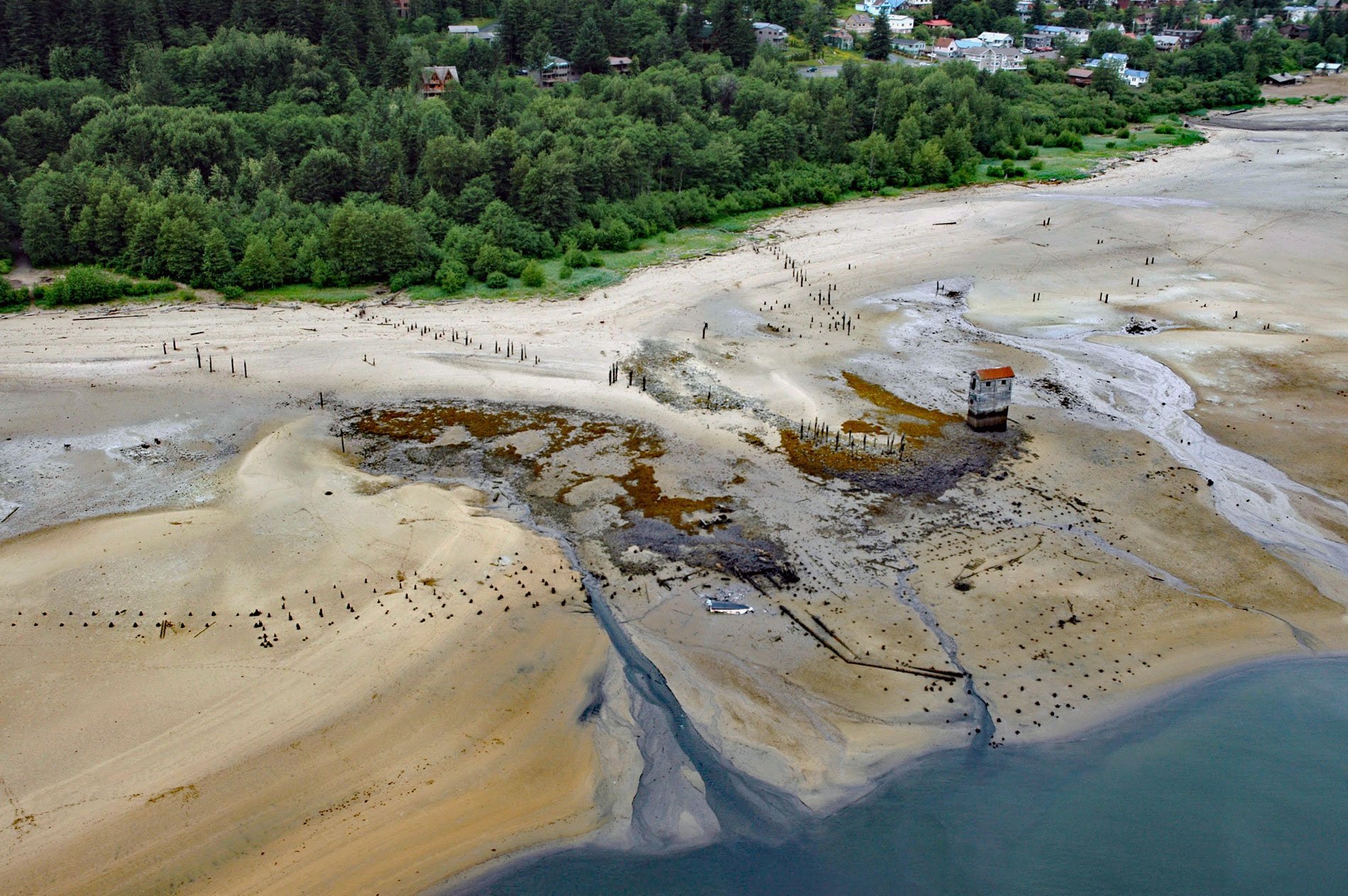
Treadwell is a historical gold mine on the eastern coast of Douglas Island on Gastineau Channel, about 1.2 miles (1.9 km) southeast of the community of Douglas and 3 miles (4.8 km) southeast of Juneau, Alaska. It was named after John Treadwell who discovered the gold ore and developed the mining operation. The geology of Douglas Island adjacent to Gastineau Channel consists of a belt of slate intruded by many diorite dikes. These dikes constitute the ore bodies of the Treadwell group of mines. The ore is principally pyrite and secondary low-grade gold-bearing sulfide minerals.
In 1880, prospectors Joe Juneau and Richard Harris first discovered gold in Silver Bow Basin while being guided by the Tlingit ‘Chief’ Kowee. Treadwell arrived in 1881 and mined in the Gold Creek area of Silver Bow Basin, which quickly developed into the community of Juneau. In 1882, Treadwell established the Treadwell Mining Company and started operating the Treadwell gold mine on Douglas Island. The company developed a large-scale operation to profitably extract low-grade gold ore. In 1889, Treadwell sold his interests to the Alaska Gold Mining Company for $1.5 million and returned to California. The Treadwell Mine operated from 1882 to 1922 and extracted over 3 million troy ounces of gold. The Treadwell glory hole was an open pit that is now partly filled with water. A massive cave-in occurred in 1917 resulting in the closing of three of the four Treadwell mines. The fourth mine ceased operation in 1922.
A pump house is one of the few remaining structures of the gold mine and was constructed in 1914 on Gastineau Channel at the end of a pier 600 feet (183 m) long that served steamships, freighters, and ferries. The building contained three centrifugal pumps capable of lifting 2,700 gallons (10,220 l) of water per minute and used to flush mill tailings back to the shoreline. The flushed tailings accumulated at the shoreline and there is now an artificial sand beach of about 80 acres (32 ha) and 2 miles (3.2 km) long consisting mostly of mine tailings from the Treadwell. Read more here and here. Explore more of Treadwell here:

