Twin Hills is a Yup’ik village situated on the left bank of the Togiak River at the head of Togiak Bay, about 130 miles (210 km) southeast of Bethel and 64 miles (103 km) west of Dillingham, Alaska. In 1880, Ivan Petrof recorded two villages about 7 miles (11 km) apart at the head of Togiak Bay at the mouth of the Togiak River, Togiagamute on the eastern shore, and Togiak Station on the western shore. Togiak Station was the site of an important trading post operated by a local trader and prospector named Johnny Owens. Togiagamute was abandoned when most of the residents moved to Togiak Station, but the village site is now the location of Togiak Fisheries operated by North Pacific Seafoods. Togiak Bay is known for extremely high tidal surges created by intensive storms in the Bering Sea. These tidal surges can flood the low-lying wetlands in Togiak Bay with up to 12 feet (3.6 m) of water. In 1965, the village of Twin Hills was established by families who moved from the community of Togiak to avoid recurring floods.
Togiak River drains a watershed of 1,279,512 acres (517,800 ha) and flows 93 km generally south-southwest through the Togiak National Wildlife Refuge to Bristol Bay. The watershed is bounded by the Wood River Mountains to the east and the Ahklun Mountains to the west and consists of several major tributaries including Gechiak, Pungokepuk, Nayorurun, Kemuk, and Ongivinuk Rivers, and nine lakes within the refuge wilderness boundary. The watershed provides spawning habitat for Chinook salmon which supports a wide variety of sport, commercial, and subsistence fisheries and are considered an important cultural resource for the Yup’ik people. However, Chinook salmon abundance has been below average and steadily declining across Alaska since 2007, which has resulted in management restrictions on harvest across all fishing groups to protect river escapements.
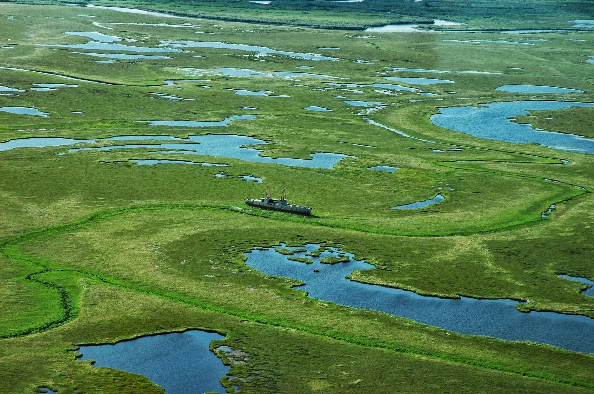
In the 1980s, a severe storm accompanied by high winds flooded the coastal wetlands at the mouth of the Togiak River and drove a World War II-era Navy ship far up into the floodplain. When the waters receded the ship became grounded in the Togiak National Wildlife Refuge and was abandoned. The ship was originally built for the U.S. Navy in 1945 by Commercial Iron Works in Portland, Oregon as LSSL-108 and used in the Pacific theater to support amphibious landings. The vessel has a flat bottom and skegs on either side of twin propellers that allowed the ships to safely beach. At the end of the war, surviving ships returned to the United States and some were restored to action for the Korean War. In 1952, LSSL-108 was transferred to the Republic of Korea Navy and renamed Kang Hwa Man. In the 1970s, the ship was purchased and brought to Seattle, converted to a fishing vessel named Gull, and then bought by Togiak Fisheries and used as a freezer ship. Read more here and here. Explore more of Twin Hills and Togiak Bay here:

