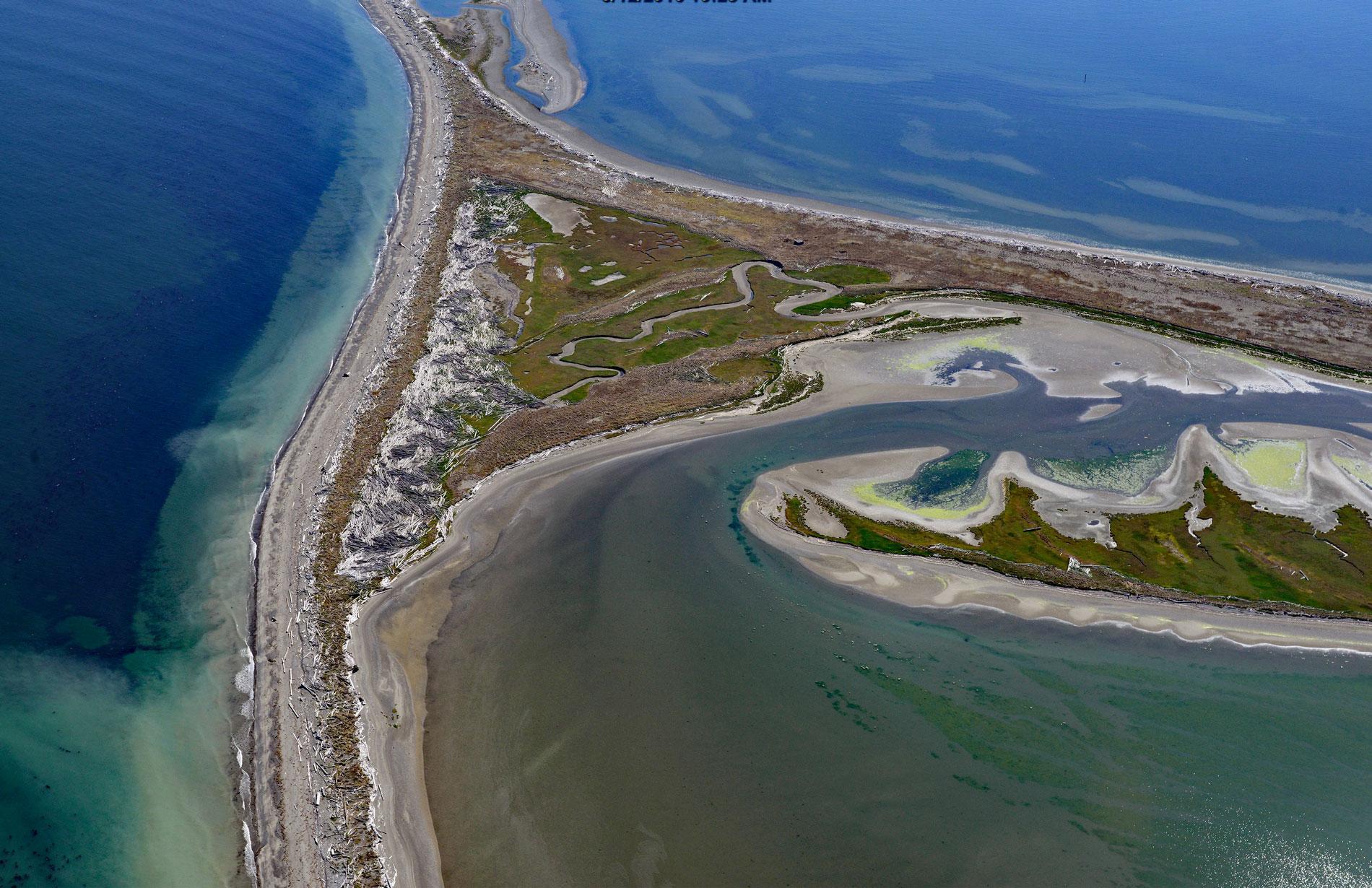
Dungeness Bay is formed by a complex of depositional features that partially enclose the embayment including Dungeness Spit, Graveyard Spit, Cline Spit, and the Dungeness River delta located on the southern shore of the Strait of Juan de Fuca and the northern coast of the Olympic Peninsula, about 19 miles (31 km) west-northwest of Port Townsend and 14 miles (23 km) east-northeast of Port Angeles, Washington. Dungeness Spit was first recorded by Europeans during the Spanish expedition of 1790 led by Manuel Quimper on the Princesa Real. British explorer Captain George Vancouver named the landform in 1792, after the Dungeness headland in England. The spits are principally formed by the predominant west-to-east wave direction through the Strait of Juan de Fuca, amplifying the tidal currents which are strongest on the flood, that transport the sediment eroded from the glacial bluffs along the Olympic Peninsula coast towards the east. Dungeness Bay is mostly mud in the central areas and near the Dungeness River delta, sand along the outer perimeter of Dungeness Spit, and gravel in the scoured tidal channels. The fine sediments creating the mud bottom are derived from the Dungeness River. The river starts at an elevation of 6,400 feet on the north flank of the Olympic Mountains and flows generally north for 32 miles (52 km) to Dungeness Bay draining a watershed of 172,000 acres (69,606 ha).
A projectile point embedded in a mastodon bone was found in 1977 in the Dungeness River watershed and provides evidence that humans have inhabited the area for at least 13,000 years. In 1790, when Quimper explored the area, there were 13 permanent villages along the shores and bays of the Strait of Juan de Fuca, plus numerous seasonal camps used for fishing, hunting, and gathering. The Dungeness River watershed is historically part of the traditional territory of the Klallam people, and prior to Euro-American settlement, the population was between 400 and 1200. In 1855, the Point No Point Treaty was intended to settle land claims with several tribes, including the local band of Klallams, and to relocate them to a reservation on Hood Canal but many tribal families refused to give up their traditional homeland. In 1874, the Dungeness band of Klallams purchased 200 acres (81 ha) of land along Dungeness Bay to avoid moving to a reservation. They named their community Jamestown after their leader who was known as Lord James Balch and officially became the Jamestown S’Klallam Tribe. Euro-Americans moved to the Dungeness valley and rapidly exerted major changes in the watershed including the removal of ancient forests, the construction of an irrigation system, bridges, dikes, and the draining of tidal areas near the Dungeness River mouth to create farmland. Fish hatchery practices from 1902 to the 1960s altered the genetic composition and spatial distribution of Dungeness salmon. While portions of the upper watershed are protected within Olympic National Park, other areas of federal and state forest land are managed for extensive timber harvest, and the lower elevations are used for farming and residential developments. In 1915, Dungeness Spit and portions of Dungeness Bay were designated as a National Wildlife Refuge by President Woodrow Wilson.
The Dungeness National Wildlife Refuge comprises 773 acres (313 ha) and protects the habitat for more than 250 species of birds and 41 species of land mammals. In 2009, the cumulative coverage of eelgrass in Dungeness Bay was 363 acres (147 ha), and represents an important fish habitat for Chinook, coho, pink salmon, and chum salmon. Harbor seals haul out to rest and give birth to pups on Dungeness Spit, and the tide flats within the bay support crabs, clams, and other shellfish. The Washington State Department of Natural Resources leases subtidal lands to private businesses and this has been an important area historically for oyster farming since before 1953. The Jamestown S’Klallam Tribe purchased an oyster farm in 1990 and operated it for a few years before it was decertified due to contamination in the bay. They led a local effort to understand the contamination sources, some of which included failing septic systems near tributaries to the bay, or along the shoreline. A conservation plan was developed that included manure management, alternative livestock watering and pasture management, and a reduction in bacterial contamination from nearby commercial and hobby farms. By 2015, after decades of clean water management, there were signs of success and the entire inner bay had conditional approval for commercial oyster harvests. The Jamestown S’Klallam Tribe sought to re-establish their oyster farm, and in 2021, they obtained all the required permits. Read more here and here. Explore more of Dungeness Bay and the Strait of Juan de Fuca here:

