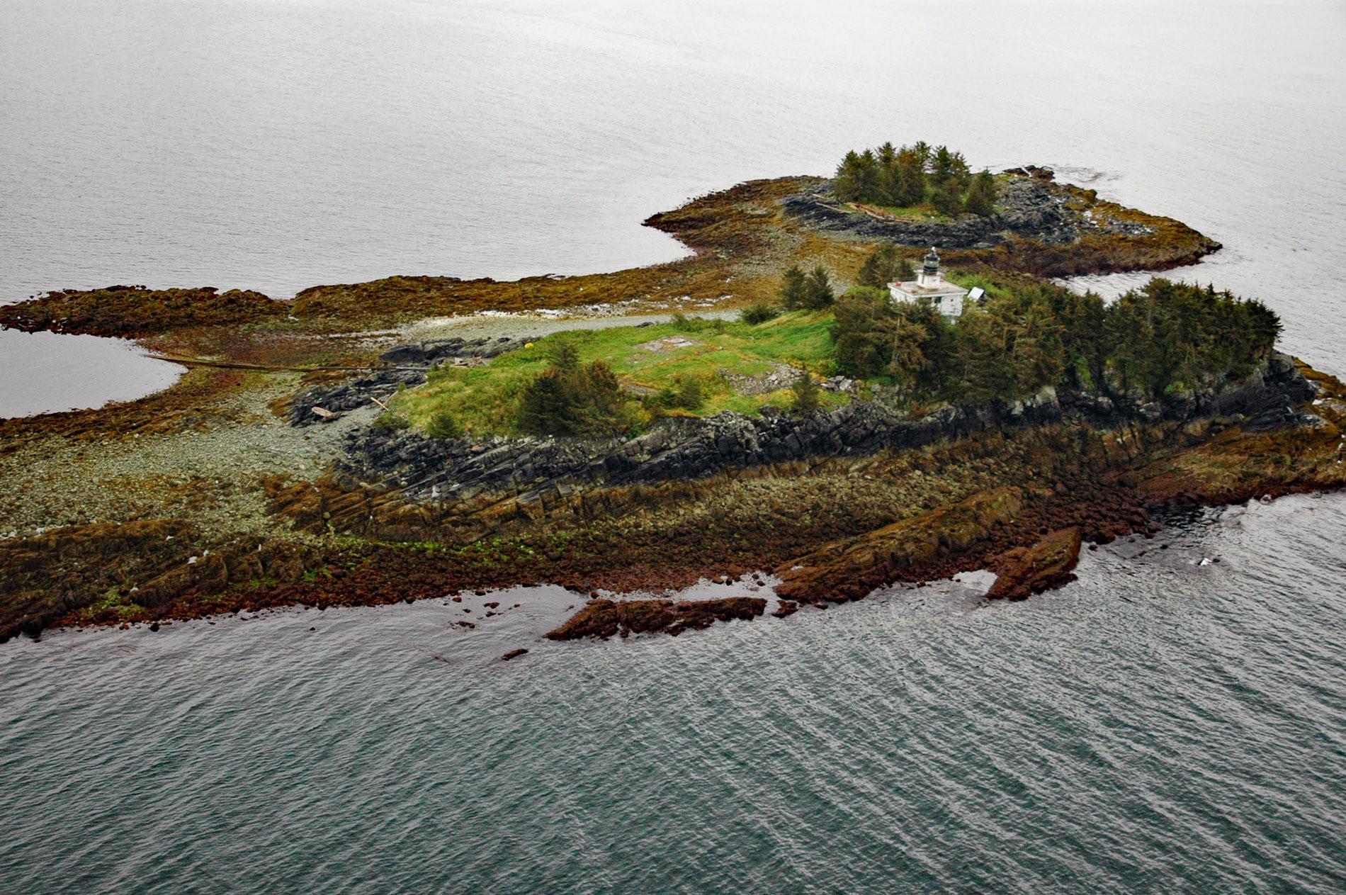
Guard Islands are separated from Vallenar Point at the northern tip of Gravina Island by Inside Passage, a channel that connects the northern entrance of Tongass Narrows to the east from Clarence Strait to the west, and are part of an island chain that includes Vallenar Rocks, about 73 miles (118 km) south-southeast of Wrangell and 10 miles (16 km) northwest of Ketchikan, Alaska. Gravina Island is 21 miles (34 km) long and about 9.5 miles (15.3 km) wide, and forms the western shoreline of Tongass Narrows opposite the city of Ketchikan on Revillagigedo Island. The Ketchikan International Airport is located on the island and is reached by ferry service. The name Vallenar was given to the north point of the island, as well as an islet and chain of rocks, by Captain George Vancouver in 1793, after his friend Ambrosio O’Higgins de Vallenar. O’Higgins was originally from Ballynary, Ireland, and of the noble O’Higgins family, and subsequently became a naturalized citizen of Chile and a national hero. He served the Spanish Empire as the military governor of Chile and Viceroy of Peru. Guard Islands were named by local navigators and in 1880 appeared on charts by the U.S. Coast and Geodetic Survey. The northern end of Gravina Island, Vallenar Point and the chain of rocks and islets extending from the point, and the Guard Islands are all formed by the Gravina Island Formation, which is composed of erosion-resistant andesitic to basaltic metavolcanic rocks.
Indigenous Peoples of Southeast Alaska are represented by the Tlingit, the Kaigani Haida of southern Prince of Wales Island, the Tsetsuat of the mainland between Behm and Portland Canals, and the Tsimshian on Annette Island. The Tlingit are the most widespread and numerous within the region. Their culture included an economy based mostly on salmon and is characterized by settled villages with a social organization structured around matrilineal clans, shamanism, and the attainment of status through potlatching. Village sites were preferably located on sheltered bays with views of the approaches and with a sandy beach for landing canoes, access to salmon streams, fresh water, timber, and hunting, fishing, and gathering grounds. Aboriginal houses were planked rectangular structures, with excavated centers and low-pitched gabled roofs. They could accommodate six or more families with slaves, often totaling 40 to 50 individuals. At the time of contact with Euro-American explorers and maritime fur traders, Gravina Island was within the territory of the Tongass Tlingit, and the Tongass Wolf clan had a smokehouse at the head of Vallenar Bay, on the western shore of Gravina Island and adjacent to Vallenar Point. This camp was connected by a portage trail to Bostwick Inlet at the southern end of the island where there was a large summer village used for drying fish and meat and gathering berries. In 1793, Captain George Vancouver sailed along the western shore of Gravina Island. In 1884, a fish saltery was built on Ketchikan Creek, and in 1889, the Ketchikan Cannery was built and a trading post operated at the mouth of the creek. By 1890, Ketchikan was a supply center for the Klondike Gold Rush and the resulting influx of settlers and gold miners dramatically increased the population. For years the Tongass Tlingit, Russian traders, fishermen, and miners plied the waters near Ketchikan, and countless lost vessels attested to the dangers of the shallow inlets, reefs, and dense fog.
After the Alaska Purchase transferred the territory from Russia to the United States in 1867, the Senate requested a review of the northwestern coasts to determine suitable spots for lighthouses, but it wasn’t until the Klondike Gold Rush of 1896 that private citizens and traders clamored loudly enough for the Lighthouse Board to build light stations. In 1901, President William McKinley signed an executive order that established the Guard Islands lighthouse reservation. In 1903, construction of the Guard Island Lighthouse was authorized, and the following winter, work commenced on the island with a force of men clearing and grading a site for the lighthouse. In 1904, the light was illuminated on a square pyramidal wooden tower that stood nearly 40 feet tall with a fog bell suspended from a beam on the north face of the tower. A two-story dwelling was built for the light keepers, a boathouse, and an oil storage house. The wood used for the original Guard Island Light Station soon deteriorated in the harsh weather conditions and in 1922, Congress authorized the reconstruction of a new structure. In 1924, the dilapidated light tower was replaced with a single-story rectangular tower made of reinforced concrete. The station was automated by the Coast Guard in 1969. Read more here and here. Explore more of Guard Island and Tongass Narrows here:

