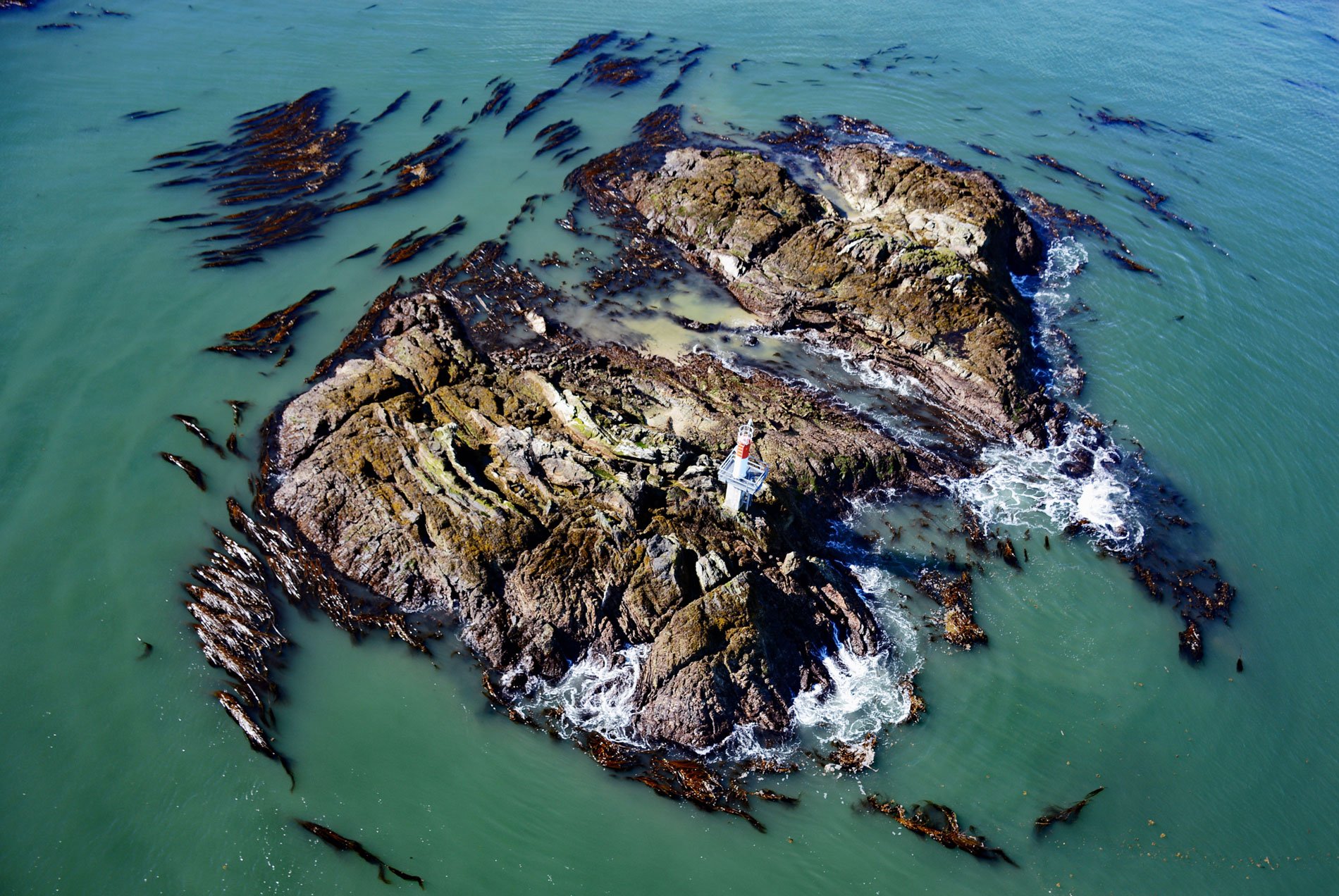
Lawyer Islands are located in Malacca Passage, part of the Canadian Inside Passage between Porcher Island to the south and the Tsimpsean Peninsula to the north and just off the mouth of the Skeena River, about 102 miles (165 km) southeast of Ketchikan and 13 miles (20 km) south of Prince Rupert, British Columbia. The name for the island group reputedly comes from local lore about British Royal Navy officers who noted that two prominent rocks near the islands were Client Rock and Bribery Rock and decided that an appropriate name for the islands should be Lawyer Islands. Malacca Passage was named by Captain Daniel Pender on the Beaver in 1867 for HMS Malacca under the command of Captain Radulphus B. Oldfield that served at the Pacific Station from 1866 to 1868. The rocky islands are formed by volcanic and sedimentary rocks of the Alexander terrane that developed during the Triassic period. The rocks comprise partially metamorphosed siltstone, mudstone, and shale.
The islands of Malacca Passage are within the traditional territory of the Coast Tsimshian people. There were several winter villages on the lower Skeena River and in prehistoric times they extended their territory towards the coast where the weather was milder. There is evidence near Prince Rupert of about 5,000 years of occupation. Their lifestyle was governed by the seasonal availability of food. At the end of winter, before the river ice breaks up, the main activity was eulachon fishing. The fish were either dried or processed for the highly valued oil or ‘grease’, and the Tsimshian had a monopoly on the grease trade which brought them wealth. In late May, the Coast Tsimshian gathered and dry seaweed at places along the coast such as Lawyer Islands, often residing for a month or more at special seaweed camps. They also fished for halibut which was sliced into thin filets for drying on racks in the sun. Large quantities of herring spawn were also gathered at this time, either from thick deposits on grass and kelp or on branches suspended in the water for the purpose. The eggs of seagulls and oystercatchers were gathered in early June, and abalone was taken at the lowest tides during the summer months. The first salmon of the year began to enter the tidal waters during the seaweed season, at which time they were caught by trolling. As the salmon entered the rivers in early summer, the Tsimshian people moved to traditional fishing sites where seasonal camps were maintained. The sites for fishing were under the hereditary control of matrilineal clans or ‘houses’ managed by chiefs. In the late summer and autumn, berries were harvested from house territories, and hunting began for terrestrial and marine animals.
Lawyer Islands were set aside for lighthouse purposes by the dominion government in 1899, but it wasn’t until July 1901 that the steamer Quadra offloaded construction materials on the largest and northernmost of the islands. A work crew labored on the island for several months, and when the Quadra returned in November, the ship’s first engineer installed the lantern. The lighthouse stood on the western side of the island on a site 10 feet (3 m) above the high tide water mark. It consisted of a square wooden tower, rising from the western corner of a square wooden dwelling, surmounted by a polygonal iron lantern. The tower was 48 feet (15 m) high and the whole building was painted white with the roof and lantern red. In 1909, work began on a new tower, situated on the highest point of the island, 500 feet (152 m) north of the original lighthouse because mariners were not happy with the visibility of the original lighthouse. The new octagonal tower stood 66 feet (20 m) tall and was capped by the lantern room and lens taken from the old lighthouse, and the new light could be seen for 17 miles (27 km). This lighthouse was operational until sometime between 2006 and 2011 when a cylindrical white tower replaced it with a red band near the top and a flashing white light on an unnamed rock north of Lawyer Island. A covering of dense trees now hides any evidence of the historic lighthouses and dwellings. Read more here and here. Explore more of Lawyer Islands and Malacca Passage here:

