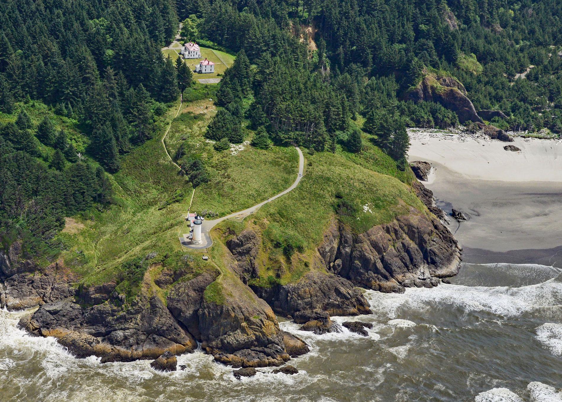
North Head is a rocky promontory with a summit elevation of 300 feet (91 m) and the site of a historic lighthouse situated on Cape Disappointment at the mouth of the Columbia River between Baker Bay to the east and the Pacific Ocean to the west, about 14 miles (23 km) northwest of Astoria and 2 miles (3.2 km) southwest of Ilwaco, Washington. Cape Disappointment was named in 1788 by British fur trader Captain John Meares who entered the river mouth seeking shelter but turn around when the ship’s lookout spotted breaking waves across the entire entrance. The cape lies along the western edge of the Willapa Hills and Oregon Coast Range and consists of a forearc basin that developed between the Paleocene and Eocene. It is part of the larger grouping known as the Pacific Coast Ranges that extends over much of the western edge of North America from California to Alaska. The central part of the cape is composed of siltstone from the late to middle Eocene and the North Head portion of the cape represents the Crescent Formation that consists of erosion resistant basalt.
The Cape Disappointment area, including the shores of the Columbia River and Shoalwater Bay, which is now called Willapa Bay, was historically inhabited by the Chinookan peoples. The Cape Disappointment Chinooks were encountered by Captain Robert Gray in 1792 on the ship Columbia Rediviva, and by Captain George Vancouver on the HMS Discovery later the same year. In 1838, USS Peacock joined the United States Exploring Expedition but in 1841 the vessel struck the bar at the mouth of the Columbia River and sank. The sand peninsula extending south from North Head to the north jetty is now called Peacock Spit. In 1849, Dr. Elijah White staked a Donation Land Claim on Baker Bay and started a settlement called Pacific City. He was soon joined by John Holman who built a prefabricated hotel that was shipped from New York. In 1852, President Millard Fillmore authorized a military reservation of 640 acres (259 ha) called Fort Canby at the site of Pacific City, and some of the original settlers were able to move their land claim farther east to a site inhabited by the family of Elowahka Jim who was the son-in-law of hereditary Chinook Chief Comcomly. Elowahka Jim, or Ilwaco, had many slaves and the new settlers hired them to build homes. The new settlement was initially called Unity in celebration of the conclusion of the American Civil War, but the town plat, filed in 1876, used the name Ilwaco.
The lighthouse at North Head was built in 1897 because mariners approaching the Columbia River from the north could not see the Cape Disappointment light until they had nearly reached the river mouth. This need was supported by the many shipwrecks that occurred along the Long Beach Peninsula, just north of the Columbia River. The North Head Light was designed by Carl W. Leick and consists of brick masonry tower built atop a sandstone foundation and finished with a cement plaster overlay. Sixty-nine steps lead to the lantern room, which is 65 feet (20 m) from the ground and 194 feet (59 m) above sea level. The Louis Sautter & Company first-order Fresnel lens was transferred from the Cape Disappointment lighthouse. It was lit for the first time on May 16, 1898 and can be seen for 19 miles (30 km). The facility is now the most intact light station on the Pacific Northwest coast. All the original buildings remain standing, including the tower, two oil houses, two residences, a barn, a chicken coop, and garages. In 2012, the Coast Guard turned over ownership of the light station to Washington State Parks. Repair and restoration efforts are being undertaken by the state and an independent preservation group called the Keepers of the North Head Lighthouse which is an arm of the non-profit Friends of the Columbia River Gateway. Read more here and here. Explore more of North Head and Ilwaco here:

