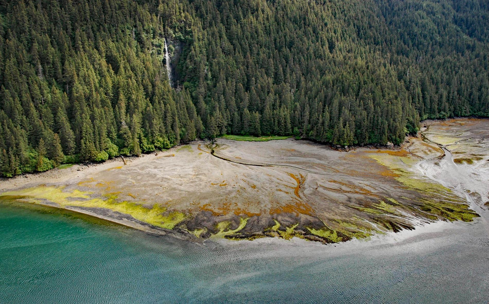
Tutka Bay is a deglaciated fjord that extends 8.5 miles (14 km) in Kachemak Bay State Park from Eldred Passage to the mouth of an unnamed river that flows generally west-northwest for 7 miles (11 km) from small remnants of the Southern Glacier, about 18 miles (29 km) southeast of Homer and 15 miles (24 km) east of Seldovia, Alaska. An intermittent waterfall cascades about 150 feet (46 m) at the head of the bay on the northern shore, mostly fed by a small watershed draining several snowfields in the Kenai Mountains. Tutka Bay was named by William H. Dall, a cartographer, geologist, and general scientist who visited Kachemak Bay in 1880 for the U.S. Coast and Geodetic Survey, in 1895 for the U.S. Geological Survey, and again in 1899 on the Harriman Expedition. The name is reputedly from the Dena’ina Athabascan word meaning ‘big enclosed water’. In 1891, about 4 miles of Tutka Bay was filled with ice of the Southern Glacier extended from elevations of 3,400 feet (1,036 m) in the Kenai Mountains to sea level in Kachemak Bay and to Port Dick in the Gulf of Alaska but has since all but disappeared.
The southern Kenai Mountains are underlain by rocks representing the McHugh Complex that consists of greywacke and volcanic greenstones that developed during the Late Jurassic to Early Cretaceous as ocean trench turbidites and mélange sequences and were subsequently thrust up as an accretionary wedge. Tectonic activity since the Wisconsin period has resulted in as much as 330 feet (100 m) of subsidence. The present-day topography was mostly shaped during the Last Glacial Maximum when the entire area was covered by an ice sheet, which started retreating about 9,000 years ago leaving remnant icefields at elevations from 3,000 feet (900 m) to 5,900 feet (1800 m). The remaining ice persists mostly due to an estimated precipitation of 10 feet (3 m) to 33 feet (10 m) per year which is intercepted from moisture-laden Pacific air masses that move westward from the Gulf of Alaska. The archaeological record suggests that humans have lived along the outer Kenai Peninsula coast for at least 7,500 years and occupied Kachemak Bay as early as 8,000 years ago. About 1,000 years ago, Dena’ina Athabascan people migrated into Cook Inlet and Kachemak Bay from the mountains to the west and north of the Kenai Peninsula. In the late 1800s, Chugach Sugpiaq people moved from the outer coast and Prince William Sound to Kachemak Bay, and their descendants still live in Seldovia, Nanwalek, and Port Graham.
The State of Alaska Legislature in 1970 approved 105,387 acres (42,649 ha) of state lands to be designated as Kachemak Bay State Park and two years later, the Legislature added nearly 200,000 acres (80,937 ha) of remote and rugged land and waters adjacent to the state park as a wilderness area called Kachemak Bay State Wilderness Park. In 1974, the Legislature established the Kachemak Bay Critical Habitat Area, that partially overlaps with the state park, with the purpose of protecting and preserving habitat crucial to the perpetuation of fish and wildlife. Located within the boundaries of the state park and the wilderness area are 201 privately owned parcels totaling approximately 845 acres (342 ha) of land. Another 7 parcels totaling 189 acres (77 ha) are owned by the University of Alaska, Bureau of Indian Affairs, Seldovia Native Association, and Bureau of Land Management. The park is mostly wild land, although a few cabins and semi developed campgrounds exist, there is no road access and visitors normally fly in or travel by boat from Homer. Read more here and here. Explore more of Tutka Bay and Kachemak Bay State Park here:

