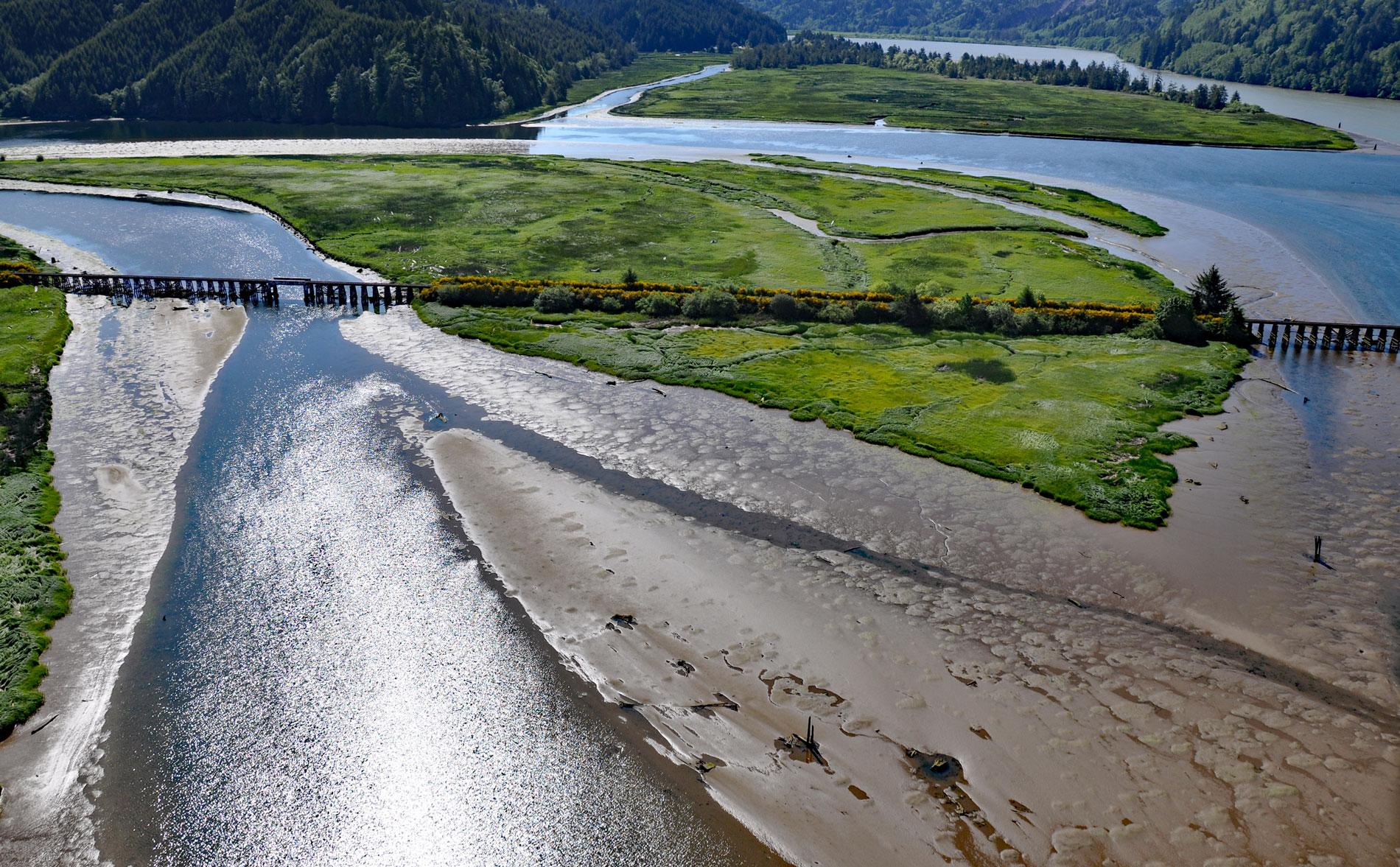
Blacks Island is situated at the confluence of the Smith River and the Umpqua River, on the historic spur line of the Southern Pacific Railroad connecting Eugene with Coos Bay, about 1.7 miles (2.7 km) southeast of Gardiner and 1 mile (1.6 km) northeast of Reedsport, Oregon. The Smith River drains a watershed of 225,280 acres (91,168 ha) and flows 90 miles (140 km) generally west from the Central Oregon Coast Range between the Umpqua River to the south and the Siuslaw River to the north. These watersheds are formed by rocks representing the Flournoy Formation that developed during the middle Eocene and is composed of siltstone mantled by sandy loam and silty loam soils that locally are very thin. Blacks Island is reputedly named after Arthur Black who was with a group of explorers accompanying Jedediah S. Smith in 1828. The island consists of unconsolidated organic soils of clay, silt, and sand covered by peat and marsh vegetation that is frequently inundated by stream and estuarine flooding. The islands in the Umpqua estuary provided ideal sites for fish camps and there is archaeological evidence of human occupation dating to at least 8,000 years before the arrival of Euro-American settlers.
The mouth of Smith River and the lower Umpqua are the traditional lands of the Siuslaw and Kuitsh people, who are often called Lower Umpqua or Kalawatset. The Kuitsh had their winter villages around Winchester Bay and at the mouth of the Umpqua River. In 1828, Jedediah Smith led a party of explorers on an expedition to find new fur trading opportunities. The party numbered 18 men and nearly 300 horses and they departed Mexican Alta California and entered the Oregon Country in the summer where they contacted the Umpqua people. An ax was stolen and several members of the party forced the thief to return it. The following day, the group was camped at the mouth of the Smith River when hostile Umpquas attacked, killing 14 of the men and only 4 escaped. Arthur Black was cleaning his gun and darted into the woods, John Turner was cooking and fought his way through the attackers with a fire brand, Smith and Richard Leyland were around the bend of the river in a canoe seeking a route for the day’s march. These four made their way separately to Fort Vancouver on the Columbia River. This event essentially stopped further incursions by Euro-American pioneers until 1850 when the schooner Bostonian owned by a Massachusetts merchant named Gardiner was sent to the Pacific coast to trade. The ship wrecked while crossing the Umpqua River bar but most of the cargo was salvaged. The crew established a town 8 miles (13 km) upriver known as Gardiner City. In 1856, Fort Umpqua was established nearby with a blockhouse and barracks but was abandoned in 1862. From 1885 to 1916, the Gardiner Mill Company operated several logging camps and a thriving lumber export trade with several docks on the river. From 1963 to 1999, International Paper had a mill in Gardiner and was one of the largest employers on the southern Oregon Coast.
Industrial development has caused many changes to the Umpqua River estuary. Many former tidal wetlands have been filled or excavated to develop port facilities, mills, marinas, and residential sites. By contrast, the Smith River watershed is primarily agricultural and contains few filled areas, however, most historic tidal wetlands are now diked pastures. In recent years, some of the diked lands have been restored through deliberate breaching or removal of dikes, and others are reverting to tidal influence through natural breakdown of dikes, but most of the diked lands remain. Despite the levees, the estuary still has all the major tidal wetland types in Oregon including mud flats, eelgrass and algal beds, emergent marsh, scrub-shrub wetlands, and forested wetlands. The river is also an important fish habitat with spawning runs of Chinook, coho, and steelhead. The juveniles of these salmonids use the estuary’s tidal wetlands to forage and to acclimate to ocean salinities before ocean entry. The estuary is also an important area for wetland dependent species such as breeding bald eagles, waterfowl such as dabbling ducks and diving ducks. This area is one of only two important wintering areas for tundra swans in Oregon. Read more here and here. Explore more of Blacks Island and Smith River here:

