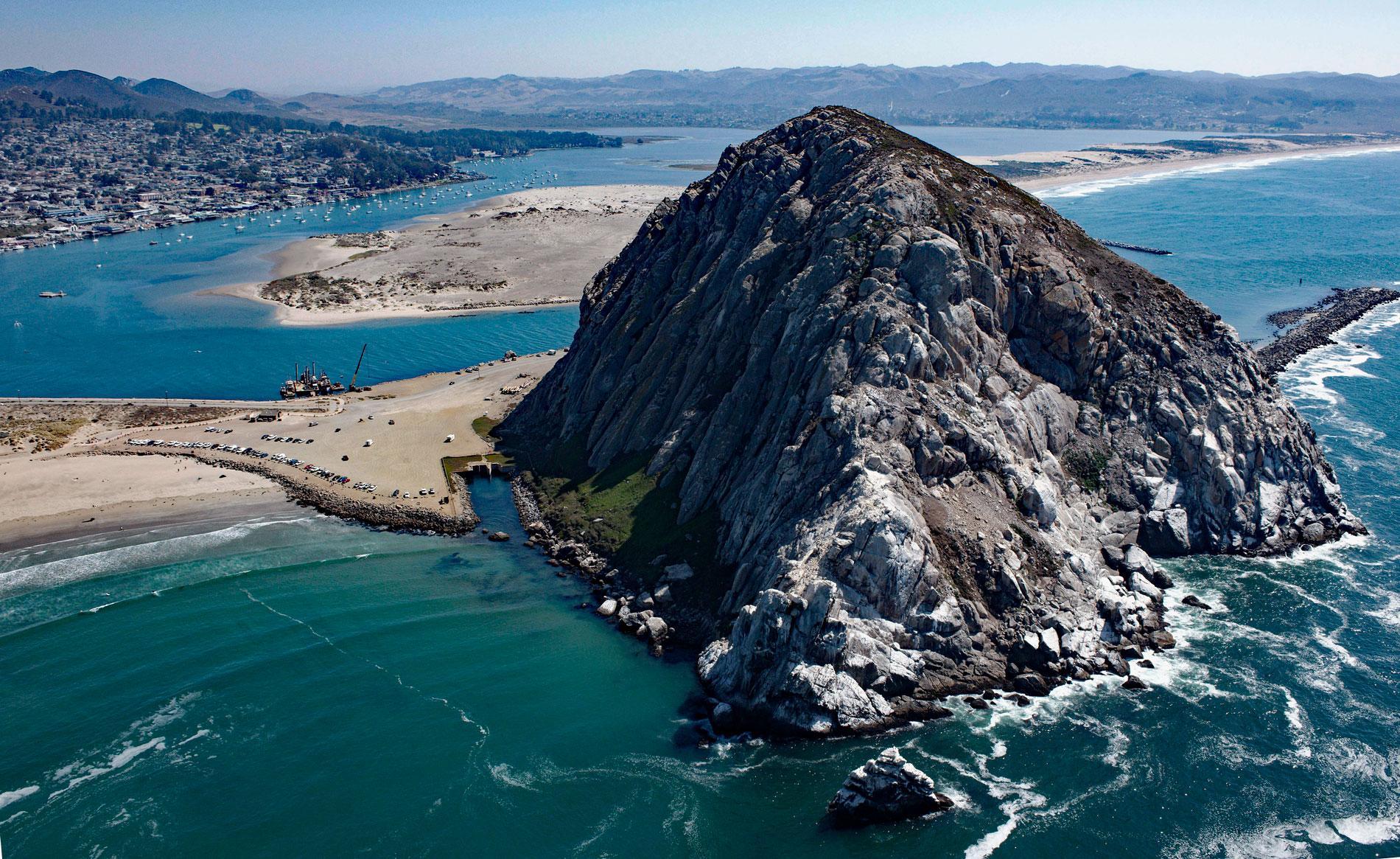
Morro Rock is a volcanic plug with an elevation of 576 feet (176 m), connected to the mainland by a causeway that forms the entrance channel to Morro Bay, about 102 miles (164 km) southeast of Monterey and 21 miles (34 km) northwest of Pismo Beach, California. Morro Bay is an estuary formed by a massive sand spit that extends north for almost 7 miles (11 km) from the mouth of Islay Creek and separates the estuary from Estero Bay, a bight between Point Estero to the north and Point Buchon to the south. Morro Rock was named in 1769 by Juan Crespí, a Franciscan missionary and member of the Portolá expedition that traveled overland down Los Osos Valley and camped near the estuary. Morro Rock is one of many volcanic hills in the area that developed during the Eocene to Oligocene, or about 34 million years ago, as igneous intrusions in bedrock representing the Franciscan Assemblage. The magma solidified as porphyritic dacite and the surrounding rock eroded away.
Morro Bay is the traditional territory of the Obispeño Chumash people whose ancestors had a settlement called Chotcagua situated at the mouth of Morro Creek. The archaeological record suggests that the site was used between 8,500 and 3,500 BC and became a more continuous settlement between 3,500 and 1,000 BC. A midden at the site has been excavated and yielded many human burials, stone tools, flaked weapons, and diverse animal remains. In 1772, Father Junípero Serra established Mission San Luis Obispo about 12 miles (19 km) southeast of Morro Bay. The site was chosen for its proximity to food and natural resources, good weather, and the existing population of Chumash people that moved from nearby settlements to the mission and became baptized and incorporated into the labor pool. In 1821, Mexico achieved independence from Spain, but the missions maintained authority over Indigenous Peoples and land holdings until 1833 when the First Mexican Republic secularized the mission lands and emancipated the Chumash and other Indigenous Peoples. Mission lands were largely given to settlers and soldiers. In 1840, a Mexican land grant of 4,379 acres (1,772 ha) called Rancho San Bernardo was given by Governor Juan B. Alvarado to Vicente Canet. The grant extended east from the mouth of Morro Bay to San Bernardo Creek. To the north lay another land grant called Rancho Moro y Cayucos and to the south Rancho San Luisito and Rancho Cañada de los Osos y Pecho y Islay. In 1870, Franklin Riley founded the town of Morro Bay, originally called El Morro, by subdividing 160 acres (65 ha) along the waterfront into town lots and building a wharf for coastal steamers that ran regularly between Morro Bay and San Francisco.
Historically, there were channels on both sides of Morro Rock and the preferred navigational channel was to the north. In 1872, the U.S. Army Corps of Engineers recommended closing the south channel, but instead, the north channel was partially closed with a revetment built by the San Francisco Bridge Company. In the early 1880s, a quarry on Morro Rock was started for construction of a lighthouse, and in 1889 for construction of a breakwater at present-day Port San Luis. Over the years, about 1,200,000 tons of stone were removed from Morro Rock. By 1919, the revetment was in need of repair, and between 1935 and 1936, the revetment was rebuilt and extended to the length of 1,700 feet (518 m) and a height of 12 feet (3.7 m). In 1943, the revetment was again rebuilt with a fill of heavy gravel that stabilized the embankment and promoted the accretion of sand carried by southward currents and deposited against the north face of the revetment, and the north channel was finally closed. The U.S. Army Corps of Engineers also built a harbor in Morro Bay between 1941 and 1946 primarily for the fishing industry which had become economically significant. In the 1950s, 20 to 30 boats were regularly using the bay including 12 purse seiners that unloaded sardines amounting to 11,000,000 pounds (4,989,516 kg) for overland transport to the canneries of San Francisco, Monterey, and San Pedro. Today, the marine and estuarine waters are protected by the Morro Bay State Marine Recreational Management Area and Morro Bay State Marine Reserve. Read more here and here. Explore more of Morro Rock and Morro Bay here:

